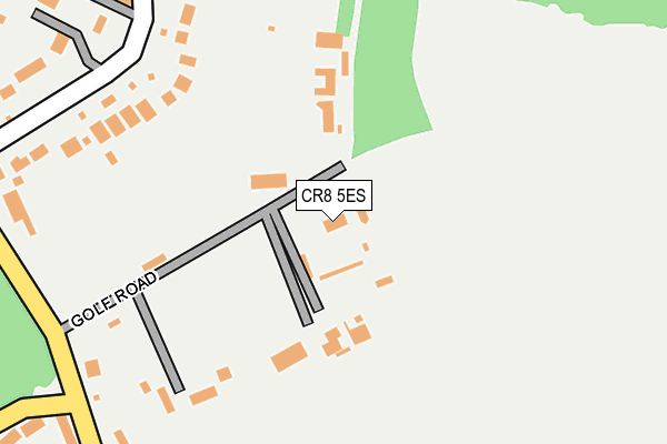
CR8 5ES lies on Golf Road in Kenley. CR8 5ES is located in the Kenley electoral ward, within the London borough of Croydon and the English Parliamentary constituency of Croydon South. The Sub Integrated Care Board (ICB) Location is NHS South West London ICB - 36L and the police force is Metropolitan Police. This postcode has been in use since July 1990.


GetTheData
Source: OS OpenMap – Local (Ordnance Survey)
Source: OS VectorMap District (Ordnance Survey)
Licence: Open Government Licence (requires attribution)
| Easting | 532780 |
| Northing | 158382 |
| Latitude | 51.309072 |
| Longitude | -0.096408 |
GetTheData
Source: Open Postcode Geo
Licence: Open Government Licence
| Street | Golf Road |
| Town/City | Kenley |
| Country | England |
| Postcode District | CR8 |
➜ See where CR8 is on a map ➜ Where is London? | |
GetTheData
Source: Land Registry Price Paid Data
Licence: Open Government Licence
Elevation or altitude of CR8 5ES as distance above sea level:
| Metres | Feet | |
|---|---|---|
| Elevation | 160m | 525ft |
Elevation is measured from the approximate centre of the postcode, to the nearest point on an OS contour line from OS Terrain 50, which has contour spacing of ten vertical metres.
➜ How high above sea level am I? Find the elevation of your current position using your device's GPS.
GetTheData
Source: Open Postcode Elevation
Licence: Open Government Licence
| Ward | Kenley |
| Constituency | Croydon South |
GetTheData
Source: ONS Postcode Database
Licence: Open Government Licence
FERNLEA COTTAGE, GOLF ROAD, KENLEY, CR8 5ES 2009 29 JAN £500,000 |
GetTheData
Source: HM Land Registry Price Paid Data
Licence: Contains HM Land Registry data © Crown copyright and database right 2025. This data is licensed under the Open Government Licence v3.0.
| Badgers Walk (Whyteleafe Hill) | Whyteleafe | 804m |
| Badgers Walk (Whyteleafe Hill) | Whyteleafe | 835m |
| Beverley Road | Kenley | 892m |
| Beverley Road | Kenley | 894m |
| Beverley Road | Kenley | 912m |
| Whyteleafe Station | 1.1km |
| Upper Warlingham Station | 1.3km |
| Whyteleafe South Station | 1.5km |
GetTheData
Source: NaPTAN
Licence: Open Government Licence
| Percentage of properties with Next Generation Access | 100.0% |
| Percentage of properties with Superfast Broadband | 100.0% |
| Percentage of properties with Ultrafast Broadband | 0.0% |
| Percentage of properties with Full Fibre Broadband | 0.0% |
Superfast Broadband is between 30Mbps and 300Mbps
Ultrafast Broadband is > 300Mbps
| Percentage of properties unable to receive 2Mbps | 0.0% |
| Percentage of properties unable to receive 5Mbps | 0.0% |
| Percentage of properties unable to receive 10Mbps | 0.0% |
| Percentage of properties unable to receive 30Mbps | 0.0% |
GetTheData
Source: Ofcom
Licence: Ofcom Terms of Use (requires attribution)
GetTheData
Source: ONS Postcode Database
Licence: Open Government Licence


➜ Get more ratings from the Food Standards Agency
GetTheData
Source: Food Standards Agency
Licence: FSA terms & conditions
| Last Collection | |||
|---|---|---|---|
| Location | Mon-Fri | Sat | Distance |
| Golf Road | 16:30 | 12:00 | 278m |
| Caterham Drive (179) | 16:30 | 12:00 | 944m |
| Valley Road (120) | 16:45 | 12:00 | 1,057m |
GetTheData
Source: Dracos
Licence: Creative Commons Attribution-ShareAlike
The below table lists the International Territorial Level (ITL) codes (formerly Nomenclature of Territorial Units for Statistics (NUTS) codes) and Local Administrative Units (LAU) codes for CR8 5ES:
| ITL 1 Code | Name |
|---|---|
| TLI | London |
| ITL 2 Code | Name |
| TLI6 | Outer London - South |
| ITL 3 Code | Name |
| TLI62 | Croydon |
| LAU 1 Code | Name |
| E09000008 | Croydon |
GetTheData
Source: ONS Postcode Directory
Licence: Open Government Licence
The below table lists the Census Output Area (OA), Lower Layer Super Output Area (LSOA), and Middle Layer Super Output Area (MSOA) for CR8 5ES:
| Code | Name | |
|---|---|---|
| OA | E00005332 | |
| LSOA | E01001072 | Croydon 042C |
| MSOA | E02000235 | Croydon 042 |
GetTheData
Source: ONS Postcode Directory
Licence: Open Government Licence
| CR8 5HB | Welcomes Road | 220m |
| CR8 5EJ | Hayes Lane | 254m |
| CR8 5EG | Hayes Lane | 305m |
| CR8 5HH | Welcomes Road | 327m |
| CR8 5HX | Pine Close | 390m |
| CR8 5HG | Welcomes Road | 414m |
| CR8 5HL | Lovelock Close | 458m |
| CR8 5EW | Old Lodge Lane | 467m |
| CR8 5EU | Old Lodge Lane | 485m |
| CR8 5PD | Cadogan Place | 532m |
GetTheData
Source: Open Postcode Geo; Land Registry Price Paid Data
Licence: Open Government Licence