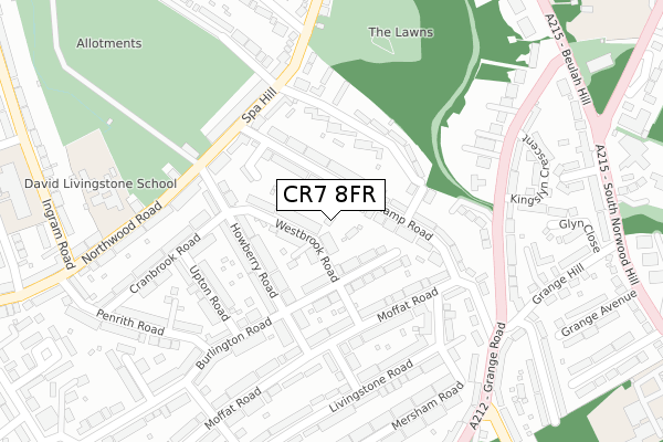
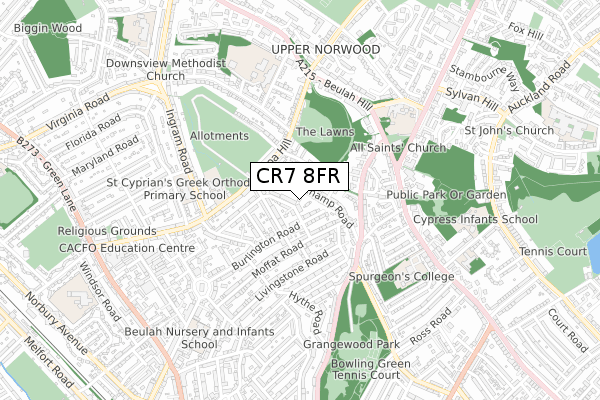
CR7 8FR is located in the Thornton Heath electoral ward, within the London borough of Croydon and the English Parliamentary constituency of Croydon North. The Sub Integrated Care Board (ICB) Location is NHS South West London ICB - 36L and the police force is Metropolitan Police. This postcode has been in use since September 2018.


GetTheData
Source: OS Open Zoomstack (Ordnance Survey)
Licence: Open Government Licence (requires attribution)
Attribution: Contains OS data © Crown copyright and database right 2025
Source: Open Postcode Geo
Licence: Open Government Licence (requires attribution)
Attribution: Contains OS data © Crown copyright and database right 2025; Contains Royal Mail data © Royal Mail copyright and database right 2025; Source: Office for National Statistics licensed under the Open Government Licence v.3.0
| Easting | 532741 |
| Northing | 169507 |
| Latitude | 51.409058 |
| Longitude | -0.092794 |
GetTheData
Source: Open Postcode Geo
Licence: Open Government Licence
| Country | England |
| Postcode District | CR7 |
➜ See where CR7 is on a map ➜ Where is London? | |
GetTheData
Source: Land Registry Price Paid Data
Licence: Open Government Licence
| Ward | Thornton Heath |
| Constituency | Croydon North |
GetTheData
Source: ONS Postcode Database
Licence: Open Government Licence
| Dale Park Road | Upper Norwood | 200m |
| Dale Park Road (Spa Hill) | Upper Norwood | 213m |
| Howberry Road (Northwood Road) | Upper Norwood | 244m |
| Howberry Road (Northwood Road) | Upper Norwood | 249m |
| Beulah Hill (Spa Hill) | Upper Norwood | 419m |
| Thornton Heath Station | 1.3km |
| Crystal Palace Station | 1.7km |
| Norwood Junction Station | 1.8km |
GetTheData
Source: NaPTAN
Licence: Open Government Licence
| Percentage of properties with Next Generation Access | 0.0% |
| Percentage of properties with Superfast Broadband | 0.0% |
| Percentage of properties with Ultrafast Broadband | 0.0% |
| Percentage of properties with Full Fibre Broadband | 0.0% |
Superfast Broadband is between 30Mbps and 300Mbps
Ultrafast Broadband is > 300Mbps
| Percentage of properties unable to receive 2Mbps | 0.0% |
| Percentage of properties unable to receive 5Mbps | 0.0% |
| Percentage of properties unable to receive 10Mbps | 0.0% |
| Percentage of properties unable to receive 30Mbps | 100.0% |
GetTheData
Source: Ofcom
Licence: Ofcom Terms of Use (requires attribution)
GetTheData
Source: ONS Postcode Database
Licence: Open Government Licence


➜ Get more ratings from the Food Standards Agency
GetTheData
Source: Food Standards Agency
Licence: FSA terms & conditions
| Last Collection | |||
|---|---|---|---|
| Location | Mon-Fri | Sat | Distance |
| Beauchamp Road | 17:30 | 12:00 | 63m |
| Howberry Road (12) Tso | 16:45 | 12:00 | 160m |
| Northwood Road(246) | 17:00 | 12:00 | 211m |
GetTheData
Source: Dracos
Licence: Creative Commons Attribution-ShareAlike
The below table lists the International Territorial Level (ITL) codes (formerly Nomenclature of Territorial Units for Statistics (NUTS) codes) and Local Administrative Units (LAU) codes for CR7 8FR:
| ITL 1 Code | Name |
|---|---|
| TLI | London |
| ITL 2 Code | Name |
| TLI6 | Outer London - South |
| ITL 3 Code | Name |
| TLI62 | Croydon |
| LAU 1 Code | Name |
| E09000008 | Croydon |
GetTheData
Source: ONS Postcode Directory
Licence: Open Government Licence
The below table lists the Census Output Area (OA), Lower Layer Super Output Area (LSOA), and Middle Layer Super Output Area (MSOA) for CR7 8FR:
| Code | Name | |
|---|---|---|
| OA | E00005719 | |
| LSOA | E01001148 | Croydon 005B |
| MSOA | E02000198 | Croydon 005 |
GetTheData
Source: ONS Postcode Directory
Licence: Open Government Licence
| SE19 3DJ | Beauchamp Road | 47m |
| CR7 8PS | Westbrook Road | 70m |
| SE19 3DL | Beauchamp Road | 71m |
| SE19 3DA | Beauchamp Road | 72m |
| SE19 3DB | Beauchamp Road | 79m |
| CR7 8PJ | Burlington Road | 91m |
| CR7 8PH | Burlington Road | 102m |
| CR7 8HZ | Howberry Road | 116m |
| SE19 3TS | The Lawns | 133m |
| CR7 8HY | Howberry Road | 146m |
GetTheData
Source: Open Postcode Geo; Land Registry Price Paid Data
Licence: Open Government Licence