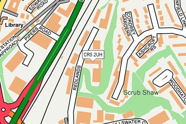
CR5 2UH is located in the Coulsdon Town electoral ward, within the London borough of Croydon and the English Parliamentary constituency of Croydon South. The Sub Integrated Care Board (ICB) Location is NHS South West London ICB - 36L and the police force is Metropolitan Police. This postcode has been in use since January 2005.


GetTheData
Source: OS OpenMap – Local (Ordnance Survey)
Source: OS VectorMap District (Ordnance Survey)
Licence: Open Government Licence (requires attribution)
| Easting | 530097 |
| Northing | 159384 |
| Latitude | 51.318696 |
| Longitude | -0.134514 |
GetTheData
Source: Open Postcode Geo
Licence: Open Government Licence
| Country | England |
| Postcode District | CR5 |
➜ See where CR5 is on a map ➜ Where is Coulsdon? | |
GetTheData
Source: Land Registry Price Paid Data
Licence: Open Government Licence
Elevation or altitude of CR5 2UH as distance above sea level:
| Metres | Feet | |
|---|---|---|
| Elevation | 90m | 295ft |
Elevation is measured from the approximate centre of the postcode, to the nearest point on an OS contour line from OS Terrain 50, which has contour spacing of ten vertical metres.
➜ How high above sea level am I? Find the elevation of your current position using your device's GPS.
GetTheData
Source: Open Postcode Elevation
Licence: Open Government Licence
| Ward | Coulsdon Town |
| Constituency | Croydon South |
GetTheData
Source: ONS Postcode Database
Licence: Open Government Licence
| Coulsdon South | Coulsdon South | 300m |
| Lion Green Road (Brighton Road) | Coulsdon | 308m |
| Coulsdon South | Coulsdon South | 312m |
| Coulsdon Library (Brighton Road) | Coulsdon | 330m |
| Coulsdon Library | Coulsdon | 342m |
| Coulsdon Town Station | 0.4km |
| Coulsdon South Station | 0.4km |
| Woodmansterne Station | 1.4km |
GetTheData
Source: NaPTAN
Licence: Open Government Licence
GetTheData
Source: ONS Postcode Database
Licence: Open Government Licence


➜ Get more ratings from the Food Standards Agency
GetTheData
Source: Food Standards Agency
Licence: FSA terms & conditions
| Last Collection | |||
|---|---|---|---|
| Location | Mon-Fri | Sat | Distance |
| Reddown Road (2a) | 18:30 | 12:00 | 362m |
| Brighton Road | 17:15 | 12:00 | 429m |
| Portnalls Road(50) | 17:00 | 12:00 | 459m |
GetTheData
Source: Dracos
Licence: Creative Commons Attribution-ShareAlike
The below table lists the International Territorial Level (ITL) codes (formerly Nomenclature of Territorial Units for Statistics (NUTS) codes) and Local Administrative Units (LAU) codes for CR5 2UH:
| ITL 1 Code | Name |
|---|---|
| TLI | London |
| ITL 2 Code | Name |
| TLI6 | Outer London - South |
| ITL 3 Code | Name |
| TLI62 | Croydon |
| LAU 1 Code | Name |
| E09000008 | Croydon |
GetTheData
Source: ONS Postcode Directory
Licence: Open Government Licence
The below table lists the Census Output Area (OA), Lower Layer Super Output Area (LSOA), and Middle Layer Super Output Area (MSOA) for CR5 2UH:
| Code | Name | |
|---|---|---|
| OA | E00005065 | |
| LSOA | E01001016 | Croydon 041B |
| MSOA | E02000234 | Croydon 041 |
GetTheData
Source: ONS Postcode Directory
Licence: Open Government Licence
| CR5 2HT | Redlands | 64m |
| CR5 2SR | Deepfield Way | 100m |
| CR5 2SQ | Cordrey Gardens | 157m |
| CR5 2AR | Gateway Business Park | 171m |
| CR5 2HR | Ullswater Crescent | 184m |
| CR5 2SS | Ashcroft Rise | 187m |
| CR5 2NT | Station Approach | 236m |
| CR5 2SP | Cordrey Gardens | 236m |
| CR5 2NQ | Edward Road | 251m |
| CR5 2SU | Woodhatch Spinney | 258m |
GetTheData
Source: Open Postcode Geo; Land Registry Price Paid Data
Licence: Open Government Licence