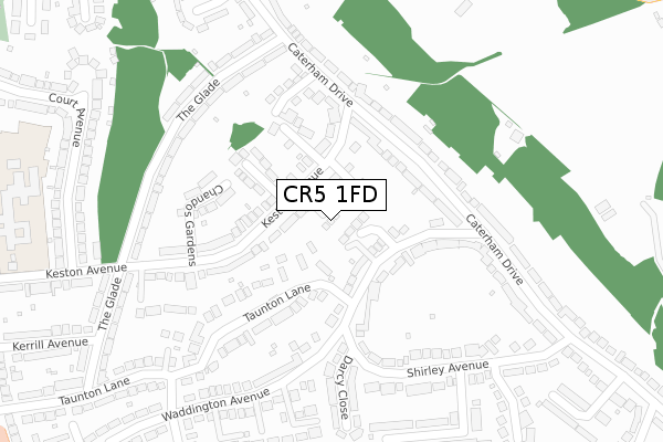
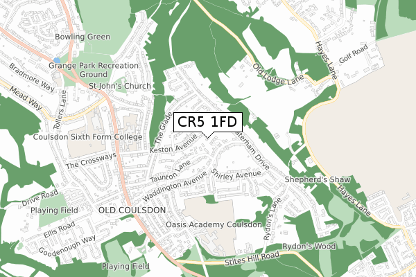
CR5 1FD is located in the Old Coulsdon electoral ward, within the London borough of Croydon and the English Parliamentary constituency of Croydon South. The Sub Integrated Care Board (ICB) Location is NHS South West London ICB - 36L and the police force is Metropolitan Police. This postcode has been in use since October 2019.


GetTheData
Source: OS Open Zoomstack (Ordnance Survey)
Licence: Open Government Licence (requires attribution)
Attribution: Contains OS data © Crown copyright and database right 2025
Source: Open Postcode Geo
Licence: Open Government Licence (requires attribution)
Attribution: Contains OS data © Crown copyright and database right 2025; Contains Royal Mail data © Royal Mail copyright and database right 2025; Source: Office for National Statistics licensed under the Open Government Licence v.3.0
| Easting | 531785 |
| Northing | 157848 |
| Latitude | 51.304503 |
| Longitude | -0.110845 |
GetTheData
Source: Open Postcode Geo
Licence: Open Government Licence
| Country | England |
| Postcode District | CR5 |
➜ See where CR5 is on a map ➜ Where is Coulsdon? | |
GetTheData
Source: Land Registry Price Paid Data
Licence: Open Government Licence
| Ward | Old Coulsdon |
| Constituency | Croydon South |
GetTheData
Source: ONS Postcode Database
Licence: Open Government Licence
2020 5 MAR £590,000 |
1, REED GARDENS, COULSDON, CR5 1FD 2020 28 FEB £590,000 |
2, REED GARDENS, COULSDON, CR5 1FD 2020 8 JAN £585,000 |
GetTheData
Source: HM Land Registry Price Paid Data
Licence: Contains HM Land Registry data © Crown copyright and database right 2025. This data is licensed under the Open Government Licence v3.0.
| Taunton Lane (Cr5) (Waddington Avenue) | Old Coulsdon | 136m |
| Taunton Lane (Cr5) | Old Coulsdon | 139m |
| Caterham Drive Keston Avenue (Caterham Drive) | Old Coulsdon | 159m |
| Caterham Drive Waddington Ave (Caterham Drive) | Old Coulsdon | 177m |
| Shirley Avenue | Old Coulsdon | 195m |
| Whyteleafe Station | 2.2km |
| Coulsdon South Station | 2.3km |
| Upper Warlingham Station | 2.3km |
GetTheData
Source: NaPTAN
Licence: Open Government Licence
GetTheData
Source: ONS Postcode Database
Licence: Open Government Licence


➜ Get more ratings from the Food Standards Agency
GetTheData
Source: Food Standards Agency
Licence: FSA terms & conditions
| Last Collection | |||
|---|---|---|---|
| Location | Mon-Fri | Sat | Distance |
| Keston Avenue(30) | 16:00 | 12:00 | 363m |
| Caterham Drive (179) | 16:30 | 12:00 | 562m |
| Coulsdon Road (124) | 19:15 | 12:00 | 668m |
GetTheData
Source: Dracos
Licence: Creative Commons Attribution-ShareAlike
The below table lists the International Territorial Level (ITL) codes (formerly Nomenclature of Territorial Units for Statistics (NUTS) codes) and Local Administrative Units (LAU) codes for CR5 1FD:
| ITL 1 Code | Name |
|---|---|
| TLI | London |
| ITL 2 Code | Name |
| TLI6 | Outer London - South |
| ITL 3 Code | Name |
| TLI62 | Croydon |
| LAU 1 Code | Name |
| E09000008 | Croydon |
GetTheData
Source: ONS Postcode Directory
Licence: Open Government Licence
The below table lists the Census Output Area (OA), Lower Layer Super Output Area (LSOA), and Middle Layer Super Output Area (MSOA) for CR5 1FD:
| Code | Name | |
|---|---|---|
| OA | E00005083 | |
| LSOA | E01001018 | Croydon 044A |
| MSOA | E02000237 | Croydon 044 |
GetTheData
Source: ONS Postcode Directory
Licence: Open Government Licence
| CR5 1QP | Waddington Avenue | 83m |
| CR5 1HP | Keston Avenue | 121m |
| CR5 1HN | Keston Avenue | 123m |
| CR5 1QN | Waddington Avenue | 123m |
| CR5 1JH | Caterham Drive | 132m |
| CR5 1HT | Ambercroft Way | 143m |
| CR5 1HS | Margaret Way | 155m |
| CR5 1SH | Taunton Lane | 166m |
| CR5 1JF | Caterham Drive | 185m |
| CR5 1HW | Chandos Gardens | 207m |
GetTheData
Source: Open Postcode Geo; Land Registry Price Paid Data
Licence: Open Government Licence