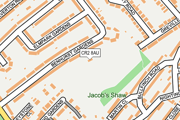
CR2 8AU is located in the Selsdon Vale & Forestdale electoral ward, within the London borough of Croydon and the English Parliamentary constituency of Croydon South. The Sub Integrated Care Board (ICB) Location is NHS South West London ICB - 36L and the police force is Metropolitan Police. This postcode has been in use since March 2017.


GetTheData
Source: OS OpenMap – Local (Ordnance Survey)
Source: OS VectorMap District (Ordnance Survey)
Licence: Open Government Licence (requires attribution)
| Easting | 535512 |
| Northing | 162150 |
| Latitude | 51.342290 |
| Longitude | -0.055779 |
GetTheData
Source: Open Postcode Geo
Licence: Open Government Licence
| Country | England |
| Postcode District | CR2 |
➜ See where CR2 is on a map ➜ Where is London? | |
GetTheData
Source: Land Registry Price Paid Data
Licence: Open Government Licence
| Ward | Selsdon Vale & Forestdale |
| Constituency | Croydon South |
GetTheData
Source: ONS Postcode Database
Licence: Open Government Licence
| Bullfinch Road (Nightingale Road) | Selsdon/South Croydon | 255m |
| Bullfinch Road | Selsdon/South Croydon | 263m |
| Redwing Close (Sandpiper Road) | Selsdon/South Croydon | 335m |
| Hawthorn Crescent (Old Farleigh Road) | Selsdon/South Croydon | 346m |
| Hawthorn Crescent (Old Farleigh Road) | Selsdon/South Croydon | 350m |
| Gravel Hill Tram Stop (Gravel Hill) | Forestdale | 1,623m |
| Sanderstead Station | 2.7km |
| Purley Oaks Station | 3km |
| Riddlesdown Station | 3.2km |
GetTheData
Source: NaPTAN
Licence: Open Government Licence
GetTheData
Source: ONS Postcode Database
Licence: Open Government Licence


➜ Get more ratings from the Food Standards Agency
GetTheData
Source: Food Standards Agency
Licence: FSA terms & conditions
| Last Collection | |||
|---|---|---|---|
| Location | Mon-Fri | Sat | Distance |
| Addington Road (Opp School) | 16:00 | 12:00 | 456m |
| Selsdon Tso (6) The Broadway | 17:15 | 12:00 | 486m |
| Ashen Vale (4) | 16:00 | 12:00 | 597m |
GetTheData
Source: Dracos
Licence: Creative Commons Attribution-ShareAlike
The below table lists the International Territorial Level (ITL) codes (formerly Nomenclature of Territorial Units for Statistics (NUTS) codes) and Local Administrative Units (LAU) codes for CR2 8AU:
| ITL 1 Code | Name |
|---|---|
| TLI | London |
| ITL 2 Code | Name |
| TLI6 | Outer London - South |
| ITL 3 Code | Name |
| TLI62 | Croydon |
| LAU 1 Code | Name |
| E09000008 | Croydon |
GetTheData
Source: ONS Postcode Directory
Licence: Open Government Licence
The below table lists the Census Output Area (OA), Lower Layer Super Output Area (LSOA), and Middle Layer Super Output Area (MSOA) for CR2 8AU:
| Code | Name | |
|---|---|---|
| OA | E00005588 | |
| LSOA | E01001120 | Croydon 033A |
| MSOA | E02000226 | Croydon 033 |
GetTheData
Source: ONS Postcode Directory
Licence: Open Government Licence
| CR2 8NU | Benhurst Gardens | 45m |
| CR2 8NY | Benhurst Gardens | 88m |
| CR2 8NX | Benhurst Close | 103m |
| CR2 8RU | Elm Park Gardens | 151m |
| CR2 8NZ | Benhurst Gardens | 170m |
| CR2 8RW | Elm Park Gardens | 171m |
| CR2 8QS | Martin Close | 173m |
| CR2 8PU | Bullfinch Road | 184m |
| CR2 8NW | Benhurst Gardens | 185m |
| CR2 8NG | Abbey Road | 202m |
GetTheData
Source: Open Postcode Geo; Land Registry Price Paid Data
Licence: Open Government Licence