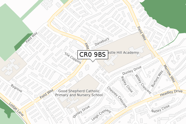
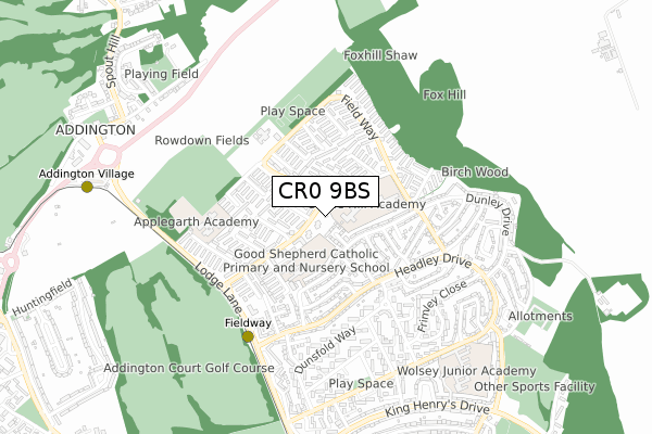
CR0 9BS is located in the New Addington North electoral ward, within the London borough of Croydon and the English Parliamentary constituency of Croydon Central. The Sub Integrated Care Board (ICB) Location is NHS South West London ICB - 36L and the police force is Metropolitan Police. This postcode has been in use since September 2019.


GetTheData
Source: OS Open Zoomstack (Ordnance Survey)
Licence: Open Government Licence (requires attribution)
Attribution: Contains OS data © Crown copyright and database right 2025
Source: Open Postcode Geo
Licence: Open Government Licence (requires attribution)
Attribution: Contains OS data © Crown copyright and database right 2025; Contains Royal Mail data © Royal Mail copyright and database right 2025; Source: Office for National Statistics licensed under the Open Government Licence v.3.0
| Easting | 537984 |
| Northing | 163629 |
| Latitude | 51.354987 |
| Longitude | -0.019737 |
GetTheData
Source: Open Postcode Geo
Licence: Open Government Licence
| Country | England |
| Postcode District | CR0 |
➜ See where CR0 is on a map ➜ Where is London? | |
GetTheData
Source: Land Registry Price Paid Data
Licence: Open Government Licence
| Ward | New Addington North |
| Constituency | Croydon Central |
GetTheData
Source: ONS Postcode Database
Licence: Open Government Licence
| The Coppins (Fieldway) | Addington | 57m |
| Brierley (Field Way) | Addington | 128m |
| Foxcombe | Addington | 153m |
| Foxcombe | Addington | 197m |
| Castle Hill School (Fieldway) | Addington | 292m |
| Fieldway Tram Stop (Lodge Lane) | Forestdale | 526m |
| Addington Village Tram Stop (Kent Gate Way) | Addington | 911m |
| King Henry's Drive Tram Stop (Parkway) | New Addington | 1,071m |
| New Addington Tram Stop (Central Park) | New Addington | 1,389m |
| West Wickham Station | 3km |
| Hayes (Kent) Station | 3.2km |
| Eden Park Station | 3.9km |
GetTheData
Source: NaPTAN
Licence: Open Government Licence
GetTheData
Source: ONS Postcode Database
Licence: Open Government Licence


➜ Get more ratings from the Food Standards Agency
GetTheData
Source: Food Standards Agency
Licence: FSA terms & conditions
| Last Collection | |||
|---|---|---|---|
| Location | Mon-Fri | Sat | Distance |
| Fieldway P.o. | 17:00 | 12:00 | 90m |
| Headley Drive Tso (118) | 18:00 | 12:00 | 351m |
| Leigh Crescent (43) | 17:45 | 12:00 | 364m |
GetTheData
Source: Dracos
Licence: Creative Commons Attribution-ShareAlike
The below table lists the International Territorial Level (ITL) codes (formerly Nomenclature of Territorial Units for Statistics (NUTS) codes) and Local Administrative Units (LAU) codes for CR0 9BS:
| ITL 1 Code | Name |
|---|---|
| TLI | London |
| ITL 2 Code | Name |
| TLI6 | Outer London - South |
| ITL 3 Code | Name |
| TLI62 | Croydon |
| LAU 1 Code | Name |
| E09000008 | Croydon |
GetTheData
Source: ONS Postcode Directory
Licence: Open Government Licence
The below table lists the Census Output Area (OA), Lower Layer Super Output Area (LSOA), and Middle Layer Super Output Area (MSOA) for CR0 9BS:
| Code | Name | |
|---|---|---|
| OA | E00005271 | |
| LSOA | E01001055 | Croydon 032B |
| MSOA | E02000225 | Croydon 032 |
GetTheData
Source: ONS Postcode Directory
Licence: Open Government Licence
| CR0 9DX | Wayside | 115m |
| CR0 9DF | The Coppins | 119m |
| CR0 9EU | Danebury | 132m |
| CR0 9DE | The Coppins | 138m |
| CR0 9EW | Danebury | 180m |
| CR0 9DS | Brierley | 183m |
| CR0 9DH | Applegarth | 184m |
| CR0 0RJ | Dunley Drive | 198m |
| CR0 9EG | The Lindens | 211m |
| CR0 0RN | Chesney Crescent | 226m |
GetTheData
Source: Open Postcode Geo; Land Registry Price Paid Data
Licence: Open Government Licence