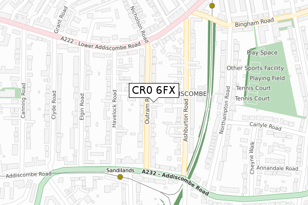
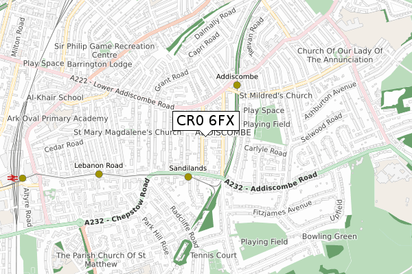
CR0 6FX is located in the Addiscombe East electoral ward, within the London borough of Croydon and the English Parliamentary constituency of Croydon Central. The Sub Integrated Care Board (ICB) Location is NHS South West London ICB - 36L and the police force is Metropolitan Police. This postcode has been in use since September 2019.


GetTheData
Source: OS Open Zoomstack (Ordnance Survey)
Licence: Open Government Licence (requires attribution)
Attribution: Contains OS data © Crown copyright and database right 2025
Source: Open Postcode Geo
Licence: Open Government Licence (requires attribution)
Attribution: Contains OS data © Crown copyright and database right 2025; Contains Royal Mail data © Royal Mail copyright and database right 2025; Source: Office for National Statistics licensed under the Open Government Licence v.3.0
| Easting | 533999 |
| Northing | 165981 |
| Latitude | 51.377076 |
| Longitude | -0.076047 |
GetTheData
Source: Open Postcode Geo
Licence: Open Government Licence
| Country | England |
| Postcode District | CR0 |
➜ See where CR0 is on a map ➜ Where is London? | |
GetTheData
Source: Land Registry Price Paid Data
Licence: Open Government Licence
| Ward | Addiscombe East |
| Constituency | Croydon Central |
GetTheData
Source: ONS Postcode Database
Licence: Open Government Licence
| Havelock Road (Cr0) | Addiscombe | 205m |
| Havelock Road (Cr0) (Lower Addiscombe Road) | Addiscombe | 224m |
| Ashburton Road Addiscombe (Addiscombe Road) | Addiscombe | 226m |
| Ashburton Road | Addiscombe | 254m |
| Sandilands Tram Stop | Addiscombe | 257m |
| Sandilands Tram Stop (Addiscombe Road) | Addiscombe | 266m |
| Addiscombe Tram Stop (Off Bingham Road) | Addiscombe | 362m |
| Lebanon Road Tram Stop (Addiscombe Road) | Addiscombe | 656m |
| Blackhorse Lane Tram Stop (Dalmally Road) | Woodside | 936m |
| East Croydon Tram Stop (George Street) | Croydon | 1,164m |
| East Croydon Station | 1.2km |
| West Croydon Station | 1.9km |
| Selhurst Station | 1.9km |
GetTheData
Source: NaPTAN
Licence: Open Government Licence
GetTheData
Source: ONS Postcode Database
Licence: Open Government Licence


➜ Get more ratings from the Food Standards Agency
GetTheData
Source: Food Standards Agency
Licence: FSA terms & conditions
| Last Collection | |||
|---|---|---|---|
| Location | Mon-Fri | Sat | Distance |
| Havelock Road(23) | 18:00 | 12:00 | 124m |
| Ashburton Road(Walcot Crt) | 18:00 | 12:00 | 239m |
| Northampton Road (32) | 17:45 | 12:00 | 241m |
GetTheData
Source: Dracos
Licence: Creative Commons Attribution-ShareAlike
The below table lists the International Territorial Level (ITL) codes (formerly Nomenclature of Territorial Units for Statistics (NUTS) codes) and Local Administrative Units (LAU) codes for CR0 6FX:
| ITL 1 Code | Name |
|---|---|
| TLI | London |
| ITL 2 Code | Name |
| TLI6 | Outer London - South |
| ITL 3 Code | Name |
| TLI62 | Croydon |
| LAU 1 Code | Name |
| E09000008 | Croydon |
GetTheData
Source: ONS Postcode Directory
Licence: Open Government Licence
The below table lists the Census Output Area (OA), Lower Layer Super Output Area (LSOA), and Middle Layer Super Output Area (MSOA) for CR0 6FX:
| Code | Name | |
|---|---|---|
| OA | E00004899 | |
| LSOA | E01000977 | Croydon 022C |
| MSOA | E02000215 | Croydon 022 |
GetTheData
Source: ONS Postcode Directory
Licence: Open Government Licence
| CR0 6AS | Ashburton Gardens | 53m |
| CR0 6QR | Mulberry Lane | 80m |
| CR0 6XE | Outram Road | 89m |
| CR0 6XJ | Outram Road | 104m |
| CR0 6XF | Outram Road | 106m |
| CR0 6QP | Havelock Road | 111m |
| CR0 6XG | Outram Road | 117m |
| CR0 6AQ | Ashburton Road | 122m |
| CR0 6AP | Ashburton Road | 134m |
| CR0 6QQ | Havelock Road | 150m |
GetTheData
Source: Open Postcode Geo; Land Registry Price Paid Data
Licence: Open Government Licence