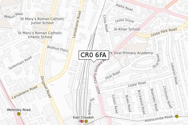
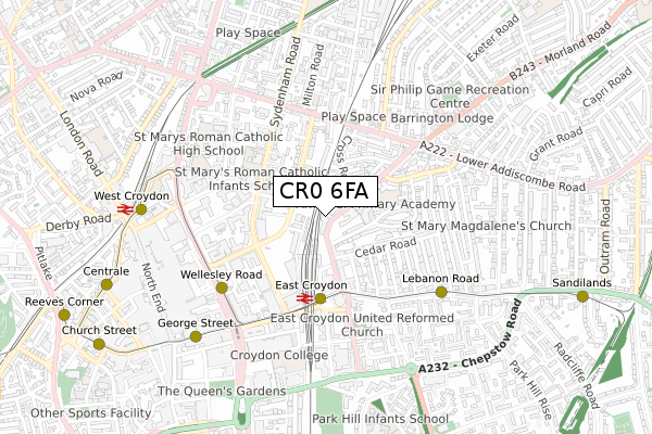
CR0 6FA is located in the Addiscombe West electoral ward, within the London borough of Croydon and the English Parliamentary constituency of Croydon Central. The Sub Integrated Care Board (ICB) Location is NHS South West London ICB - 36L and the police force is Metropolitan Police. This postcode has been in use since August 2017.


GetTheData
Source: OS Open Zoomstack (Ordnance Survey)
Licence: Open Government Licence (requires attribution)
Attribution: Contains OS data © Crown copyright and database right 2025
Source: Open Postcode Geo
Licence: Open Government Licence (requires attribution)
Attribution: Contains OS data © Crown copyright and database right 2025; Contains Royal Mail data © Royal Mail copyright and database right 2025; Source: Office for National Statistics licensed under the Open Government Licence v.3.0
| Easting | 532905 |
| Northing | 166035 |
| Latitude | 51.377818 |
| Longitude | -0.091736 |
GetTheData
Source: Open Postcode Geo
Licence: Open Government Licence
| Country | England |
| Postcode District | CR0 |
➜ See where CR0 is on a map ➜ Where is Croydon? | |
GetTheData
Source: Land Registry Price Paid Data
Licence: Open Government Licence
| Ward | Addiscombe West |
| Constituency | Croydon Central |
GetTheData
Source: ONS Postcode Database
Licence: Open Government Licence
| Cross Road (Cr0) | Croydon | 53m |
| Cross Road (Cr0) | Croydon | 80m |
| Addiscombe Road | Croydon | 207m |
| Cherry Orchard Road East Croydon Station (Cherry Orchard Road) | Croydon | 243m |
| East Croydon Rail Station (East Croydon Bus Station) | Croydon | 322m |
| East Croydon Tram Stop (George Street) | Croydon | 332m |
| Wellesley Road Tram Stop (Wellesley Road) | Croydon | 487m |
| Lebanon Road Tram Stop (Addiscombe Road) | Addiscombe | 553m |
| George Street Tram Stop (George Street) | Croydon | 647m |
| West Croydon Tram Stop (Station Road) | Croydon | 704m |
| East Croydon Station | 0.3km |
| West Croydon Station | 0.8km |
| Selhurst Station | 1.6km |
GetTheData
Source: NaPTAN
Licence: Open Government Licence
| Percentage of properties with Next Generation Access | 100.0% |
| Percentage of properties with Superfast Broadband | 100.0% |
| Percentage of properties with Ultrafast Broadband | 100.0% |
| Percentage of properties with Full Fibre Broadband | 100.0% |
Superfast Broadband is between 30Mbps and 300Mbps
Ultrafast Broadband is > 300Mbps
| Median download speed | 90.0Mbps |
| Average download speed | 94.6Mbps |
| Maximum download speed | 350.00Mbps |
| Median upload speed | 19.5Mbps |
| Average upload speed | 14.2Mbps |
| Maximum upload speed | 20.00Mbps |
| Percentage of properties unable to receive 2Mbps | 0.0% |
| Percentage of properties unable to receive 5Mbps | 0.0% |
| Percentage of properties unable to receive 10Mbps | 0.0% |
| Percentage of properties unable to receive 30Mbps | 0.0% |
GetTheData
Source: Ofcom
Licence: Ofcom Terms of Use (requires attribution)
GetTheData
Source: ONS Postcode Database
Licence: Open Government Licence


➜ Get more ratings from the Food Standards Agency
GetTheData
Source: Food Standards Agency
Licence: FSA terms & conditions
| Last Collection | |||
|---|---|---|---|
| Location | Mon-Fri | Sat | Distance |
| Croydon Delivery Office | 18:45 | 12:30 | 273m |
| Sydenham Road (School) | 17:45 | 12:00 | 291m |
| Lansdown Road | 17:30 | 12:00 | 376m |
GetTheData
Source: Dracos
Licence: Creative Commons Attribution-ShareAlike
The below table lists the International Territorial Level (ITL) codes (formerly Nomenclature of Territorial Units for Statistics (NUTS) codes) and Local Administrative Units (LAU) codes for CR0 6FA:
| ITL 1 Code | Name |
|---|---|
| TLI | London |
| ITL 2 Code | Name |
| TLI6 | Outer London - South |
| ITL 3 Code | Name |
| TLI62 | Croydon |
| LAU 1 Code | Name |
| E09000008 | Croydon |
GetTheData
Source: ONS Postcode Directory
Licence: Open Government Licence
The below table lists the Census Output Area (OA), Lower Layer Super Output Area (LSOA), and Middle Layer Super Output Area (MSOA) for CR0 6FA:
| Code | Name | |
|---|---|---|
| OA | E00004903 | |
| LSOA | E01000975 | Croydon 022A |
| MSOA | E02000215 | Croydon 022 |
GetTheData
Source: ONS Postcode Directory
Licence: Open Government Licence
| CR0 6BQ | Oval Road | 114m |
| CR0 6BA | Cherry Orchard Road | 149m |
| CR0 6BL | Oval Road | 153m |
| CR0 2BE | Lansdowne Road | 157m |
| CR0 6TE | Cross Road | 169m |
| CR0 6UG | Cedar Road | 178m |
| CR0 6TA | Cross Road | 187m |
| CR0 2BF | Lansdowne Road | 192m |
| CR0 6UB | Cedar Road | 195m |
| CR0 2BS | Bedford Place | 201m |
GetTheData
Source: Open Postcode Geo; Land Registry Price Paid Data
Licence: Open Government Licence