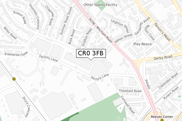
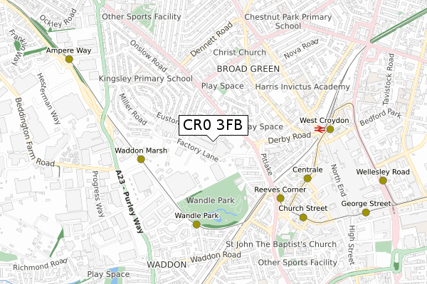
CR0 3FB is located in the Broad Green electoral ward, within the London borough of Croydon and the English Parliamentary constituency of Croydon North. The Sub Integrated Care Board (ICB) Location is NHS South West London ICB - 36L and the police force is Metropolitan Police. This postcode has been in use since May 2018.


GetTheData
Source: OS Open Zoomstack (Ordnance Survey)
Licence: Open Government Licence (requires attribution)
Attribution: Contains OS data © Crown copyright and database right 2025
Source: Open Postcode Geo
Licence: Open Government Licence (requires attribution)
Attribution: Contains OS data © Crown copyright and database right 2025; Contains Royal Mail data © Royal Mail copyright and database right 2025; Source: Office for National Statistics licensed under the Open Government Licence v.3.0
| Easting | 531512 |
| Northing | 165998 |
| Latitude | 51.377810 |
| Longitude | -0.111753 |
GetTheData
Source: Open Postcode Geo
Licence: Open Government Licence
| Country | England |
| Postcode District | CR0 |
➜ See where CR0 is on a map ➜ Where is London? | |
GetTheData
Source: Land Registry Price Paid Data
Licence: Open Government Licence
| Ward | Broad Green |
| Constituency | Croydon North |
GetTheData
Source: ONS Postcode Database
Licence: Open Government Licence
| Leighton Street (Mitcham Road) | West Croydon | 151m |
| Factory Lane (Mitcham Road) | West Croydon | 160m |
| Factory Lane (Mitcham Road) | West Croydon | 200m |
| Sumner Road Mitcham Road (Mitcham Road) | Broad Green | 396m |
| Sumner Road Mitcham Road (Mitcham Road) | Broad Green | 402m |
| Waddon Marsh Tram Stop (Off Gurney Crescent) | Waddon | 442m |
| Reeves Corner Tram Stop (Cairo New Road) | Croydon | 468m |
| Wandle Park Tram Stop (Vicarage Road) | Waddon | 502m |
| Centrale Tram Stop (Tamworth Road) | Croydon | 593m |
| Church Street Tram Stop (Church Street) | Croydon | 689m |
| West Croydon Station | 0.6km |
| Waddon Station | 1.2km |
| East Croydon Station | 1.3km |
GetTheData
Source: NaPTAN
Licence: Open Government Licence
| Percentage of properties with Next Generation Access | 100.0% |
| Percentage of properties with Superfast Broadband | 100.0% |
| Percentage of properties with Ultrafast Broadband | 100.0% |
| Percentage of properties with Full Fibre Broadband | 100.0% |
Superfast Broadband is between 30Mbps and 300Mbps
Ultrafast Broadband is > 300Mbps
| Percentage of properties unable to receive 2Mbps | 0.0% |
| Percentage of properties unable to receive 5Mbps | 0.0% |
| Percentage of properties unable to receive 10Mbps | 0.0% |
| Percentage of properties unable to receive 30Mbps | 0.0% |
GetTheData
Source: Ofcom
Licence: Ofcom Terms of Use (requires attribution)
GetTheData
Source: ONS Postcode Database
Licence: Open Government Licence


➜ Get more ratings from the Food Standards Agency
GetTheData
Source: Food Standards Agency
Licence: FSA terms & conditions
| Last Collection | |||
|---|---|---|---|
| Location | Mon-Fri | Sat | Distance |
| Parsons Mead(Flats) | 18:00 | 12:00 | 411m |
| Sainsbury | 19:00 | 12:00 | 485m |
| London Road (99) | 18:15 | 12:00 | 556m |
GetTheData
Source: Dracos
Licence: Creative Commons Attribution-ShareAlike
The below table lists the International Territorial Level (ITL) codes (formerly Nomenclature of Territorial Units for Statistics (NUTS) codes) and Local Administrative Units (LAU) codes for CR0 3FB:
| ITL 1 Code | Name |
|---|---|
| TLI | London |
| ITL 2 Code | Name |
| TLI6 | Outer London - South |
| ITL 3 Code | Name |
| TLI62 | Croydon |
| LAU 1 Code | Name |
| E09000008 | Croydon |
GetTheData
Source: ONS Postcode Directory
Licence: Open Government Licence
The below table lists the Census Output Area (OA), Lower Layer Super Output Area (LSOA), and Middle Layer Super Output Area (MSOA) for CR0 3FB:
| Code | Name | |
|---|---|---|
| OA | E00005010 | |
| LSOA | E01001010 | Croydon 019D |
| MSOA | E02000212 | Croydon 019 |
GetTheData
Source: ONS Postcode Directory
Licence: Open Government Licence
| CR0 3RL | Factory Lane | 59m |
| CR0 3RU | Mitcham Road | 127m |
| CR0 3RP | Grafton Road | 135m |
| CR0 3RG | Mitcham Road | 165m |
| CR0 3RT | Bute Road | 184m |
| CR0 3RW | Mitcham Road | 218m |
| CR0 3SA | Albion Street | 220m |
| CR0 3RS | Vanguard Close | 225m |
| CR0 3LY | Sumner Road South | 232m |
| CR0 3SB | Leighton Street | 235m |
GetTheData
Source: Open Postcode Geo; Land Registry Price Paid Data
Licence: Open Government Licence