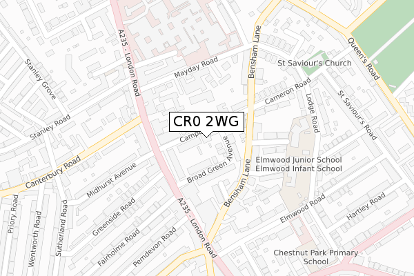
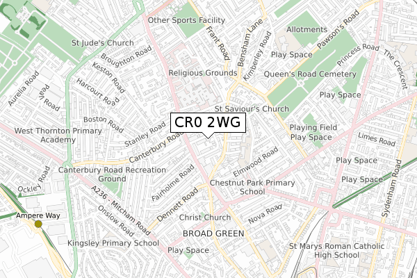
CR0 2WG is located in the Broad Green electoral ward, within the London borough of Croydon and the English Parliamentary constituency of Croydon North. The Sub Integrated Care Board (ICB) Location is NHS South West London ICB - 36L and the police force is Metropolitan Police. This postcode has been in use since November 2017.


GetTheData
Source: OS Open Zoomstack (Ordnance Survey)
Licence: Open Government Licence (requires attribution)
Attribution: Contains OS data © Crown copyright and database right 2025
Source: Open Postcode Geo
Licence: Open Government Licence (requires attribution)
Attribution: Contains OS data © Crown copyright and database right 2025; Contains Royal Mail data © Royal Mail copyright and database right 2025; Source: Office for National Statistics licensed under the Open Government Licence v.3.0
| Easting | 531686 |
| Northing | 166995 |
| Latitude | 51.386729 |
| Longitude | -0.108885 |
GetTheData
Source: Open Postcode Geo
Licence: Open Government Licence
| Country | England |
| Postcode District | CR0 |
➜ See where CR0 is on a map ➜ Where is London? | |
GetTheData
Source: Land Registry Price Paid Data
Licence: Open Government Licence
| Ward | Broad Green |
| Constituency | Croydon North |
GetTheData
Source: ONS Postcode Database
Licence: Open Government Licence
| Canterbury Road (Cr0) | Broad Green | 150m |
| Broad Green Avenue (London Road) | Broad Green | 155m |
| Broad Green Avenue (London Road) | Broad Green | 217m |
| Croydon University Hospital (London Road) | Broad Green | 284m |
| Sumner Road London Road (London Road) | Broad Green | 334m |
| West Croydon Tram Stop (Station Road) | Croydon | 999m |
| Ampere Way Tram Stop (Ampere Way) | Broad Green | 1,138m |
| Waddon Marsh Tram Stop (Off Gurney Crescent) | Waddon | 1,247m |
| Centrale Tram Stop (Tamworth Road) | Croydon | 1,268m |
| Reeves Corner Tram Stop (Cairo New Road) | Croydon | 1,286m |
| West Croydon Station | 1km |
| Thornton Heath Station | 1.5km |
| Selhurst Station | 1.5km |
GetTheData
Source: NaPTAN
Licence: Open Government Licence
| Percentage of properties with Next Generation Access | 0.0% |
| Percentage of properties with Superfast Broadband | 0.0% |
| Percentage of properties with Ultrafast Broadband | 0.0% |
| Percentage of properties with Full Fibre Broadband | 0.0% |
Superfast Broadband is between 30Mbps and 300Mbps
Ultrafast Broadband is > 300Mbps
| Median download speed | 17.3Mbps |
| Average download speed | 15.5Mbps |
| Maximum download speed | 20.57Mbps |
| Median upload speed | 1.1Mbps |
| Average upload speed | 1.0Mbps |
| Maximum upload speed | 1.25Mbps |
| Percentage of properties unable to receive 2Mbps | 0.0% |
| Percentage of properties unable to receive 5Mbps | 0.0% |
| Percentage of properties unable to receive 10Mbps | 0.0% |
| Percentage of properties unable to receive 30Mbps | 100.0% |
GetTheData
Source: Ofcom
Licence: Ofcom Terms of Use (requires attribution)
GetTheData
Source: ONS Postcode Database
Licence: Open Government Licence


➜ Get more ratings from the Food Standards Agency
GetTheData
Source: Food Standards Agency
Licence: FSA terms & conditions
| Last Collection | |||
|---|---|---|---|
| Location | Mon-Fri | Sat | Distance |
| Fancis Road | 17:45 | 12:00 | 109m |
| London Road (369) | 17:45 | 12:00 | 137m |
| London Road(516) | 17:30 | 12:00 | 232m |
GetTheData
Source: Dracos
Licence: Creative Commons Attribution-ShareAlike
The below table lists the International Territorial Level (ITL) codes (formerly Nomenclature of Territorial Units for Statistics (NUTS) codes) and Local Administrative Units (LAU) codes for CR0 2WG:
| ITL 1 Code | Name |
|---|---|
| TLI | London |
| ITL 2 Code | Name |
| TLI6 | Outer London - South |
| ITL 3 Code | Name |
| TLI62 | Croydon |
| LAU 1 Code | Name |
| E09000008 | Croydon |
GetTheData
Source: ONS Postcode Directory
Licence: Open Government Licence
The below table lists the Census Output Area (OA), Lower Layer Super Output Area (LSOA), and Middle Layer Super Output Area (MSOA) for CR0 2WG:
| Code | Name | |
|---|---|---|
| OA | E00005566 | |
| LSOA | E01001117 | Croydon 015C |
| MSOA | E02000208 | Croydon 015 |
GetTheData
Source: ONS Postcode Directory
Licence: Open Government Licence
| CR0 2SP | Campbell Road | 44m |
| CR0 2RH | Campbell Road | 52m |
| CR0 2SQ | Campbell Road | 59m |
| CR0 2ST | Broad Green Avenue | 59m |
| CR0 2NS | London Road | 94m |
| CR0 2NT | London Road | 94m |
| CR0 2NU | London Road | 94m |
| CR0 2RW | Bensham Lane | 102m |
| CR0 2RR | Bensham Lane | 130m |
| CR0 2RY | Bensham Lane | 130m |
GetTheData
Source: Open Postcode Geo; Land Registry Price Paid Data
Licence: Open Government Licence