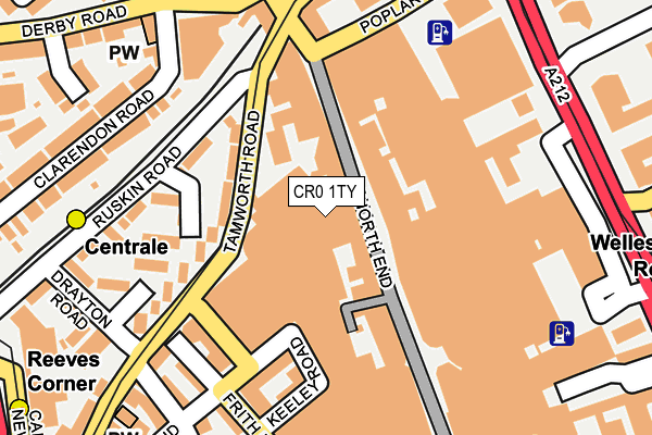
CR0 1TY is located in the Fairfield electoral ward, within the London borough of Croydon and the English Parliamentary constituency of Croydon North. The Sub Integrated Care Board (ICB) Location is NHS South West London ICB - 36L and the police force is Metropolitan Police. This postcode has been in use since January 1995.


GetTheData
Source: OS OpenMap – Local (Ordnance Survey)
Source: OS VectorMap District (Ordnance Survey)
Licence: Open Government Licence (requires attribution)
| Easting | 532178 |
| Northing | 165778 |
| Latitude | 51.375678 |
| Longitude | -0.102271 |
GetTheData
Source: Open Postcode Geo
Licence: Open Government Licence
| Country | England |
| Postcode District | CR0 |
➜ See where CR0 is on a map ➜ Where is Croydon? | |
GetTheData
Source: Land Registry Price Paid Data
Licence: Open Government Licence
Elevation or altitude of CR0 1TY as distance above sea level:
| Metres | Feet | |
|---|---|---|
| Elevation | 50m | 164ft |
Elevation is measured from the approximate centre of the postcode, to the nearest point on an OS contour line from OS Terrain 50, which has contour spacing of ten vertical metres.
➜ How high above sea level am I? Find the elevation of your current position using your device's GPS.
GetTheData
Source: Open Postcode Elevation
Licence: Open Government Licence
| Ward | Fairfield |
| Constituency | Croydon North |
GetTheData
Source: ONS Postcode Database
Licence: Open Government Licence
| Centrale Tram Stop | Croydon | 106m |
| Ruskin Road (Tamworth Road) | Croydon | 132m |
| Ruskin Road (Tamworth Road) | Croydon | 134m |
| Church Street Tram Stop | Croydon | 227m |
| Reeves Corner The Eagle (Tamworth Road) | Croydon | 239m |
| Centrale Tram Stop (Tamworth Road) | Croydon | 113m |
| Church Street Tram Stop (Church Street) | Croydon | 262m |
| Reeves Corner Tram Stop (Cairo New Road) | Croydon | 290m |
| George Street Tram Stop (George Street) | Croydon | 311m |
| Wellesley Road Tram Stop (Wellesley Road) | Croydon | 332m |
| West Croydon Station | 0.3km |
| East Croydon Station | 0.7km |
| Waddon Station | 1.4km |
GetTheData
Source: NaPTAN
Licence: Open Government Licence
| Median download speed | 16.8Mbps |
| Average download speed | 15.2Mbps |
| Maximum download speed | 24.38Mbps |
| Median upload speed | 1.0Mbps |
| Average upload speed | 1.0Mbps |
| Maximum upload speed | 1.79Mbps |
GetTheData
Source: Ofcom
Licence: Ofcom Terms of Use (requires attribution)
GetTheData
Source: ONS Postcode Database
Licence: Open Government Licence


➜ Get more ratings from the Food Standards Agency
GetTheData
Source: Food Standards Agency
Licence: FSA terms & conditions
| Last Collection | |||
|---|---|---|---|
| Location | Mon-Fri | Sat | Distance |
| North End (Opp M&s) | 18:30 | 12:00 | 192m |
| 10 High Street P.o. | 18:45 | 12:15 | 286m |
| Dingwall Avenue (Opp 2) | 18:15 | 12:00 | 315m |
GetTheData
Source: Dracos
Licence: Creative Commons Attribution-ShareAlike
The below table lists the International Territorial Level (ITL) codes (formerly Nomenclature of Territorial Units for Statistics (NUTS) codes) and Local Administrative Units (LAU) codes for CR0 1TY:
| ITL 1 Code | Name |
|---|---|
| TLI | London |
| ITL 2 Code | Name |
| TLI6 | Outer London - South |
| ITL 3 Code | Name |
| TLI62 | Croydon |
| LAU 1 Code | Name |
| E09000008 | Croydon |
GetTheData
Source: ONS Postcode Directory
Licence: Open Government Licence
The below table lists the Census Output Area (OA), Lower Layer Super Output Area (LSOA), and Middle Layer Super Output Area (MSOA) for CR0 1TY:
| Code | Name | |
|---|---|---|
| OA | E00174934 | |
| LSOA | E01001014 | Croydon 024A |
| MSOA | E02000217 | Croydon 024 |
GetTheData
Source: ONS Postcode Directory
Licence: Open Government Licence
| CR0 1TW | Drummond Road | 95m |
| CR0 1UG | North End | 113m |
| CR0 1TH | Frith Road | 115m |
| CR0 1XT | Tamworth Road | 116m |
| CR0 1US | Whitgift Centre | 128m |
| CR0 1XZ | Otterbourne Road | 151m |
| CR0 1TS | Priddys Yard | 162m |
| CR0 1TA | Frith Road | 176m |
| CR0 1XJ | Ruskin Road | 181m |
| CR0 1TB | Frith Road | 183m |
GetTheData
Source: Open Postcode Geo; Land Registry Price Paid Data
Licence: Open Government Licence