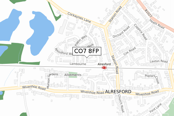
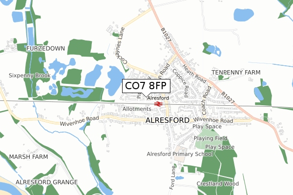
CO7 8FP is located in the Alresford & Elmstead electoral ward, within the local authority district of Tendring and the English Parliamentary constituency of Harwich and North Essex. The Sub Integrated Care Board (ICB) Location is NHS Suffolk and North East Essex ICB - 06T and the police force is Essex. This postcode has been in use since October 2019.


GetTheData
Source: OS Open Zoomstack (Ordnance Survey)
Licence: Open Government Licence (requires attribution)
Attribution: Contains OS data © Crown copyright and database right 2025
Source: Open Postcode Geo
Licence: Open Government Licence (requires attribution)
Attribution: Contains OS data © Crown copyright and database right 2025; Contains Royal Mail data © Royal Mail copyright and database right 2025; Source: Office for National Statistics licensed under the Open Government Licence v.3.0
| Easting | 606369 |
| Northing | 221571 |
| Latitude | 51.854570 |
| Longitude | 0.995238 |
GetTheData
Source: Open Postcode Geo
Licence: Open Government Licence
| Country | England |
| Postcode District | CO7 |
➜ See where CO7 is on a map ➜ Where is Alresford? | |
GetTheData
Source: Land Registry Price Paid Data
Licence: Open Government Licence
| Ward | Alresford & Elmstead |
| Constituency | Harwich And North Essex |
GetTheData
Source: ONS Postcode Database
Licence: Open Government Licence
2024 27 JUN £415,000 |
2021 6 APR £380,000 |
14, RUBENS CLOSE, ALRESFORD, COLCHESTER, CO7 8FP 2020 12 JUN £389,995 |
7, RUBENS CLOSE, ALRESFORD, COLCHESTER, CO7 8FP 2019 25 OCT £272,995 |
2019 10 OCT £355,000 |
8, RUBENS CLOSE, ALRESFORD, COLCHESTER, CO7 8FP 2019 27 SEP £374,995 |
4, RUBENS CLOSE, ALRESFORD, COLCHESTER, CO7 8FP 2019 27 SEP £364,995 |
GetTheData
Source: HM Land Registry Price Paid Data
Licence: Contains HM Land Registry data © Crown copyright and database right 2025. This data is licensed under the Open Government Licence v3.0.
| The Pointer (Wivenhoe Road) | Alresford | 244m |
| The Pointer (Wivenhoe Road) | Alresford | 246m |
| Wivenhoe Road | Alresford | 261m |
| Wivenhoe Road | Alresford | 265m |
| Coach Road Corner (Wivenhoe Road) | Alresford | 439m |
| Alresford (Essex) Station | 0.2km |
| Wivenhoe Station | 2.7km |
| Great Bentley Station | 4.8km |
GetTheData
Source: NaPTAN
Licence: Open Government Licence
GetTheData
Source: ONS Postcode Database
Licence: Open Government Licence


➜ Get more ratings from the Food Standards Agency
GetTheData
Source: Food Standards Agency
Licence: FSA terms & conditions
| Last Collection | |||
|---|---|---|---|
| Location | Mon-Fri | Sat | Distance |
| Alresford Post Office | 16:45 | 11:40 | 176m |
| Wivenhoe Road Alresford | 17:00 | 11:35 | 245m |
| Elmstead Row Alresford | 17:30 | 11:35 | 439m |
GetTheData
Source: Dracos
Licence: Creative Commons Attribution-ShareAlike
The below table lists the International Territorial Level (ITL) codes (formerly Nomenclature of Territorial Units for Statistics (NUTS) codes) and Local Administrative Units (LAU) codes for CO7 8FP:
| ITL 1 Code | Name |
|---|---|
| TLH | East |
| ITL 2 Code | Name |
| TLH3 | Essex |
| ITL 3 Code | Name |
| TLH34 | Essex Haven Gateway |
| LAU 1 Code | Name |
| E07000076 | Tendring |
GetTheData
Source: ONS Postcode Directory
Licence: Open Government Licence
The below table lists the Census Output Area (OA), Lower Layer Super Output Area (LSOA), and Middle Layer Super Output Area (MSOA) for CO7 8FP:
| Code | Name | |
|---|---|---|
| OA | E00111574 | |
| LSOA | E01021967 | Tendring 009A |
| MSOA | E02004581 | Tendring 009 |
GetTheData
Source: ONS Postcode Directory
Licence: Open Government Licence
| CO7 8BN | Furze Crescent | 141m |
| CO7 8BU | Station Road | 163m |
| CO7 8BW | The Chequers | 166m |
| CO7 8BY | Poundfield Close | 168m |
| CO7 8AA | Station Road | 202m |
| CO7 8AQ | Wivenhoe Road | 218m |
| CO7 8BZ | Cockaynes Lane | 226m |
| CO7 8EJ | Cox Road | 244m |
| CO7 8DX | Orchard Road | 255m |
| CO7 8EL | Bramley Close | 266m |
GetTheData
Source: Open Postcode Geo; Land Registry Price Paid Data
Licence: Open Government Licence