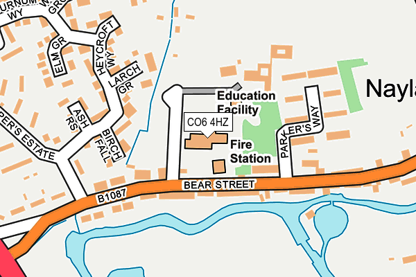
CO6 4HZ is located in the Bures St Mary & Nayland electoral ward, within the local authority district of Babergh and the English Parliamentary constituency of South Suffolk. The Sub Integrated Care Board (ICB) Location is NHS Suffolk and North East Essex ICB - 06L and the police force is Suffolk. This postcode has been in use since January 1980.


GetTheData
Source: OS OpenMap – Local (Ordnance Survey)
Source: OS VectorMap District (Ordnance Survey)
Licence: Open Government Licence (requires attribution)
| Easting | 597092 |
| Northing | 234371 |
| Latitude | 51.972861 |
| Longitude | 0.868036 |
GetTheData
Source: Open Postcode Geo
Licence: Open Government Licence
| Country | England |
| Postcode District | CO6 |
➜ See where CO6 is on a map ➜ Where is Nayland? | |
GetTheData
Source: Land Registry Price Paid Data
Licence: Open Government Licence
Elevation or altitude of CO6 4HZ as distance above sea level:
| Metres | Feet | |
|---|---|---|
| Elevation | 20m | 66ft |
Elevation is measured from the approximate centre of the postcode, to the nearest point on an OS contour line from OS Terrain 50, which has contour spacing of ten vertical metres.
➜ How high above sea level am I? Find the elevation of your current position using your device's GPS.
GetTheData
Source: Open Postcode Elevation
Licence: Open Government Licence
| Ward | Bures St Mary & Nayland |
| Constituency | South Suffolk |
GetTheData
Source: ONS Postcode Database
Licence: Open Government Licence
| Shelter (Heycroft Way) | Nayland | 194m |
| Doctors Surgery (Bear Street) | Nayland | 196m |
| Doctors Surgery (Bear Street) | Nayland | 225m |
| Bear Street (A134) | Nayland | 343m |
| Mill Street (Birch Street) | Nayland | 378m |
GetTheData
Source: NaPTAN
Licence: Open Government Licence
GetTheData
Source: ONS Postcode Database
Licence: Open Government Licence


➜ Get more ratings from the Food Standards Agency
GetTheData
Source: Food Standards Agency
Licence: FSA terms & conditions
| Last Collection | |||
|---|---|---|---|
| Location | Mon-Fri | Sat | Distance |
| Bear Street Nayland | 16:30 | 10:30 | 144m |
| Crossfields Butt Road | 16:30 | 10:30 | 2,494m |
| Stoke By Nayland Post Office | 17:15 | 11:00 | 2,605m |
GetTheData
Source: Dracos
Licence: Creative Commons Attribution-ShareAlike
The below table lists the International Territorial Level (ITL) codes (formerly Nomenclature of Territorial Units for Statistics (NUTS) codes) and Local Administrative Units (LAU) codes for CO6 4HZ:
| ITL 1 Code | Name |
|---|---|
| TLH | East |
| ITL 2 Code | Name |
| TLH1 | East Anglia |
| ITL 3 Code | Name |
| TLH14 | Suffolk CC |
| LAU 1 Code | Name |
| E07000200 | Babergh |
GetTheData
Source: ONS Postcode Directory
Licence: Open Government Licence
The below table lists the Census Output Area (OA), Lower Layer Super Output Area (LSOA), and Middle Layer Super Output Area (MSOA) for CO6 4HZ:
| Code | Name | |
|---|---|---|
| OA | E00152404 | |
| LSOA | E01029906 | Babergh 009D |
| MSOA | E02006235 | Babergh 009 |
GetTheData
Source: ONS Postcode Directory
Licence: Open Government Licence
| CO6 4HY | Bear Street | 75m |
| CO6 4LA | Bear Street | 105m |
| CO6 4LD | Birch Fall | 145m |
| CO6 4LN | Heycroft Way | 156m |
| CO6 4LE | Larch Grove | 158m |
| CO6 4LP | Ash Rise | 198m |
| CO6 4LF | Heycroft Way | 229m |
| CO6 4HX | Bear Street | 258m |
| CO6 4LL | Elm Grove | 259m |
| CO6 4LB | Harpers Estate | 274m |
GetTheData
Source: Open Postcode Geo; Land Registry Price Paid Data
Licence: Open Government Licence