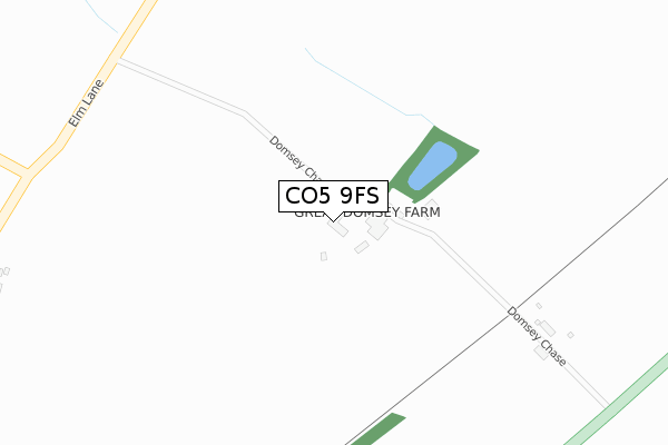
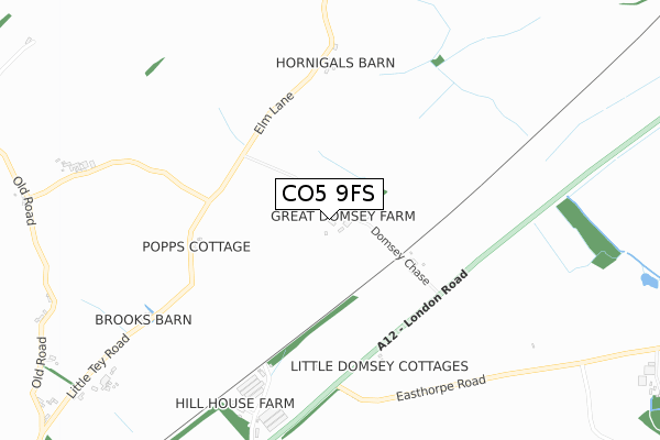
CO5 9FS is located in the Kelvedon & Feering electoral ward, within the local authority district of Braintree and the English Parliamentary constituency of Witham. The Sub Integrated Care Board (ICB) Location is NHS Mid and South Essex ICB - 06Q and the police force is Essex. This postcode has been in use since May 2019.


GetTheData
Source: OS Open Zoomstack (Ordnance Survey)
Licence: Open Government Licence (requires attribution)
Attribution: Contains OS data © Crown copyright and database right 2024
Source: Open Postcode Geo
Licence: Open Government Licence (requires attribution)
Attribution: Contains OS data © Crown copyright and database right 2024; Contains Royal Mail data © Royal Mail copyright and database right 2024; Source: Office for National Statistics licensed under the Open Government Licence v.3.0
| Easting | 588782 |
| Northing | 221740 |
| Latitude | 51.862309 |
| Longitude | 0.740283 |
GetTheData
Source: Open Postcode Geo
Licence: Open Government Licence
| Country | England |
| Postcode District | CO5 |
➜ See where CO5 is on a map | |
GetTheData
Source: Land Registry Price Paid Data
Licence: Open Government Licence
| Ward | Kelvedon & Feering |
| Constituency | Witham |
GetTheData
Source: ONS Postcode Database
Licence: Open Government Licence
| Little Domsey (London Road) | Feering | 470m |
| Little Domsey (London Road) | Feering | 511m |
| Easthorpe Road (London Road) | Feering | 580m |
| Easthorpe Road (London Road) | Feering | 671m |
| Easthorpegreen Farm (London Road) | Marks Tey | 1,469m |
| Kelvedon Station | 3.5km |
| Marks Tey Station | 3.6km |
GetTheData
Source: NaPTAN
Licence: Open Government Licence
| Percentage of properties with Next Generation Access | 100.0% |
| Percentage of properties with Superfast Broadband | 0.0% |
| Percentage of properties with Ultrafast Broadband | 0.0% |
| Percentage of properties with Full Fibre Broadband | 0.0% |
Superfast Broadband is between 30Mbps and 300Mbps
Ultrafast Broadband is > 300Mbps
| Percentage of properties unable to receive 2Mbps | 100.0% |
| Percentage of properties unable to receive 5Mbps | 100.0% |
| Percentage of properties unable to receive 10Mbps | 100.0% |
| Percentage of properties unable to receive 30Mbps | 100.0% |
GetTheData
Source: Ofcom
Licence: Ofcom Terms of Use (requires attribution)
GetTheData
Source: ONS Postcode Database
Licence: Open Government Licence


➜ Get more ratings from the Food Standards Agency
GetTheData
Source: Food Standards Agency
Licence: FSA terms & conditions
| Last Collection | |||
|---|---|---|---|
| Location | Mon-Fri | Sat | Distance |
| New Lane Feering | 17:00 | 10:30 | 1,738m |
| Godmans Lane Marks Tey | 17:00 | 10:30 | 2,237m |
| Rye Mill Lane Kelvedon | 17:00 | 10:30 | 2,621m |
GetTheData
Source: Dracos
Licence: Creative Commons Attribution-ShareAlike
The below table lists the International Territorial Level (ITL) codes (formerly Nomenclature of Territorial Units for Statistics (NUTS) codes) and Local Administrative Units (LAU) codes for CO5 9FS:
| ITL 1 Code | Name |
|---|---|
| TLH | East |
| ITL 2 Code | Name |
| TLH3 | Essex |
| ITL 3 Code | Name |
| TLH34 | Essex Haven Gateway |
| LAU 1 Code | Name |
| E07000067 | Braintree |
GetTheData
Source: ONS Postcode Directory
Licence: Open Government Licence
The below table lists the Census Output Area (OA), Lower Layer Super Output Area (LSOA), and Middle Layer Super Output Area (MSOA) for CO5 9FS:
| Code | Name | |
|---|---|---|
| OA | E00108600 | |
| LSOA | E01021377 | Braintree 014A |
| MSOA | E02004459 | Braintree 014 |
GetTheData
Source: ONS Postcode Directory
Licence: Open Government Licence
| CO5 9ES | Domsey Chase | 353m |
| CO5 9EP | London Road | 585m |
| CO5 9RS | Little Tey Road | 596m |
| CO5 9EN | London Road | 627m |
| CO5 9EW | London Road | 862m |
| CO5 9RP | Little Tey Road | 993m |
| CO5 9RL | Langley Green | 1017m |
| CO5 9RH | Langley Green | 1164m |
| CO5 9RN | Old Road | 1177m |
| CO5 9EL | London Road | 1265m |
GetTheData
Source: Open Postcode Geo; Land Registry Price Paid Data
Licence: Open Government Licence