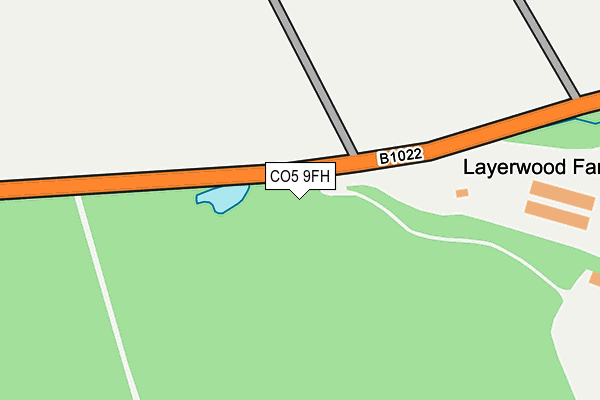
CO5 9FH is located in the Marks Tey and Layer electoral ward, within the local authority district of Colchester and the English Parliamentary constituency of Witham. The Sub Integrated Care Board (ICB) Location is NHS Suffolk and North East Essex ICB - 06T and the police force is Essex. This postcode has been in use since September 2013.


GetTheData
Source: OS OpenMap – Local (Ordnance Survey)
Source: OS VectorMap District (Ordnance Survey)
Licence: Open Government Licence (requires attribution)
| Easting | 591452 |
| Northing | 218446 |
| Latitude | 51.831808 |
| Longitude | 0.777160 |
GetTheData
Source: Open Postcode Geo
Licence: Open Government Licence
| Country | England |
| Postcode District | CO5 |
➜ See where CO5 is on a map | |
GetTheData
Source: Land Registry Price Paid Data
Licence: Open Government Licence
Elevation or altitude of CO5 9FH as distance above sea level:
| Metres | Feet | |
|---|---|---|
| Elevation | 50m | 164ft |
Elevation is measured from the approximate centre of the postcode, to the nearest point on an OS contour line from OS Terrain 50, which has contour spacing of ten vertical metres.
➜ How high above sea level am I? Find the elevation of your current position using your device's GPS.
GetTheData
Source: Open Postcode Elevation
Licence: Open Government Licence
| Ward | Marks Tey And Layer |
| Constituency | Witham |
GetTheData
Source: ONS Postcode Database
Licence: Open Government Licence
| Smyths Green (Maldon Road) | Smyths Green | 712m |
| Smyths Green (Maldon Road) | Smyths Green | 719m |
| Harborough Hall Lane (Maldon Road (B1022)) | Messing | 879m |
| Harborough Hall Lane (Maldon Road (B1022)) | Messing | 886m |
| Roundbush Road (Maldon Road) | Birch | 1,459m |
GetTheData
Source: NaPTAN
Licence: Open Government Licence
GetTheData
Source: ONS Postcode Database
Licence: Open Government Licence


➜ Get more ratings from the Food Standards Agency
GetTheData
Source: Food Standards Agency
Licence: FSA terms & conditions
| Last Collection | |||
|---|---|---|---|
| Location | Mon-Fri | Sat | Distance |
| Tower Corner Layer Marney | 16:30 | 10:30 | 1,247m |
| Mill Lane Birch Green | 16:35 | 11:30 | 2,613m |
| Tiptree Delivery Office | 16:30 | 10:30 | 2,756m |
GetTheData
Source: Dracos
Licence: Creative Commons Attribution-ShareAlike
The below table lists the International Territorial Level (ITL) codes (formerly Nomenclature of Territorial Units for Statistics (NUTS) codes) and Local Administrative Units (LAU) codes for CO5 9FH:
| ITL 1 Code | Name |
|---|---|
| TLH | East |
| ITL 2 Code | Name |
| TLH3 | Essex |
| ITL 3 Code | Name |
| TLH34 | Essex Haven Gateway |
| LAU 1 Code | Name |
| E07000071 | Colchester |
GetTheData
Source: ONS Postcode Directory
Licence: Open Government Licence
The below table lists the Census Output Area (OA), Lower Layer Super Output Area (LSOA), and Middle Layer Super Output Area (MSOA) for CO5 9FH:
| Code | Name | |
|---|---|---|
| OA | E00109944 | |
| LSOA | E01021643 | Colchester 019A |
| MSOA | E02004524 | Colchester 019 |
GetTheData
Source: ONS Postcode Directory
Licence: Open Government Licence
| CO5 9XT | 562m | |
| CO5 9XN | 601m | |
| CO5 9XW | 605m | |
| CO5 9XS | Poplar Cottages | 621m |
| CO5 9XG | Birch Holt Cottages | 632m |
| CO5 9XP | 662m | |
| CO5 9UE | Haynes Green Cottages | 700m |
| CO5 9UD | Oak Pit Cottages | 909m |
| CO5 9XE | 957m | |
| CO5 9UP | Woodview Cottages | 1076m |
GetTheData
Source: Open Postcode Geo; Land Registry Price Paid Data
Licence: Open Government Licence