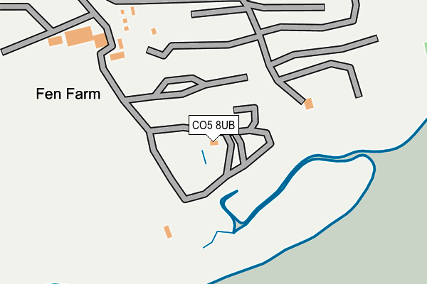
CO5 8UB is located in the Mersea and Pyefleet electoral ward, within the local authority district of Colchester and the English Parliamentary constituency of Harwich and North Essex. The Sub Integrated Care Board (ICB) Location is NHS Suffolk and North East Essex ICB - 06T and the police force is Essex. This postcode has been in use since January 1980.


GetTheData
Source: OS OpenMap – Local (Ordnance Survey)
Source: OS VectorMap District (Ordnance Survey)
Licence: Open Government Licence (requires attribution)
| Easting | 606200 |
| Northing | 214293 |
| Latitude | 51.789285 |
| Longitude | 0.988458 |
GetTheData
Source: Open Postcode Geo
Licence: Open Government Licence
| Country | England |
| Postcode District | CO5 |
➜ See where CO5 is on a map | |
GetTheData
Source: Land Registry Price Paid Data
Licence: Open Government Licence
Elevation or altitude of CO5 8UB as distance above sea level:
| Metres | Feet | |
|---|---|---|
| Elevation | 10m | 33ft |
Elevation is measured from the approximate centre of the postcode, to the nearest point on an OS contour line from OS Terrain 50, which has contour spacing of ten vertical metres.
➜ How high above sea level am I? Find the elevation of your current position using your device's GPS.
GetTheData
Source: Open Postcode Elevation
Licence: Open Government Licence
| Ward | Mersea And Pyefleet |
| Constituency | Harwich And North Essex |
GetTheData
Source: ONS Postcode Database
Licence: Open Government Licence
| Bromans Lane (East Road) | East Mersea | 567m |
| Bromans Lane (East Road) | East Mersea | 574m |
| The Dog & Pheasant (East Road) | East Mersea | 659m |
| The Dog & Pheasant (East Road) | East Mersea | 693m |
| Ivy Lane (East Road) | East Mersea | 1,075m |
GetTheData
Source: NaPTAN
Licence: Open Government Licence
GetTheData
Source: ONS Postcode Database
Licence: Open Government Licence


➜ Get more ratings from the Food Standards Agency
GetTheData
Source: Food Standards Agency
Licence: FSA terms & conditions
| Last Collection | |||
|---|---|---|---|
| Location | Mon-Fri | Sat | Distance |
| Tower Estate Point Clear | 16:50 | 09:00 | 2,535m |
| Colne Way Point Clear | 16:50 | 09:00 | 2,731m |
| Waterside Brightlingsea | 17:15 | 11:05 | 3,075m |
GetTheData
Source: Dracos
Licence: Creative Commons Attribution-ShareAlike
The below table lists the International Territorial Level (ITL) codes (formerly Nomenclature of Territorial Units for Statistics (NUTS) codes) and Local Administrative Units (LAU) codes for CO5 8UB:
| ITL 1 Code | Name |
|---|---|
| TLH | East |
| ITL 2 Code | Name |
| TLH3 | Essex |
| ITL 3 Code | Name |
| TLH34 | Essex Haven Gateway |
| LAU 1 Code | Name |
| E07000071 | Colchester |
GetTheData
Source: ONS Postcode Directory
Licence: Open Government Licence
The below table lists the Census Output Area (OA), Lower Layer Super Output Area (LSOA), and Middle Layer Super Output Area (MSOA) for CO5 8UB:
| Code | Name | |
|---|---|---|
| OA | E00110194 | |
| LSOA | E01021694 | Colchester 019D |
| MSOA | E02004524 | Colchester 019 |
GetTheData
Source: ONS Postcode Directory
Licence: Open Government Licence
| CO5 8UE | Bromans Lane | 507m |
| CO5 8TP | East Road | 674m |
| CO5 8UJ | East Road | 763m |
| CO5 8TR | Shop Lane | 974m |
| CO5 8UN | East Road | 1039m |
| CO5 8TJ | Church Lane | 1059m |
| CO5 8UW | Dormy Houses | 1099m |
| CO5 8US | Ivy Lane | 1221m |
| CO5 8TQ | East Road | 1372m |
| CO5 8TG | Hall Cottages | 1564m |
GetTheData
Source: Open Postcode Geo; Land Registry Price Paid Data
Licence: Open Government Licence