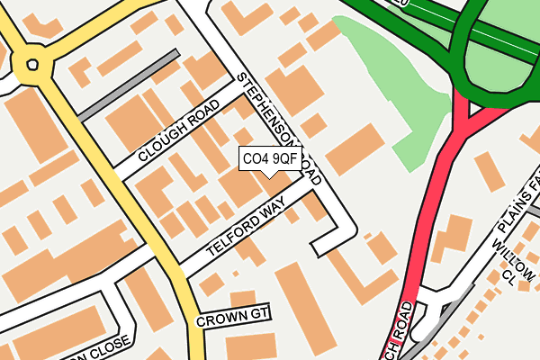
CO4 9QF is located in the Highwoods electoral ward, within the local authority district of Colchester and the English Parliamentary constituency of Colchester. The Sub Integrated Care Board (ICB) Location is NHS Suffolk and North East Essex ICB - 06T and the police force is Essex. This postcode has been in use since June 2002.


GetTheData
Source: OS OpenMap – Local (Ordnance Survey)
Source: OS VectorMap District (Ordnance Survey)
Licence: Open Government Licence (requires attribution)
| Easting | 601636 |
| Northing | 228712 |
| Latitude | 51.920408 |
| Longitude | 0.930750 |
GetTheData
Source: Open Postcode Geo
Licence: Open Government Licence
| Country | England |
| Postcode District | CO4 |
➜ See where CO4 is on a map ➜ Where is Colchester? | |
GetTheData
Source: Land Registry Price Paid Data
Licence: Open Government Licence
Elevation or altitude of CO4 9QF as distance above sea level:
| Metres | Feet | |
|---|---|---|
| Elevation | 40m | 131ft |
Elevation is measured from the approximate centre of the postcode, to the nearest point on an OS contour line from OS Terrain 50, which has contour spacing of ten vertical metres.
➜ How high above sea level am I? Find the elevation of your current position using your device's GPS.
GetTheData
Source: Open Postcode Elevation
Licence: Open Government Licence
| Ward | Highwoods |
| Constituency | Colchester |
GetTheData
Source: ONS Postcode Database
Licence: Open Government Licence
| Balkerne Gate (Ipswich Road) | Ardleigh | 191m |
| Balkerne Gate (Ipswich Road) | Ardleigh | 196m |
| Crown Gate (Wyncolls Road) | Colchester | 198m |
| Crown Gate (Wyncolls Road) | Colchester | 205m |
| Business Centre (Wyncolls Road) | Severalls Park | 227m |
| Colchester Station | 3.4km |
| Hythe (Essex) Station | 3.9km |
| Colchester Town Station | 4.2km |
GetTheData
Source: NaPTAN
Licence: Open Government Licence
GetTheData
Source: ONS Postcode Database
Licence: Open Government Licence


➜ Get more ratings from the Food Standards Agency
GetTheData
Source: Food Standards Agency
Licence: FSA terms & conditions
| Last Collection | |||
|---|---|---|---|
| Location | Mon-Fri | Sat | Distance |
| Lion And Lamb | 17:00 | 10:30 | 243m |
| Crown Lane Ardleigh | 16:00 | 10:30 | 728m |
| Chinook Highwoods | 17:30 | 11:30 | 1,139m |
GetTheData
Source: Dracos
Licence: Creative Commons Attribution-ShareAlike
The below table lists the International Territorial Level (ITL) codes (formerly Nomenclature of Territorial Units for Statistics (NUTS) codes) and Local Administrative Units (LAU) codes for CO4 9QF:
| ITL 1 Code | Name |
|---|---|
| TLH | East |
| ITL 2 Code | Name |
| TLH3 | Essex |
| ITL 3 Code | Name |
| TLH34 | Essex Haven Gateway |
| LAU 1 Code | Name |
| E07000071 | Colchester |
GetTheData
Source: ONS Postcode Directory
Licence: Open Government Licence
The below table lists the Census Output Area (OA), Lower Layer Super Output Area (LSOA), and Middle Layer Super Output Area (MSOA) for CO4 9QF:
| Code | Name | |
|---|---|---|
| OA | E00110069 | |
| LSOA | E01033720 | Colchester 002F |
| MSOA | E02004507 | Colchester 002 |
GetTheData
Source: ONS Postcode Directory
Licence: Open Government Licence
| CO4 9QS | Clough Road | 84m |
| CO4 9TZ | Crown Court | 140m |
| CO4 9QR | Stephenson Road | 179m |
| CO7 7QU | Plains Farm Close | 275m |
| CO7 7QX | Plains Farm Close | 284m |
| CO4 9HB | Ipswich Road | 294m |
| CO7 7QN | Willow Close | 318m |
| CO7 7QT | Plains Farm Close | 339m |
| CO4 9TB | Heckworth Close | 381m |
| CO4 9AJ | Francis Gunn Close | 391m |
GetTheData
Source: Open Postcode Geo; Land Registry Price Paid Data
Licence: Open Government Licence