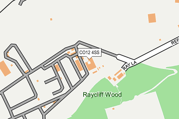
CO12 4SS is located in the Dovercourt Vines & Parkeston electoral ward, within the local authority district of Tendring and the English Parliamentary constituency of Harwich and North Essex. The Sub Integrated Care Board (ICB) Location is NHS Suffolk and North East Essex ICB - 06T and the police force is Essex. This postcode has been in use since January 1980.


GetTheData
Source: OS OpenMap – Local (Ordnance Survey)
Source: OS VectorMap District (Ordnance Survey)
Licence: Open Government Licence (requires attribution)
| Easting | 622943 |
| Northing | 232174 |
| Latitude | 51.943369 |
| Longitude | 1.242325 |
GetTheData
Source: Open Postcode Geo
Licence: Open Government Licence
| Country | England |
| Postcode District | CO12 |
➜ See where CO12 is on a map | |
GetTheData
Source: Land Registry Price Paid Data
Licence: Open Government Licence
Elevation or altitude of CO12 4SS as distance above sea level:
| Metres | Feet | |
|---|---|---|
| Elevation | 10m | 33ft |
Elevation is measured from the approximate centre of the postcode, to the nearest point on an OS contour line from OS Terrain 50, which has contour spacing of ten vertical metres.
➜ How high above sea level am I? Find the elevation of your current position using your device's GPS.
GetTheData
Source: Open Postcode Elevation
Licence: Open Government Licence
| Ward | Dovercourt Vines & Parkeston |
| Constituency | Harwich And North Essex |
GetTheData
Source: ONS Postcode Database
Licence: Open Government Licence
| Una Road (Station Road) | Parkeston | 675m |
| Una Road (Station Road) | Parkeston | 680m |
| Dart Parkeston (Tyler Street) | Parkeston | 767m |
| Harwich International Station (East Dock Road) | Harwich International Port | 875m |
| Churchill Court (Parkeston Road) | Upper Dovercourt | 1,189m |
| Harwich International Station | 1km |
| Dovercourt Station | 2.7km |
| Harwich Town Station | 3.1km |
GetTheData
Source: NaPTAN
Licence: Open Government Licence
GetTheData
Source: ONS Postcode Database
Licence: Open Government Licence


➜ Get more ratings from the Food Standards Agency
GetTheData
Source: Food Standards Agency
Licence: FSA terms & conditions
| Last Collection | |||
|---|---|---|---|
| Location | Mon-Fri | Sat | Distance |
| Edward Street Parkeston | 16:45 | 11:15 | 594m |
| Coller Road Parkeston | 17:15 | 11:15 | 687m |
| Parkeston Post Office | 17:15 | 11:15 | 854m |
GetTheData
Source: Dracos
Licence: Creative Commons Attribution-ShareAlike
| Risk of CO12 4SS flooding from rivers and sea | Low |
| ➜ CO12 4SS flood map | |
GetTheData
Source: Open Flood Risk by Postcode
Licence: Open Government Licence
The below table lists the International Territorial Level (ITL) codes (formerly Nomenclature of Territorial Units for Statistics (NUTS) codes) and Local Administrative Units (LAU) codes for CO12 4SS:
| ITL 1 Code | Name |
|---|---|
| TLH | East |
| ITL 2 Code | Name |
| TLH3 | Essex |
| ITL 3 Code | Name |
| TLH34 | Essex Haven Gateway |
| LAU 1 Code | Name |
| E07000076 | Tendring |
GetTheData
Source: ONS Postcode Directory
Licence: Open Government Licence
The below table lists the Census Output Area (OA), Lower Layer Super Output Area (LSOA), and Middle Layer Super Output Area (MSOA) for CO12 4SS:
| Code | Name | |
|---|---|---|
| OA | E00111914 | |
| LSOA | E01033051 | Tendring 002F |
| MSOA | E02004574 | Tendring 002 |
GetTheData
Source: ONS Postcode Directory
Licence: Open Government Licence
| CO12 4PX | Edward Street | 504m |
| CO12 4QA | Foster Road | 509m |
| CO12 4PS | Una Road | 569m |
| CO12 4PR | Una Road | 606m |
| CO12 4PP | Una Road | 648m |
| CO12 4QD | Makins Road | 685m |
| CO12 4PL | Adelaide Street | 694m |
| CO12 4PH | Tyler Street | 749m |
| CO12 4PY | Tyler Street | 779m |
| CO12 4PB | Garland Road | 797m |
GetTheData
Source: Open Postcode Geo; Land Registry Price Paid Data
Licence: Open Government Licence