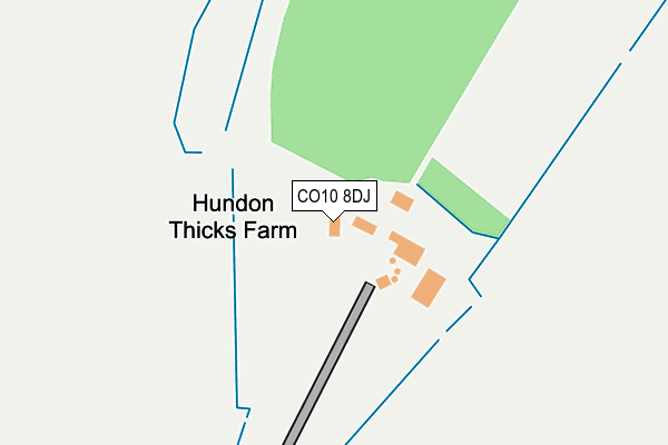
CO10 8DJ is located in the Clare, Hundon & Kedington electoral ward, within the local authority district of West Suffolk and the English Parliamentary constituency of West Suffolk. The Sub Integrated Care Board (ICB) Location is NHS Suffolk and North East Essex ICB - 07K and the police force is Suffolk. This postcode has been in use since January 1980.


GetTheData
Source: OS OpenMap – Local (Ordnance Survey)
Source: OS VectorMap District (Ordnance Survey)
Licence: Open Government Licence (requires attribution)
| Easting | 574415 |
| Northing | 248687 |
| Latitude | 52.109005 |
| Longitude | 0.545527 |
GetTheData
Source: Open Postcode Geo
Licence: Open Government Licence
| Country | England |
| Postcode District | CO10 |
➜ See where CO10 is on a map | |
GetTheData
Source: Land Registry Price Paid Data
Licence: Open Government Licence
Elevation or altitude of CO10 8DJ as distance above sea level:
| Metres | Feet | |
|---|---|---|
| Elevation | 80m | 262ft |
Elevation is measured from the approximate centre of the postcode, to the nearest point on an OS contour line from OS Terrain 50, which has contour spacing of ten vertical metres.
➜ How high above sea level am I? Find the elevation of your current position using your device's GPS.
GetTheData
Source: Open Postcode Elevation
Licence: Open Government Licence
| Ward | Clare, Hundon & Kedington |
| Constituency | West Suffolk |
GetTheData
Source: ONS Postcode Database
Licence: Open Government Licence
| Farmerie Road (Lower North Street) | Hundon | 606m |
| Farmerie Road (Lower North Street) | Hundon | 607m |
| Council Houses (Mill Lane) | Hundon | 853m |
| Council Houses (Mill Lane) | Hundon | 880m |
| Galley Road (Lower Road) | Hundon | 1,016m |
GetTheData
Source: NaPTAN
Licence: Open Government Licence
GetTheData
Source: ONS Postcode Database
Licence: Open Government Licence


➜ Get more ratings from the Food Standards Agency
GetTheData
Source: Food Standards Agency
Licence: FSA terms & conditions
| Last Collection | |||
|---|---|---|---|
| Location | Mon-Fri | Sat | Distance |
| Barnadiston Village | 16:15 | 11:00 | 3,324m |
| High Point Prison | 16:00 | 08:45 | 3,660m |
| Bridewell Street Clare | 16:00 | 10:30 | 3,932m |
GetTheData
Source: Dracos
Licence: Creative Commons Attribution-ShareAlike
The below table lists the International Territorial Level (ITL) codes (formerly Nomenclature of Territorial Units for Statistics (NUTS) codes) and Local Administrative Units (LAU) codes for CO10 8DJ:
| ITL 1 Code | Name |
|---|---|
| TLH | East |
| ITL 2 Code | Name |
| TLH1 | East Anglia |
| ITL 3 Code | Name |
| TLH14 | Suffolk CC |
| LAU 1 Code | Name |
| E07000245 | West Suffolk |
GetTheData
Source: ONS Postcode Directory
Licence: Open Government Licence
The below table lists the Census Output Area (OA), Lower Layer Super Output Area (LSOA), and Middle Layer Super Output Area (MSOA) for CO10 8DJ:
| Code | Name | |
|---|---|---|
| OA | E00169948 | |
| LSOA | E01030120 | St Edmundsbury 011A |
| MSOA | E02006283 | St Edmundsbury 011 |
GetTheData
Source: ONS Postcode Directory
Licence: Open Government Licence
| CO10 8EB | Lower North Street | 553m |
| CO10 8DL | Clare Road | 566m |
| CO10 8DN | Clare Road | 603m |
| CO10 8ED | North Street | 641m |
| CO10 8EE | North Street | 649m |
| CO10 8EA | Lower North Street | 650m |
| CO10 8ER | Church Street | 693m |
| CO10 8HA | Farmerie Road | 698m |
| CO10 8HD | Armstrong Close | 701m |
| CO10 8EF | Upper North Street | 745m |
GetTheData
Source: Open Postcode Geo; Land Registry Price Paid Data
Licence: Open Government Licence