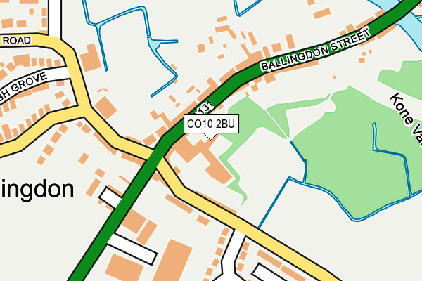
CO10 2BU lies on Ellistons Yard in Sudbury. CO10 2BU is located in the Sudbury South West electoral ward, within the local authority district of Babergh and the English Parliamentary constituency of South Suffolk. The Sub Integrated Care Board (ICB) Location is NHS Suffolk and North East Essex ICB - 07K and the police force is Suffolk. This postcode has been in use since December 1998.


GetTheData
Source: OS OpenMap – Local (Ordnance Survey)
Source: OS VectorMap District (Ordnance Survey)
Licence: Open Government Licence (requires attribution)
| Easting | 586480 |
| Northing | 240725 |
| Latitude | 52.033583 |
| Longitude | 0.717186 |
GetTheData
Source: Open Postcode Geo
Licence: Open Government Licence
| Street | Ellistons Yard |
| Town/City | Sudbury |
| Country | England |
| Postcode District | CO10 |
➜ See where CO10 is on a map ➜ Where is Sudbury? | |
GetTheData
Source: Land Registry Price Paid Data
Licence: Open Government Licence
Elevation or altitude of CO10 2BU as distance above sea level:
| Metres | Feet | |
|---|---|---|
| Elevation | 30m | 98ft |
Elevation is measured from the approximate centre of the postcode, to the nearest point on an OS contour line from OS Terrain 50, which has contour spacing of ten vertical metres.
➜ How high above sea level am I? Find the elevation of your current position using your device's GPS.
GetTheData
Source: Open Postcode Elevation
Licence: Open Government Licence
| Ward | Sudbury South West |
| Constituency | South Suffolk |
GetTheData
Source: ONS Postcode Database
Licence: Open Government Licence
| Strawberry Stores (Ballingdon Street) | Ballingdon | 52m |
| Strawberry Stores (Ballingdon Street) | Ballingdon | 61m |
| Meadow View Road (Middleton Road) | Ballingdon | 132m |
| Meadow View Road (Middleton Road) | Ballingdon | 137m |
| Old Railway Bridge (Ballingdon Street) | Ballingdon | 232m |
| Sudbury (Suffolk) Station | 1.3km |
GetTheData
Source: NaPTAN
Licence: Open Government Licence
GetTheData
Source: ONS Postcode Database
Licence: Open Government Licence


➜ Get more ratings from the Food Standards Agency
GetTheData
Source: Food Standards Agency
Licence: FSA terms & conditions
| Last Collection | |||
|---|---|---|---|
| Location | Mon-Fri | Sat | Distance |
| Ballingdon Post Office | 17:00 | 11:30 | 53m |
| Meadow View Road | 16:00 | 11:30 | 266m |
| Market Hill | 17:30 | 12:00 | 999m |
GetTheData
Source: Dracos
Licence: Creative Commons Attribution-ShareAlike
| Risk of CO10 2BU flooding from rivers and sea | Medium |
| ➜ CO10 2BU flood map | |
GetTheData
Source: Open Flood Risk by Postcode
Licence: Open Government Licence
The below table lists the International Territorial Level (ITL) codes (formerly Nomenclature of Territorial Units for Statistics (NUTS) codes) and Local Administrative Units (LAU) codes for CO10 2BU:
| ITL 1 Code | Name |
|---|---|
| TLH | East |
| ITL 2 Code | Name |
| TLH1 | East Anglia |
| ITL 3 Code | Name |
| TLH14 | Suffolk CC |
| LAU 1 Code | Name |
| E07000200 | Babergh |
GetTheData
Source: ONS Postcode Directory
Licence: Open Government Licence
The below table lists the Census Output Area (OA), Lower Layer Super Output Area (LSOA), and Middle Layer Super Output Area (MSOA) for CO10 2BU:
| Code | Name | |
|---|---|---|
| OA | E00152475 | |
| LSOA | E01029919 | Babergh 007G |
| MSOA | E02006233 | Babergh 007 |
GetTheData
Source: ONS Postcode Directory
Licence: Open Government Licence
| CO10 2BX | Ballingdon Street | 45m |
| CO10 2DA | Ballingdon Street | 74m |
| CO10 2DB | Middleton Road | 82m |
| CO10 2BT | Ballingdon Street | 94m |
| CO10 2DE | Braybrooke Mews | 97m |
| CO10 1DE | Bulmer Road | 160m |
| CO10 2BA | Ballingdon Gardens | 161m |
| CO10 2DX | Ballingdon Hill Industrial Estate | 190m |
| CO10 7NU | Meadow View Road | 197m |
| CO10 1DF | Sandy Lane | 222m |
GetTheData
Source: Open Postcode Geo; Land Registry Price Paid Data
Licence: Open Government Licence