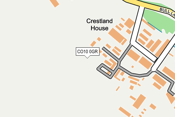
CO10 0GR is located in the Long Melford electoral ward, within the local authority district of Babergh and the English Parliamentary constituency of South Suffolk. The Sub Integrated Care Board (ICB) Location is NHS Suffolk and North East Essex ICB - 07K and the police force is Suffolk. This postcode has been in use since February 2015.


GetTheData
Source: OS OpenMap – Local (Ordnance Survey)
Source: OS VectorMap District (Ordnance Survey)
Licence: Open Government Licence (requires attribution)
| Easting | 588182 |
| Northing | 245767 |
| Latitude | 52.078289 |
| Longitude | 0.744743 |
GetTheData
Source: Open Postcode Geo
Licence: Open Government Licence
| Country | England |
| Postcode District | CO10 |
➜ See where CO10 is on a map | |
GetTheData
Source: Land Registry Price Paid Data
Licence: Open Government Licence
Elevation or altitude of CO10 0GR as distance above sea level:
| Metres | Feet | |
|---|---|---|
| Elevation | 50m | 164ft |
Elevation is measured from the approximate centre of the postcode, to the nearest point on an OS contour line from OS Terrain 50, which has contour spacing of ten vertical metres.
➜ How high above sea level am I? Find the elevation of your current position using your device's GPS.
GetTheData
Source: Open Postcode Elevation
Licence: Open Government Licence
| Ward | Long Melford |
| Constituency | South Suffolk |
GetTheData
Source: ONS Postcode Database
Licence: Open Government Licence
| Industrial Estate (Melford Road) | Acton Place | 344m |
| Industrial Estate (Melford Road) | Acton Place | 358m |
| Bull Lane Farm (Bull Lane) | Long Melford | 897m |
| Bull Lane Farm (Bull Lane) | Long Melford | 901m |
| Lakforth (Bull Lane) | Long Melford | 1,194m |
| Sudbury (Suffolk) Station | 4.7km |
GetTheData
Source: NaPTAN
Licence: Open Government Licence
GetTheData
Source: ONS Postcode Database
Licence: Open Government Licence

➜ Get more ratings from the Food Standards Agency
GetTheData
Source: Food Standards Agency
Licence: FSA terms & conditions
| Last Collection | |||
|---|---|---|---|
| Location | Mon-Fri | Sat | Distance |
| Acton Post Office | 17:15 | 10:30 | 1,365m |
| Shaw Road Long Melford | 16:45 | 10:30 | 1,537m |
| Cordell Road Long Melford | 16:45 | 10:30 | 1,676m |
GetTheData
Source: Dracos
Licence: Creative Commons Attribution-ShareAlike
The below table lists the International Territorial Level (ITL) codes (formerly Nomenclature of Territorial Units for Statistics (NUTS) codes) and Local Administrative Units (LAU) codes for CO10 0GR:
| ITL 1 Code | Name |
|---|---|
| TLH | East |
| ITL 2 Code | Name |
| TLH1 | East Anglia |
| ITL 3 Code | Name |
| TLH14 | Suffolk CC |
| LAU 1 Code | Name |
| E07000200 | Babergh |
GetTheData
Source: ONS Postcode Directory
Licence: Open Government Licence
The below table lists the Census Output Area (OA), Lower Layer Super Output Area (LSOA), and Middle Layer Super Output Area (MSOA) for CO10 0GR:
| Code | Name | |
|---|---|---|
| OA | E00152486 | |
| LSOA | E01029922 | Babergh 006C |
| MSOA | E02006232 | Babergh 006 |
GetTheData
Source: ONS Postcode Directory
Licence: Open Government Licence
| CO10 0BB | Melford Road | 345m |
| CO10 0BE | Bull Lane | 387m |
| CO10 0BG | Bull Lane | 767m |
| CO10 0BQ | Bull Lane | 934m |
| CO10 0BH | Lavenham Road | 1084m |
| CO10 0BA | Melford Road | 1129m |
| CO10 9TG | Palmerswent Close | 1182m |
| CO10 9TF | Sampson Drive | 1215m |
| CO10 0UG | Walnut Close | 1234m |
| CO10 0AX | Sudbury Road | 1288m |
GetTheData
Source: Open Postcode Geo; Land Registry Price Paid Data
Licence: Open Government Licence