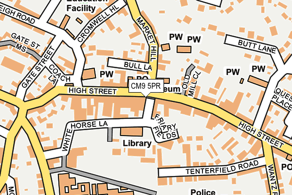
CM9 5PR is located in the Maldon North electoral ward, within the local authority district of Maldon and the English Parliamentary constituency of Maldon. The Sub Integrated Care Board (ICB) Location is NHS Mid and South Essex ICB - 06Q and the police force is Essex. This postcode has been in use since July 1995.


GetTheData
Source: OS OpenMap – Local (Ordnance Survey)
Source: OS VectorMap District (Ordnance Survey)
Licence: Open Government Licence (requires attribution)
| Easting | 585055 |
| Northing | 207021 |
| Latitude | 51.731352 |
| Longitude | 0.678345 |
GetTheData
Source: Open Postcode Geo
Licence: Open Government Licence
| Country | England |
| Postcode District | CM9 |
➜ See where CM9 is on a map | |
GetTheData
Source: Land Registry Price Paid Data
Licence: Open Government Licence
Elevation or altitude of CM9 5PR as distance above sea level:
| Metres | Feet | |
|---|---|---|
| Elevation | 30m | 98ft |
Elevation is measured from the approximate centre of the postcode, to the nearest point on an OS contour line from OS Terrain 50, which has contour spacing of ten vertical metres.
➜ How high above sea level am I? Find the elevation of your current position using your device's GPS.
GetTheData
Source: Open Postcode Elevation
Licence: Open Government Licence
| Ward | Maldon North |
| Constituency | Maldon |
GetTheData
Source: ONS Postcode Database
Licence: Open Government Licence
| The Swan Hotel (High Street) | Maldon Town Centre | 40m |
| The Swan Hotel (High Street) | Maldon Town Centre | 58m |
| All Saints Church (High Street) | Maldon Town Centre | 118m |
| The White Horse (High Street) | Maldon Town Centre | 131m |
| Upper Plume School (Fambridge Road) | Maldon | 269m |
GetTheData
Source: NaPTAN
Licence: Open Government Licence
GetTheData
Source: ONS Postcode Database
Licence: Open Government Licence


➜ Get more ratings from the Food Standards Agency
GetTheData
Source: Food Standards Agency
Licence: FSA terms & conditions
| Last Collection | |||
|---|---|---|---|
| Location | Mon-Fri | Sat | Distance |
| Maldon Post Office | 17:30 | 12:15 | 58m |
| Wantz Corner | 17:30 | 11:30 | 241m |
| West Square | 18:00 | 11:30 | 242m |
GetTheData
Source: Dracos
Licence: Creative Commons Attribution-ShareAlike
The below table lists the International Territorial Level (ITL) codes (formerly Nomenclature of Territorial Units for Statistics (NUTS) codes) and Local Administrative Units (LAU) codes for CM9 5PR:
| ITL 1 Code | Name |
|---|---|
| TLH | East |
| ITL 2 Code | Name |
| TLH3 | Essex |
| ITL 3 Code | Name |
| TLH36 | Heart of Essex |
| LAU 1 Code | Name |
| E07000074 | Maldon |
GetTheData
Source: ONS Postcode Directory
Licence: Open Government Licence
The below table lists the Census Output Area (OA), Lower Layer Super Output Area (LSOA), and Middle Layer Super Output Area (MSOA) for CM9 5PR:
| Code | Name | |
|---|---|---|
| OA | E00111207 | |
| LSOA | E01021890 | Maldon 004B |
| MSOA | E02004558 | Maldon 004 |
GetTheData
Source: ONS Postcode Directory
Licence: Open Government Licence
| CM9 5YH | High Street | 27m |
| CM9 5PF | High Street | 49m |
| CM9 5PN | High Street | 77m |
| CM9 4PZ | Market Hill | 90m |
| CM9 4HS | Saxon Court | 93m |
| CM9 5EH | Old Mill Close | 104m |
| CM9 5FJ | Carmelite Way | 125m |
| CM9 5EP | High Street | 126m |
| CM9 5QP | White Horse Lane | 135m |
| CM9 4FH | Hill House Park | 152m |
GetTheData
Source: Open Postcode Geo; Land Registry Price Paid Data
Licence: Open Government Licence