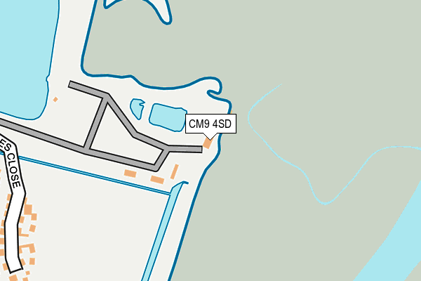
CM9 4SD is located in the Heybridge East electoral ward, within the local authority district of Maldon and the English Parliamentary constituency of Maldon. The Sub Integrated Care Board (ICB) Location is NHS Mid and South Essex ICB - 06Q and the police force is Essex. This postcode has been in use since July 1995.


GetTheData
Source: OS OpenMap – Local (Ordnance Survey)
Source: OS VectorMap District (Ordnance Survey)
Licence: Open Government Licence (requires attribution)
| Easting | 587527 |
| Northing | 207427 |
| Latitude | 51.734178 |
| Longitude | 0.714317 |
GetTheData
Source: Open Postcode Geo
Licence: Open Government Licence
| Country | England |
| Postcode District | CM9 |
➜ See where CM9 is on a map | |
GetTheData
Source: Land Registry Price Paid Data
Licence: Open Government Licence
Elevation or altitude of CM9 4SD as distance above sea level:
| Metres | Feet | |
|---|---|---|
| Elevation | 0m | 0ft |
Elevation is measured from the approximate centre of the postcode, to the nearest point on an OS contour line from OS Terrain 50, which has contour spacing of ten vertical metres.
➜ How high above sea level am I? Find the elevation of your current position using your device's GPS.
GetTheData
Source: Open Postcode Elevation
Licence: Open Government Licence
| Ward | Heybridge East |
| Constituency | Maldon |
GetTheData
Source: ONS Postcode Database
Licence: Open Government Licence
| The Colliers (Basin Road) | Heybridge | 391m |
| Wharf Road (Goldhanger Road) | Heybridge | 473m |
| Wharf Road (Goldhanger Road) | Heybridge | 478m |
| Mill Beach Hotel (Goldhanger Road) | Heybridge | 533m |
| Mill Beach Hotel (Goldhanger Road) | Heybridge | 535m |
GetTheData
Source: NaPTAN
Licence: Open Government Licence
GetTheData
Source: ONS Postcode Database
Licence: Open Government Licence


➜ Get more ratings from the Food Standards Agency
GetTheData
Source: Food Standards Agency
Licence: FSA terms & conditions
| Last Collection | |||
|---|---|---|---|
| Location | Mon-Fri | Sat | Distance |
| Church Street | 17:30 | 11:30 | 2,076m |
| The Causeway | 17:30 | 11:00 | 2,181m |
| Wantz Corner | 17:30 | 11:30 | 2,290m |
GetTheData
Source: Dracos
Licence: Creative Commons Attribution-ShareAlike
| Risk of CM9 4SD flooding from rivers and sea | Low |
| ➜ CM9 4SD flood map | |
GetTheData
Source: Open Flood Risk by Postcode
Licence: Open Government Licence
The below table lists the International Territorial Level (ITL) codes (formerly Nomenclature of Territorial Units for Statistics (NUTS) codes) and Local Administrative Units (LAU) codes for CM9 4SD:
| ITL 1 Code | Name |
|---|---|
| TLH | East |
| ITL 2 Code | Name |
| TLH3 | Essex |
| ITL 3 Code | Name |
| TLH36 | Heart of Essex |
| LAU 1 Code | Name |
| E07000074 | Maldon |
GetTheData
Source: ONS Postcode Directory
Licence: Open Government Licence
The below table lists the Census Output Area (OA), Lower Layer Super Output Area (LSOA), and Middle Layer Super Output Area (MSOA) for CM9 4SD:
| Code | Name | |
|---|---|---|
| OA | E00111167 | |
| LSOA | E01021885 | Maldon 003B |
| MSOA | E02004557 | Maldon 003 |
GetTheData
Source: ONS Postcode Directory
Licence: Open Government Licence
| CM9 4RZ | St Georges Close | 304m |
| CM9 4SF | The Stiles | 352m |
| CM9 4SE | The Colliers | 362m |
| CM9 4QY | Wharf Road | 387m |
| CM9 4QP | Saltcote Maltings | 419m |
| CM9 4RJ | Basin Road | 425m |
| CM9 4RH | Harfred Avenue | 435m |
| CM9 4RT | Maritime Avenue | 445m |
| CM9 4QX | Goldhanger Road | 449m |
| CM9 4RA | Goldhanger Road | 475m |
GetTheData
Source: Open Postcode Geo; Land Registry Price Paid Data
Licence: Open Government Licence