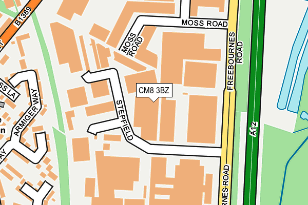
CM8 3BZ is located in the Witham Central electoral ward, within the local authority district of Braintree and the English Parliamentary constituency of Witham. The Sub Integrated Care Board (ICB) Location is NHS Mid and South Essex ICB - 06Q and the police force is Essex. This postcode has been in use since March 1988.


GetTheData
Source: OS OpenMap – Local (Ordnance Survey)
Source: OS VectorMap District (Ordnance Survey)
Licence: Open Government Licence (requires attribution)
| Easting | 582782 |
| Northing | 214858 |
| Latitude | 51.802494 |
| Longitude | 0.649616 |
GetTheData
Source: Open Postcode Geo
Licence: Open Government Licence
| Country | England |
| Postcode District | CM8 |
➜ See where CM8 is on a map ➜ Where is Witham? | |
GetTheData
Source: Land Registry Price Paid Data
Licence: Open Government Licence
Elevation or altitude of CM8 3BZ as distance above sea level:
| Metres | Feet | |
|---|---|---|
| Elevation | 20m | 66ft |
Elevation is measured from the approximate centre of the postcode, to the nearest point on an OS contour line from OS Terrain 50, which has contour spacing of ten vertical metres.
➜ How high above sea level am I? Find the elevation of your current position using your device's GPS.
GetTheData
Source: Open Postcode Elevation
Licence: Open Government Licence
| Ward | Witham Central |
| Constituency | Witham |
GetTheData
Source: ONS Postcode Database
Licence: Open Government Licence
| Wheaton Road (Freebournes Road) | Witham | 300m |
| Wheaton Road (Freebournes Road) | Witham | 305m |
| Avenue Road (Newland Street) | Witham | 384m |
| Avenue Road (Newland Street) | Witham | 385m |
| Ford Garage (Colchester Road) | Witham | 457m |
| Witham (Essex) Station | 0.8km |
| Hatfield Peverel Station | 4.7km |
| White Notley Station | 5.5km |
GetTheData
Source: NaPTAN
Licence: Open Government Licence
GetTheData
Source: ONS Postcode Database
Licence: Open Government Licence


➜ Get more ratings from the Food Standards Agency
GetTheData
Source: Food Standards Agency
Licence: FSA terms & conditions
| Last Collection | |||
|---|---|---|---|
| Location | Mon-Fri | Sat | Distance |
| Witham Sorting Office | 18:30 | 13:00 | 598m |
| Railway Station | 17:45 | 11:30 | 842m |
| Eastways Industrial Estate | 18:15 | 11:30 | 868m |
GetTheData
Source: Dracos
Licence: Creative Commons Attribution-ShareAlike
The below table lists the International Territorial Level (ITL) codes (formerly Nomenclature of Territorial Units for Statistics (NUTS) codes) and Local Administrative Units (LAU) codes for CM8 3BZ:
| ITL 1 Code | Name |
|---|---|
| TLH | East |
| ITL 2 Code | Name |
| TLH3 | Essex |
| ITL 3 Code | Name |
| TLH34 | Essex Haven Gateway |
| LAU 1 Code | Name |
| E07000067 | Braintree |
GetTheData
Source: ONS Postcode Directory
Licence: Open Government Licence
The below table lists the Census Output Area (OA), Lower Layer Super Output Area (LSOA), and Middle Layer Super Output Area (MSOA) for CM8 3BZ:
| Code | Name | |
|---|---|---|
| OA | E00108802 | |
| LSOA | E01021416 | Braintree 017B |
| MSOA | E02004462 | Braintree 017 |
GetTheData
Source: ONS Postcode Directory
Licence: Open Government Licence
| CM8 3UN | Freebournes Road | 108m |
| CM8 3TH | Stepfield | 111m |
| CM8 2UD | Oliver Place | 242m |
| CM8 2UY | Armiger Way | 258m |
| CM8 2YS | Bevington Mews | 271m |
| CM8 2TZ | Charlotte Way | 275m |
| CM8 2UZ | Armiger Way | 284m |
| CM8 2UA | Kynaston Place | 288m |
| CM8 3UQ | Moss Road | 292m |
| CM8 2UB | Richardson Walk | 309m |
GetTheData
Source: Open Postcode Geo; Land Registry Price Paid Data
Licence: Open Government Licence