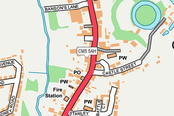
CM5 5AH is located in the Chipping Ongar, Greensted and Marden Ash electoral ward, within the local authority district of Epping Forest and the English Parliamentary constituency of Brentwood and Ongar. The Sub Integrated Care Board (ICB) Location is NHS Hertfordshire and West Essex ICB - 07H and the police force is Essex. This postcode has been in use since November 2010.


GetTheData
Source: OS OpenMap – Local (Ordnance Survey)
Source: OS VectorMap District (Ordnance Survey)
Licence: Open Government Licence (requires attribution)
| Easting | 555239 |
| Northing | 202949 |
| Latitude | 51.703812 |
| Longitude | 0.245164 |
GetTheData
Source: Open Postcode Geo
Licence: Open Government Licence
| Country | England |
| Postcode District | CM5 |
➜ See where CM5 is on a map ➜ Where is Chipping Ongar? | |
GetTheData
Source: Land Registry Price Paid Data
Licence: Open Government Licence
Elevation or altitude of CM5 5AH as distance above sea level:
| Metres | Feet | |
|---|---|---|
| Elevation | 50m | 164ft |
Elevation is measured from the approximate centre of the postcode, to the nearest point on an OS contour line from OS Terrain 50, which has contour spacing of ten vertical metres.
➜ How high above sea level am I? Find the elevation of your current position using your device's GPS.
GetTheData
Source: Open Postcode Elevation
Licence: Open Government Licence
| Ward | Chipping Ongar, Greensted And Marden Ash |
| Constituency | Brentwood And Ongar |
GetTheData
Source: ONS Postcode Database
Licence: Open Government Licence
| The Kings Inn (High Street) | Ongar | 36m |
| Stanley Place (High Street) | Ongar | 163m |
| Stanley Place (High Street) | Ongar | 168m |
| The Kings Inn (High Street) | Ongar | 226m |
| Two Brewers (High Street) | Ongar | 362m |
GetTheData
Source: NaPTAN
Licence: Open Government Licence
GetTheData
Source: ONS Postcode Database
Licence: Open Government Licence


➜ Get more ratings from the Food Standards Agency
GetTheData
Source: Food Standards Agency
Licence: FSA terms & conditions
| Last Collection | |||
|---|---|---|---|
| Location | Mon-Fri | Sat | Distance |
| Marden Ash | 17:30 | 12:00 | 557m |
| Greenstead Church | 16:30 | 07:00 | 1,369m |
| Greenstead Green | 16:30 | 07:30 | 2,865m |
GetTheData
Source: Dracos
Licence: Creative Commons Attribution-ShareAlike
The below table lists the International Territorial Level (ITL) codes (formerly Nomenclature of Territorial Units for Statistics (NUTS) codes) and Local Administrative Units (LAU) codes for CM5 5AH:
| ITL 1 Code | Name |
|---|---|
| TLH | East |
| ITL 2 Code | Name |
| TLH3 | Essex |
| ITL 3 Code | Name |
| TLH35 | West Essex |
| LAU 1 Code | Name |
| E07000072 | Epping Forest |
GetTheData
Source: ONS Postcode Directory
Licence: Open Government Licence
The below table lists the Census Output Area (OA), Lower Layer Super Output Area (LSOA), and Middle Layer Super Output Area (MSOA) for CM5 5AH:
| Code | Name | |
|---|---|---|
| OA | E00110500 | |
| LSOA | E01021753 | Epping Forest 004A |
| MSOA | E02004530 | Epping Forest 004 |
GetTheData
Source: ONS Postcode Directory
Licence: Open Government Licence
| CM5 9JD | High Street | 26m |
| CM5 9JA | High Street | 31m |
| CM5 9JH | High Street | 41m |
| CM5 9JX | High Street | 50m |
| CM5 9DR | Castle Street | 54m |
| CM5 9JR | Castle Street | 75m |
| CM5 9DX | High Street | 81m |
| CM5 9JY | Castle Street | 91m |
| CM5 9EB | High Street | 93m |
| CM5 9JJ | High Street | 102m |
GetTheData
Source: Open Postcode Geo; Land Registry Price Paid Data
Licence: Open Government Licence