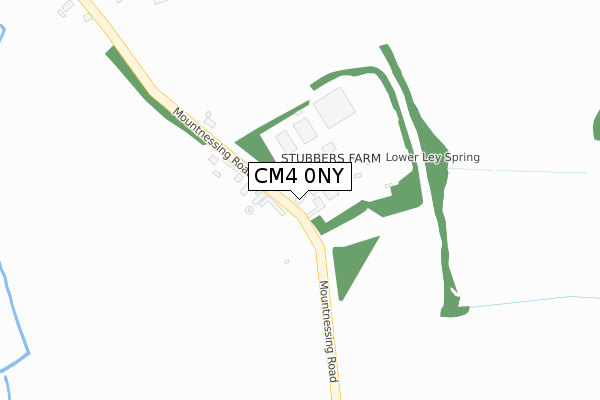
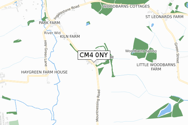
CM4 0NY is located in the Tipps Cross electoral ward, within the local authority district of Brentwood and the English Parliamentary constituency of Brentwood and Ongar. The Sub Integrated Care Board (ICB) Location is NHS Mid and South Essex ICB - 99E and the police force is Essex. This postcode has been in use since January 1980.


GetTheData
Source: OS Open Zoomstack (Ordnance Survey)
Licence: Open Government Licence (requires attribution)
Attribution: Contains OS data © Crown copyright and database right 2025
Source: Open Postcode Geo
Licence: Open Government Licence (requires attribution)
Attribution: Contains OS data © Crown copyright and database right 2025; Contains Royal Mail data © Royal Mail copyright and database right 2025; Source: Office for National Statistics licensed under the Open Government Licence v.3.0
| Easting | 561190 |
| Northing | 200177 |
| Latitude | 51.677233 |
| Longitude | 0.329930 |
GetTheData
Source: Open Postcode Geo
Licence: Open Government Licence
| Country | England |
| Postcode District | CM4 |
➜ See where CM4 is on a map | |
GetTheData
Source: Land Registry Price Paid Data
Licence: Open Government Licence
Elevation or altitude of CM4 0NY as distance above sea level:
| Metres | Feet | |
|---|---|---|
| Elevation | 80m | 262ft |
Elevation is measured from the approximate centre of the postcode, to the nearest point on an OS contour line from OS Terrain 50, which has contour spacing of ten vertical metres.
➜ How high above sea level am I? Find the elevation of your current position using your device's GPS.
GetTheData
Source: Open Postcode Elevation
Licence: Open Government Licence
| Ward | Tipps Cross |
| Constituency | Brentwood And Ongar |
GetTheData
Source: ONS Postcode Database
Licence: Open Government Licence
| Plovers Mead (Wyatts Green Road) | Wyatts Green | 1,649m |
| Copyhold Farm (Blackmore Road) | Blackmore | 1,883m |
| Ingatestone Station | 3.9km |
GetTheData
Source: NaPTAN
Licence: Open Government Licence
GetTheData
Source: ONS Postcode Database
Licence: Open Government Licence


➜ Get more ratings from the Food Standards Agency
GetTheData
Source: Food Standards Agency
Licence: FSA terms & conditions
| Last Collection | |||
|---|---|---|---|
| Location | Mon-Fri | Sat | Distance |
| Jessops Corner | 16:15 | 08:00 | 767m |
| Wyatts Green | 16:45 | 08:15 | 1,556m |
| Cock Lane | 16:30 | 09:05 | 1,868m |
GetTheData
Source: Dracos
Licence: Creative Commons Attribution-ShareAlike
The below table lists the International Territorial Level (ITL) codes (formerly Nomenclature of Territorial Units for Statistics (NUTS) codes) and Local Administrative Units (LAU) codes for CM4 0NY:
| ITL 1 Code | Name |
|---|---|
| TLH | East |
| ITL 2 Code | Name |
| TLH3 | Essex |
| ITL 3 Code | Name |
| TLH36 | Heart of Essex |
| LAU 1 Code | Name |
| E07000068 | Brentwood |
GetTheData
Source: ONS Postcode Directory
Licence: Open Government Licence
The below table lists the Census Output Area (OA), Lower Layer Super Output Area (LSOA), and Middle Layer Super Output Area (MSOA) for CM4 0NY:
| Code | Name | |
|---|---|---|
| OA | E00109078 | |
| LSOA | E01021469 | Brentwood 001E |
| MSOA | E02004464 | Brentwood 001 |
GetTheData
Source: ONS Postcode Directory
Licence: Open Government Licence
| CM4 0NX | Mountnessing Road | 199m |
| CM4 0QE | Hay Green Lane | 657m |
| CM4 0NZ | Ingatestone Road | 760m |
| CM4 0NT | Green Street | 834m |
| CM4 0PA | Blackmore Road | 980m |
| CM4 0NU | Green Street | 1118m |
| CM4 0PB | Blackmore Road | 1175m |
| CM15 0NX | Hay Green Lane | 1289m |
| CM15 0PY | Wyatts Green Lane | 1426m |
| CM15 0QG | Whitelands | 1435m |
GetTheData
Source: Open Postcode Geo; Land Registry Price Paid Data
Licence: Open Government Licence