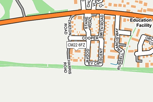
CM22 6FZ is located in the Takeley electoral ward, within the local authority district of Uttlesford and the English Parliamentary constituency of Saffron Walden. The Sub Integrated Care Board (ICB) Location is NHS Hertfordshire and West Essex ICB - 07H and the police force is Essex. This postcode has been in use since April 2017.


GetTheData
Source: OS OpenMap – Local (Ordnance Survey)
Source: OS VectorMap District (Ordnance Survey)
Licence: Open Government Licence (requires attribution)
| Easting | 555496 |
| Northing | 221150 |
| Latitude | 51.867267 |
| Longitude | 0.257057 |
GetTheData
Source: Open Postcode Geo
Licence: Open Government Licence
| Country | England |
| Postcode District | CM22 |
➜ See where CM22 is on a map ➜ Where is Takeley? | |
GetTheData
Source: Land Registry Price Paid Data
Licence: Open Government Licence
| Ward | Takeley |
| Constituency | Saffron Walden |
GetTheData
Source: ONS Postcode Database
Licence: Open Government Licence
| Church Lane (Dunmow Road) | Takeley | 196m |
| Mill Court (Dunmow Road) | Takeley | 386m |
| The Four Ashes (Dunmow Road) | Takeley | 559m |
| The Four Ashes (Parsonage Road) | Takeley | 659m |
| Chestnut Way (Parsonage Road) | Takeley | 685m |
| Stansted Airport Station | 2.4km |
| Stansted Mountfitchet Station | 5.5km |
GetTheData
Source: NaPTAN
Licence: Open Government Licence
| Percentage of properties with Next Generation Access | 100.0% |
| Percentage of properties with Superfast Broadband | 100.0% |
| Percentage of properties with Ultrafast Broadband | 100.0% |
| Percentage of properties with Full Fibre Broadband | 100.0% |
Superfast Broadband is between 30Mbps and 300Mbps
Ultrafast Broadband is > 300Mbps
| Percentage of properties unable to receive 2Mbps | 0.0% |
| Percentage of properties unable to receive 5Mbps | 0.0% |
| Percentage of properties unable to receive 10Mbps | 0.0% |
| Percentage of properties unable to receive 30Mbps | 0.0% |
GetTheData
Source: Ofcom
Licence: Ofcom Terms of Use (requires attribution)
GetTheData
Source: ONS Postcode Database
Licence: Open Government Licence


➜ Get more ratings from the Food Standards Agency
GetTheData
Source: Food Standards Agency
Licence: FSA terms & conditions
| Last Collection | |||
|---|---|---|---|
| Location | Mon-Fri | Sat | Distance |
| Harrod's Aviation | 16:15 | 09:00 | 1,648m |
| Monks | 16:15 | 09:30 | 2,329m |
| Stanstead Airport - Concourse | 17:00 | 10:30 | 2,398m |
GetTheData
Source: Dracos
Licence: Creative Commons Attribution-ShareAlike
The below table lists the International Territorial Level (ITL) codes (formerly Nomenclature of Territorial Units for Statistics (NUTS) codes) and Local Administrative Units (LAU) codes for CM22 6FZ:
| ITL 1 Code | Name |
|---|---|
| TLH | East |
| ITL 2 Code | Name |
| TLH3 | Essex |
| ITL 3 Code | Name |
| TLH35 | West Essex |
| LAU 1 Code | Name |
| E07000077 | Uttlesford |
GetTheData
Source: ONS Postcode Directory
Licence: Open Government Licence
The below table lists the Census Output Area (OA), Lower Layer Super Output Area (LSOA), and Middle Layer Super Output Area (MSOA) for CM22 6FZ:
| Code | Name | |
|---|---|---|
| OA | E00112246 | |
| LSOA | E01022090 | Uttlesford 006B |
| MSOA | E02004596 | Uttlesford 006 |
GetTheData
Source: ONS Postcode Directory
Licence: Open Government Licence
| CM22 6FQ | Russell Francis Way | 182m |
| CM22 6QL | Cooks Hill | 189m |
| CM22 6TN | Orchid Close | 244m |
| CM22 6TP | Orchid Close | 294m |
| CM22 6TJ | The Pastures | 305m |
| CM22 6TH | The Pastures | 309m |
| CM22 6QQ | Chestnut Mews | 315m |
| CM22 6QH | Brewers End | 329m |
| CM22 6TT | Harvest Fields | 330m |
| CM22 6QJ | Brewers End | 345m |
GetTheData
Source: Open Postcode Geo; Land Registry Price Paid Data
Licence: Open Government Licence