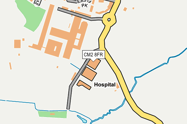
CM2 8FR is located in the Great Baddow East electoral ward, within the local authority district of Chelmsford and the English Parliamentary constituency of Chelmsford. The Sub Integrated Care Board (ICB) Location is NHS Mid and South Essex ICB - 06Q and the police force is Essex. This postcode has been in use since May 2011.


GetTheData
Source: OS OpenMap – Local (Ordnance Survey)
Source: OS VectorMap District (Ordnance Survey)
Licence: Open Government Licence (requires attribution)
| Easting | 572951 |
| Northing | 203980 |
| Latitude | 51.707904 |
| Longitude | 0.501773 |
GetTheData
Source: Open Postcode Geo
Licence: Open Government Licence
| Country | England |
| Postcode District | CM2 |
➜ See where CM2 is on a map ➜ Where is Chelmsford? | |
GetTheData
Source: Land Registry Price Paid Data
Licence: Open Government Licence
Elevation or altitude of CM2 8FR as distance above sea level:
| Metres | Feet | |
|---|---|---|
| Elevation | 40m | 131ft |
Elevation is measured from the approximate centre of the postcode, to the nearest point on an OS contour line from OS Terrain 50, which has contour spacing of ten vertical metres.
➜ How high above sea level am I? Find the elevation of your current position using your device's GPS.
GetTheData
Source: Open Postcode Elevation
Licence: Open Government Licence
| Ward | Great Baddow East |
| Constituency | Chelmsford |
GetTheData
Source: ONS Postcode Database
Licence: Open Government Licence
| Bae Systems (West Hanningfield Road) | Great Baddow | 277m |
| Park View Crescent | Great Baddow | 327m |
| Maltings Estate (Maltings Road) | Great Baddow | 366m |
| Mercia Close (West Hanningfield Road) | Great Baddow | 576m |
| West Hanningfield Road (Church Street) | Great Baddow | 622m |
| Chelmsford Station | 3.9km |
GetTheData
Source: NaPTAN
Licence: Open Government Licence
GetTheData
Source: ONS Postcode Database
Licence: Open Government Licence


➜ Get more ratings from the Food Standards Agency
GetTheData
Source: Food Standards Agency
Licence: FSA terms & conditions
| Last Collection | |||
|---|---|---|---|
| Location | Mon-Fri | Sat | Distance |
| Park View Crescent | 17:30 | 11:30 | 344m |
| Baddow Road Corner | 16:15 | 09:00 | 390m |
| Maltings Road | 17:40 | 11:30 | 403m |
GetTheData
Source: Dracos
Licence: Creative Commons Attribution-ShareAlike
The below table lists the International Territorial Level (ITL) codes (formerly Nomenclature of Territorial Units for Statistics (NUTS) codes) and Local Administrative Units (LAU) codes for CM2 8FR:
| ITL 1 Code | Name |
|---|---|
| TLH | East |
| ITL 2 Code | Name |
| TLH3 | Essex |
| ITL 3 Code | Name |
| TLH36 | Heart of Essex |
| LAU 1 Code | Name |
| E07000070 | Chelmsford |
GetTheData
Source: ONS Postcode Directory
Licence: Open Government Licence
The below table lists the Census Output Area (OA), Lower Layer Super Output Area (LSOA), and Middle Layer Super Output Area (MSOA) for CM2 8FR:
| Code | Name | |
|---|---|---|
| OA | E00109522 | |
| LSOA | E01021562 | Chelmsford 014A |
| MSOA | E02004498 | Chelmsford 014 |
GetTheData
Source: ONS Postcode Directory
Licence: Open Government Licence
| CM2 8JQ | The Westerings | 130m |
| CM2 8JE | The Westerings | 163m |
| CM2 8HW | Lucksfield Way | 170m |
| CM2 8HF | Eastwood Park | 171m |
| CM2 8JH | Heycroft Way | 193m |
| CM2 8JG | Heycroft Way | 225m |
| CM2 8HL | West Hanningfield Road | 255m |
| CM2 8JJ | Worcester Court | 285m |
| CM2 8HQ | Maltings Road | 293m |
| CM2 8HX | Park View Crescent | 313m |
GetTheData
Source: Open Postcode Geo; Land Registry Price Paid Data
Licence: Open Government Licence