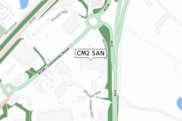
CM2 5AN is located in the Chelmer Village and Beaulieu Park electoral ward, within the local authority district of Chelmsford and the English Parliamentary constituency of Chelmsford. The Sub Integrated Care Board (ICB) Location is NHS Mid and South Essex ICB - 06Q and the police force is Essex. This postcode has been in use since February 2020.


GetTheData
Source: OS Open Zoomstack (Ordnance Survey)
Licence: Open Government Licence (requires attribution)
Attribution: Contains OS data © Crown copyright and database right 2025
Source: Open Postcode Geo
Licence: Open Government Licence (requires attribution)
Attribution: Contains OS data © Crown copyright and database right 2025; Contains Royal Mail data © Royal Mail copyright and database right 2025; Source: Office for National Statistics licensed under the Open Government Licence v.3.0
| Easting | 573944 |
| Northing | 208223 |
| Latitude | 51.745711 |
| Longitude | 0.518248 |
GetTheData
Source: Open Postcode Geo
Licence: Open Government Licence
| Country | England |
| Postcode District | CM2 |
➜ See where CM2 is on a map ➜ Where is Chelmsford? | |
GetTheData
Source: Land Registry Price Paid Data
Licence: Open Government Licence
| Ward | Chelmer Village And Beaulieu Park |
| Constituency | Chelmsford |
GetTheData
Source: ONS Postcode Database
Licence: Open Government Licence
| Barlows Reach (Chelmer Village Way) | Chelmer Village | 510m |
| Barlows Reach (Chelmer Village Way) | Chelmer Village | 513m |
| Chancellor Avenue | Chelmer Village | 526m |
| Eglinton Drive | Chelmer Village | 567m |
| Chelmer Village Way | Chelmer Village | 582m |
| Chelmsford Station | 3.6km |
| Hatfield Peverel Station | 6.4km |
GetTheData
Source: NaPTAN
Licence: Open Government Licence
GetTheData
Source: ONS Postcode Database
Licence: Open Government Licence


➜ Get more ratings from the Food Standards Agency
GetTheData
Source: Food Standards Agency
Licence: FSA terms & conditions
| Last Collection | |||
|---|---|---|---|
| Location | Mon-Fri | Sat | Distance |
| Chelmer Village Way | 17:40 | 12:00 | 651m |
| Essex Distribution Centre | 817m | ||
| Chelmer Village P.o. | 17:30 | 12:00 | 1,326m |
GetTheData
Source: Dracos
Licence: Creative Commons Attribution-ShareAlike
The below table lists the International Territorial Level (ITL) codes (formerly Nomenclature of Territorial Units for Statistics (NUTS) codes) and Local Administrative Units (LAU) codes for CM2 5AN:
| ITL 1 Code | Name |
|---|---|
| TLH | East |
| ITL 2 Code | Name |
| TLH3 | Essex |
| ITL 3 Code | Name |
| TLH36 | Heart of Essex |
| LAU 1 Code | Name |
| E07000070 | Chelmsford |
GetTheData
Source: ONS Postcode Directory
Licence: Open Government Licence
The below table lists the Census Output Area (OA), Lower Layer Super Output Area (LSOA), and Middle Layer Super Output Area (MSOA) for CM2 5AN:
| Code | Name | |
|---|---|---|
| OA | E00170991 | |
| LSOA | E01033142 | Chelmsford 005E |
| MSOA | E02004489 | Chelmsford 005 |
GetTheData
Source: ONS Postcode Directory
Licence: Open Government Licence
| CM2 6GD | Barrow Chase | 239m |
| CM2 6GB | Townsend | 247m |
| CM2 6GF | Allen Way | 270m |
| CM2 6GZ | Bryant Link | 286m |
| CM2 6GA | Meggy Tye | 367m |
| CM2 6LY | Wright Mead | 391m |
| CM2 6WU | Abell Way | 398m |
| CM2 6GL | Cowdrie Way | 419m |
| CM2 6YF | Cornelius Vale | 440m |
| CM2 6GY | Cornelius Vale | 441m |
GetTheData
Source: Open Postcode Geo; Land Registry Price Paid Data
Licence: Open Government Licence