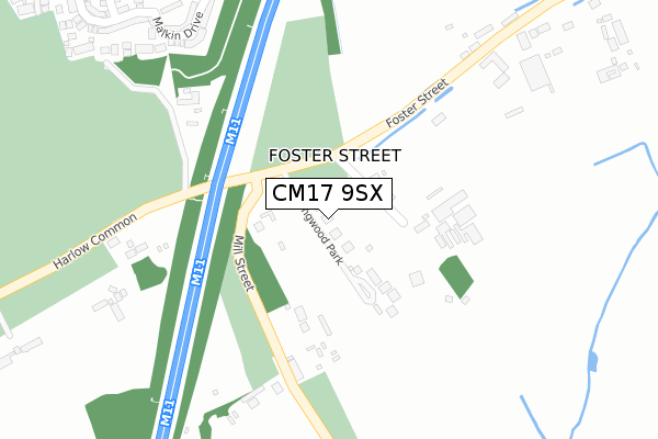
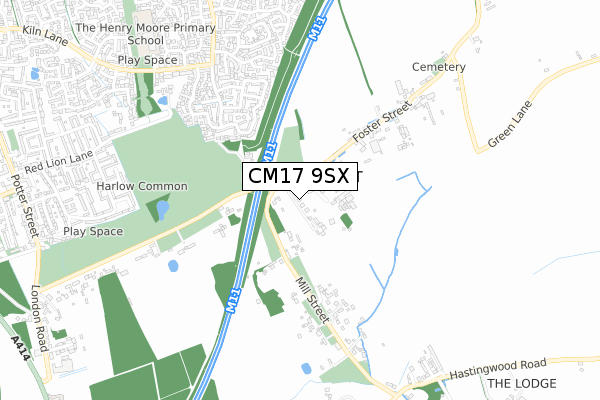
CM17 9SX is located in the Hastingwood, Matching and Sheering Village electoral ward, within the local authority district of Epping Forest and the English Parliamentary constituency of Harlow. The Sub Integrated Care Board (ICB) Location is NHS Hertfordshire and West Essex ICB - 07H and the police force is Essex. This postcode has been in use since February 2020.


GetTheData
Source: OS Open Zoomstack (Ordnance Survey)
Licence: Open Government Licence (requires attribution)
Attribution: Contains OS data © Crown copyright and database right 2024
Source: Open Postcode Geo
Licence: Open Government Licence (requires attribution)
Attribution: Contains OS data © Crown copyright and database right 2024; Contains Royal Mail data © Royal Mail copyright and database right 2024; Source: Office for National Statistics licensed under the Open Government Licence v.3.0
| Easting | 548512 |
| Northing | 208587 |
| Latitude | 51.756293 |
| Longitude | 0.150320 |
GetTheData
Source: Open Postcode Geo
Licence: Open Government Licence
| Country | England |
| Postcode District | CM17 |
➜ See where CM17 is on a map ➜ Where is Foster Street? | |
GetTheData
Source: Land Registry Price Paid Data
Licence: Open Government Licence
| Ward | Hastingwood, Matching And Sheering Village |
| Constituency | Harlow |
GetTheData
Source: ONS Postcode Database
Licence: Open Government Licence
| Whieldon Grange (Kiln Lane) | Church Langley | 866m |
| Elwood (Church Langley Way) | Church Langley | 904m |
| Westbury Rise (Kiln Lane) | Church Langley | 1,063m |
| Rushton Grove (Church Langley Way) | Church Langley | 1,082m |
| The Red Lion (Potter Street) | Potter Street | 1,209m |
| Harlow Mill Station | 4km |
| Harlow Town Station | 4.7km |
GetTheData
Source: NaPTAN
Licence: Open Government Licence
GetTheData
Source: ONS Postcode Database
Licence: Open Government Licence


➜ Get more ratings from the Food Standards Agency
GetTheData
Source: Food Standards Agency
Licence: FSA terms & conditions
| Last Collection | |||
|---|---|---|---|
| Location | Mon-Fri | Sat | Distance |
| Old Hall Rise | 17:15 | 11:40 | 1,138m |
| Harlow Post Office | 18:30 | 12:45 | 2,424m |
| London Road P.o. | 17:30 | 12:30 | 3,123m |
GetTheData
Source: Dracos
Licence: Creative Commons Attribution-ShareAlike
The below table lists the International Territorial Level (ITL) codes (formerly Nomenclature of Territorial Units for Statistics (NUTS) codes) and Local Administrative Units (LAU) codes for CM17 9SX:
| ITL 1 Code | Name |
|---|---|
| TLH | East |
| ITL 2 Code | Name |
| TLH3 | Essex |
| ITL 3 Code | Name |
| TLH35 | West Essex |
| LAU 1 Code | Name |
| E07000072 | Epping Forest |
GetTheData
Source: ONS Postcode Directory
Licence: Open Government Licence
The below table lists the Census Output Area (OA), Lower Layer Super Output Area (LSOA), and Middle Layer Super Output Area (MSOA) for CM17 9SX:
| Code | Name | |
|---|---|---|
| OA | E00110575 | |
| LSOA | E01021768 | Epping Forest 001A |
| MSOA | E02004527 | Epping Forest 001 |
GetTheData
Source: ONS Postcode Directory
Licence: Open Government Licence
| CM17 9JE | Mill Street | 108m |
| CM17 9JF | Mill Street | 188m |
| CM17 9JD | Harlow Common | 336m |
| CM17 9HX | Croft Cottages | 382m |
| CM17 9NF | Harlow Common | 391m |
| CM17 9JG | Mill Street | 392m |
| CM17 9HZ | Foster Street | 400m |
| CM17 9HL | Malkin Drive | 504m |
| CM17 9HJ | Malkin Drive | 527m |
| CM17 9HQ | Malkin Drive | 582m |
GetTheData
Source: Open Postcode Geo; Land Registry Price Paid Data
Licence: Open Government Licence