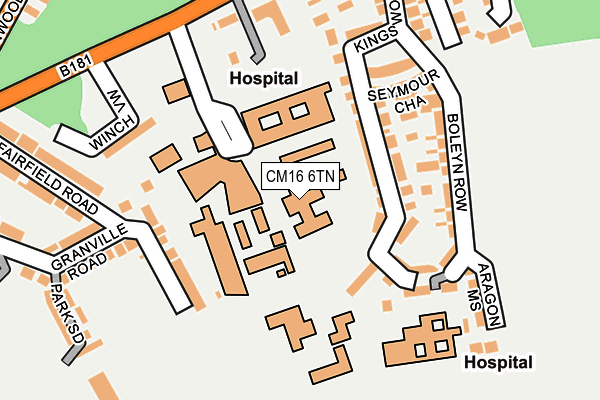
CM16 6TN is located in the Epping Lindsey and Thornwood Common electoral ward, within the local authority district of Epping Forest and the English Parliamentary constituency of Epping Forest. The Sub Integrated Care Board (ICB) Location is NHS Hertfordshire and West Essex ICB - 07H and the police force is Essex. This postcode has been in use since January 1980.


GetTheData
Source: OS OpenMap – Local (Ordnance Survey)
Source: OS VectorMap District (Ordnance Survey)
Licence: Open Government Licence (requires attribution)
| Easting | 546861 |
| Northing | 202752 |
| Latitude | 51.704295 |
| Longitude | 0.123930 |
GetTheData
Source: Open Postcode Geo
Licence: Open Government Licence
| Country | England |
| Postcode District | CM16 |
➜ See where CM16 is on a map ➜ Where is Epping? | |
GetTheData
Source: Land Registry Price Paid Data
Licence: Open Government Licence
Elevation or altitude of CM16 6TN as distance above sea level:
| Metres | Feet | |
|---|---|---|
| Elevation | 110m | 361ft |
Elevation is measured from the approximate centre of the postcode, to the nearest point on an OS contour line from OS Terrain 50, which has contour spacing of ten vertical metres.
➜ How high above sea level am I? Find the elevation of your current position using your device's GPS.
GetTheData
Source: Open Postcode Elevation
Licence: Open Government Licence
| Ward | Epping Lindsey And Thornwood Common |
| Constituency | Epping Forest |
GetTheData
Source: ONS Postcode Database
Licence: Open Government Licence
| St. Margaret's Hospital (Hospital Approach) | Epping | 120m |
| St. Margaret's Hospital - Main Rd (The Plain) | Epping | 223m |
| St. Margaret's Hospital - Main Rd (The Plain) | Epping | 225m |
| Maltings Lane (Palmers Hill) | Epping | 392m |
| Maltings Lane (Palmers Hill) | Epping | 409m |
| Epping Underground Station | Epping | 1,374m |
GetTheData
Source: NaPTAN
Licence: Open Government Licence
GetTheData
Source: ONS Postcode Database
Licence: Open Government Licence


➜ Get more ratings from the Food Standards Agency
GetTheData
Source: Food Standards Agency
Licence: FSA terms & conditions
| Last Collection | |||
|---|---|---|---|
| Location | Mon-Fri | Sat | Distance |
| High Street | 17:30 | 11:30 | 823m |
| Epping P.o. High Street | 18:15 | 12:30 | 868m |
| Epping Pdo | 17:30 | 12:30 | 1,068m |
GetTheData
Source: Dracos
Licence: Creative Commons Attribution-ShareAlike
The below table lists the International Territorial Level (ITL) codes (formerly Nomenclature of Territorial Units for Statistics (NUTS) codes) and Local Administrative Units (LAU) codes for CM16 6TN:
| ITL 1 Code | Name |
|---|---|
| TLH | East |
| ITL 2 Code | Name |
| TLH3 | Essex |
| ITL 3 Code | Name |
| TLH35 | West Essex |
| LAU 1 Code | Name |
| E07000072 | Epping Forest |
GetTheData
Source: ONS Postcode Directory
Licence: Open Government Licence
The below table lists the Census Output Area (OA), Lower Layer Super Output Area (LSOA), and Middle Layer Super Output Area (MSOA) for CM16 6TN:
| Code | Name | |
|---|---|---|
| OA | E00170074 | |
| LSOA | E01021761 | Epping Forest 005B |
| MSOA | E02004531 | Epping Forest 005 |
GetTheData
Source: ONS Postcode Directory
Licence: Open Government Licence
| CM16 6FA | Kings Wood Park | 84m |
| CM16 6FD | Kings Wood Park | 104m |
| CM16 6FH | King Henrys Walk | 128m |
| CM16 6ST | Fairfield Road | 140m |
| CM16 6FF | Boleyn Row | 149m |
| CM16 6FE | Seymour Chase | 160m |
| CM16 6TJ | Birchview | 187m |
| CM16 6TL | The Plain | 209m |
| CM16 6FG | Aragon Mews | 216m |
| CM16 6SR | Granville Road | 224m |
GetTheData
Source: Open Postcode Geo; Land Registry Price Paid Data
Licence: Open Government Licence