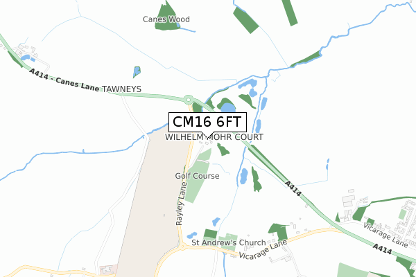
CM16 6FT is located in the North Weald Bassett electoral ward, within the local authority district of Epping Forest and the English Parliamentary constituency of Brentwood and Ongar. The Sub Integrated Care Board (ICB) Location is NHS Hertfordshire and West Essex ICB - 07H and the police force is Essex. This postcode has been in use since April 2020.


GetTheData
Source: OS Open Zoomstack (Ordnance Survey)
Licence: Open Government Licence (requires attribution)
Attribution: Contains OS data © Crown copyright and database right 2025
Source: Open Postcode Geo
Licence: Open Government Licence (requires attribution)
Attribution: Contains OS data © Crown copyright and database right 2025; Contains Royal Mail data © Royal Mail copyright and database right 2025; Source: Office for National Statistics licensed under the Open Government Licence v.3.0
| Easting | 549413 |
| Northing | 205828 |
| Latitude | 51.731264 |
| Longitude | 0.162179 |
GetTheData
Source: Open Postcode Geo
Licence: Open Government Licence
| Country | England |
| Postcode District | CM16 |
➜ See where CM16 is on a map | |
GetTheData
Source: Land Registry Price Paid Data
Licence: Open Government Licence
| Ward | North Weald Bassett |
| Constituency | Brentwood And Ongar |
GetTheData
Source: ONS Postcode Database
Licence: Open Government Licence
| The Talbot (High Road (B181)) | North Weald | 1,547m |
| The Talbot (High Road (B181)) | North Weald | 1,558m |
| Emberson Way (High Road) | North Weald | 1,576m |
| Emberson Way (High Road) | North Weald | 1,587m |
| Skips Corner (High Road) | North Weald | 1,589m |
GetTheData
Source: NaPTAN
Licence: Open Government Licence
GetTheData
Source: ONS Postcode Database
Licence: Open Government Licence


➜ Get more ratings from the Food Standards Agency
GetTheData
Source: Food Standards Agency
Licence: FSA terms & conditions
| Last Collection | |||
|---|---|---|---|
| Location | Mon-Fri | Sat | Distance |
| Thornwood Commonepping | 16:45 | 11:00 | 2,599m |
| Commonside Road | 17:30 | 12:00 | 3,150m |
| Greenstead Green | 16:30 | 07:30 | 3,905m |
GetTheData
Source: Dracos
Licence: Creative Commons Attribution-ShareAlike
The below table lists the International Territorial Level (ITL) codes (formerly Nomenclature of Territorial Units for Statistics (NUTS) codes) and Local Administrative Units (LAU) codes for CM16 6FT:
| ITL 1 Code | Name |
|---|---|
| TLH | East |
| ITL 2 Code | Name |
| TLH3 | Essex |
| ITL 3 Code | Name |
| TLH35 | West Essex |
| LAU 1 Code | Name |
| E07000072 | Epping Forest |
GetTheData
Source: ONS Postcode Directory
Licence: Open Government Licence
The below table lists the Census Output Area (OA), Lower Layer Super Output Area (LSOA), and Middle Layer Super Output Area (MSOA) for CM16 6FT:
| Code | Name | |
|---|---|---|
| OA | E00110729 | |
| LSOA | E01021797 | Epping Forest 001C |
| MSOA | E02004527 | Epping Forest 001 |
GetTheData
Source: ONS Postcode Directory
Licence: Open Government Licence
| CM16 6AR | Rayley Lane | 55m |
| CM16 6AL | Vicarage Lane | 810m |
| CM16 6ND | Weald Hall Lane | 1086m |
| CM16 6EY | The Pavilions | 1251m |
| CM16 6HA | Tower Close | 1276m |
| CM16 6JH | Oak Piece | 1320m |
| CM17 9LD | Canes Lane | 1334m |
| CM16 6ET | Vicarage Lane | 1337m |
| CM16 6EU | Bluemans | 1337m |
| CM16 6JJ | Oak Piece | 1377m |
GetTheData
Source: Open Postcode Geo; Land Registry Price Paid Data
Licence: Open Government Licence