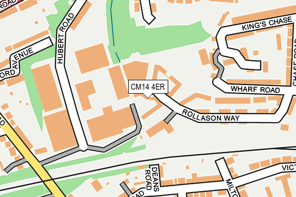
CM14 4ER lies on Rollason Way in Brentwood. CM14 4ER is located in the Brentwood West electoral ward, within the local authority district of Brentwood and the English Parliamentary constituency of Brentwood and Ongar. The Sub Integrated Care Board (ICB) Location is NHS Mid and South Essex ICB - 99E and the police force is Essex. This postcode has been in use since November 2008.


GetTheData
Source: OS OpenMap – Local (Ordnance Survey)
Source: OS VectorMap District (Ordnance Survey)
Licence: Open Government Licence (requires attribution)
| Easting | 558847 |
| Northing | 193138 |
| Latitude | 51.614661 |
| Longitude | 0.292879 |
GetTheData
Source: Open Postcode Geo
Licence: Open Government Licence
| Street | Rollason Way |
| Town/City | Brentwood |
| Country | England |
| Postcode District | CM14 |
➜ See where CM14 is on a map ➜ Where is Brentwood? | |
GetTheData
Source: Land Registry Price Paid Data
Licence: Open Government Licence
Elevation or altitude of CM14 4ER as distance above sea level:
| Metres | Feet | |
|---|---|---|
| Elevation | 70m | 230ft |
Elevation is measured from the approximate centre of the postcode, to the nearest point on an OS contour line from OS Terrain 50, which has contour spacing of ten vertical metres.
➜ How high above sea level am I? Find the elevation of your current position using your device's GPS.
GetTheData
Source: Open Postcode Elevation
Licence: Open Government Licence
| Ward | Brentwood West |
| Constituency | Brentwood And Ongar |
GetTheData
Source: ONS Postcode Database
Licence: Open Government Licence
| Bt Building (London Road) | Brentwood | 303m |
| Bt Building (London Road) | Brentwood | 309m |
| Crescent Road (Vaughan Williams Way) | Brentwood | 370m |
| Brentwood Railway Station (Kings Road) | Brentwood | 448m |
| Brentwood Railway Station (Kings Road) | Brentwood | 459m |
| Brentwood Station | 0.5km |
| Shenfield Station | 3.1km |
| Harold Wood Station | 4.8km |
GetTheData
Source: NaPTAN
Licence: Open Government Licence
| Median download speed | 40.0Mbps |
| Average download speed | 42.6Mbps |
| Maximum download speed | 80.00Mbps |
| Median upload speed | 10.0Mbps |
| Average upload speed | 11.4Mbps |
| Maximum upload speed | 20.00Mbps |
GetTheData
Source: Ofcom
Licence: Ofcom Terms of Use (requires attribution)
Estimated total energy consumption in CM14 4ER by fuel type, 2015.
| Consumption (kWh) | 52,102 |
|---|---|
| Meter count | 6 |
| Mean (kWh/meter) | 8,684 |
| Median (kWh/meter) | 8,665 |
| Consumption (kWh) | 77,505 |
|---|---|
| Meter count | 41 |
| Mean (kWh/meter) | 1,890 |
| Median (kWh/meter) | 1,625 |
GetTheData
Source: Postcode level gas estimates: 2015 (experimental)
Source: Postcode level electricity estimates: 2015 (experimental)
Licence: Open Government Licence
GetTheData
Source: ONS Postcode Database
Licence: Open Government Licence


➜ Get more ratings from the Food Standards Agency
GetTheData
Source: Food Standards Agency
Licence: FSA terms & conditions
| Last Collection | |||
|---|---|---|---|
| Location | Mon-Fri | Sat | Distance |
| Kavanaghs Road | 17:00 | 11:30 | 319m |
| Crescent Road | 17:20 | 11:30 | 353m |
| Kings Road P.o. | 17:15 | 11:30 | 493m |
GetTheData
Source: Dracos
Licence: Creative Commons Attribution-ShareAlike
The below table lists the International Territorial Level (ITL) codes (formerly Nomenclature of Territorial Units for Statistics (NUTS) codes) and Local Administrative Units (LAU) codes for CM14 4ER:
| ITL 1 Code | Name |
|---|---|
| TLH | East |
| ITL 2 Code | Name |
| TLH3 | Essex |
| ITL 3 Code | Name |
| TLH36 | Heart of Essex |
| LAU 1 Code | Name |
| E07000068 | Brentwood |
GetTheData
Source: ONS Postcode Directory
Licence: Open Government Licence
The below table lists the Census Output Area (OA), Lower Layer Super Output Area (LSOA), and Middle Layer Super Output Area (MSOA) for CM14 4ER:
| Code | Name | |
|---|---|---|
| OA | E00108918 | |
| LSOA | E01033063 | Brentwood 007F |
| MSOA | E02004470 | Brentwood 007 |
GetTheData
Source: ONS Postcode Directory
Licence: Open Government Licence
| CM14 4ET | Rollason Way | 34m |
| CM14 4AH | Rollason Way | 61m |
| CM14 4EU | Rollason Way | 78m |
| CM14 4DY | Rollason Way | 89m |
| CM14 4DT | Rollason Way | 114m |
| CM14 5DU | Deans Road | 147m |
| CM14 5DX | Deans Road | 153m |
| CM14 5EA | Cromwell Road | 170m |
| CM14 4JY | Hubert Road | 189m |
| CM14 4LQ | Wharf Road | 189m |
GetTheData
Source: Open Postcode Geo; Land Registry Price Paid Data
Licence: Open Government Licence