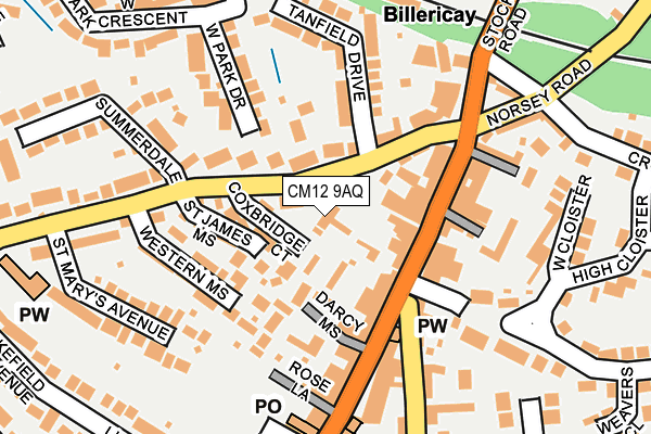
CM12 9AQ lies on High Street in Billericay. CM12 9AQ is located in the Billericay East electoral ward, within the local authority district of Basildon and the English Parliamentary constituency of Basildon and Billericay. The Sub Integrated Care Board (ICB) Location is NHS Mid and South Essex ICB - 99E and the police force is Essex. This postcode has been in use since August 1993.


GetTheData
Source: OS OpenMap – Local (Ordnance Survey)
Source: OS VectorMap District (Ordnance Survey)
Licence: Open Government Licence (requires attribution)
| Easting | 567414 |
| Northing | 194779 |
| Latitude | 51.626922 |
| Longitude | 0.417283 |
GetTheData
Source: Open Postcode Geo
Licence: Open Government Licence
| Street | High Street |
| Town/City | Billericay |
| Country | England |
| Postcode District | CM12 |
➜ See where CM12 is on a map ➜ Where is Billericay? | |
GetTheData
Source: Land Registry Price Paid Data
Licence: Open Government Licence
Elevation or altitude of CM12 9AQ as distance above sea level:
| Metres | Feet | |
|---|---|---|
| Elevation | 90m | 295ft |
Elevation is measured from the approximate centre of the postcode, to the nearest point on an OS contour line from OS Terrain 50, which has contour spacing of ten vertical metres.
➜ How high above sea level am I? Find the elevation of your current position using your device's GPS.
GetTheData
Source: Open Postcode Elevation
Licence: Open Government Licence
| Ward | Billericay East |
| Constituency | Basildon And Billericay |
GetTheData
Source: ONS Postcode Database
Licence: Open Government Licence
| The Chequers (High Street) | Billericay | 93m |
| The Chequers (High Street) | Billericay | 99m |
| Boots (High Street) | Billericay | 158m |
| Hillside Road (Chapel Street) | Billericay | 231m |
| Railway Station (Station Approach) | Billericay | 251m |
| Billericay Station | 0.2km |
| Ingatestone Station | 5km |
GetTheData
Source: NaPTAN
Licence: Open Government Licence
GetTheData
Source: ONS Postcode Database
Licence: Open Government Licence


➜ Get more ratings from the Food Standards Agency
GetTheData
Source: Food Standards Agency
Licence: FSA terms & conditions
| Last Collection | |||
|---|---|---|---|
| Location | Mon-Fri | Sat | Distance |
| School Road | 17:30 | 11:45 | 235m |
| Billericay Station | 17:30 | 11:00 | 247m |
| Waitrose Store | 17:30 | 11:30 | 264m |
GetTheData
Source: Dracos
Licence: Creative Commons Attribution-ShareAlike
The below table lists the International Territorial Level (ITL) codes (formerly Nomenclature of Territorial Units for Statistics (NUTS) codes) and Local Administrative Units (LAU) codes for CM12 9AQ:
| ITL 1 Code | Name |
|---|---|
| TLH | East |
| ITL 2 Code | Name |
| TLH3 | Essex |
| ITL 3 Code | Name |
| TLH37 | Essex Thames Gateway |
| LAU 1 Code | Name |
| E07000066 | Basildon |
GetTheData
Source: ONS Postcode Directory
Licence: Open Government Licence
The below table lists the Census Output Area (OA), Lower Layer Super Output Area (LSOA), and Middle Layer Super Output Area (MSOA) for CM12 9AQ:
| Code | Name | |
|---|---|---|
| OA | E00107891 | |
| LSOA | E01021244 | Basildon 004A |
| MSOA | E02004427 | Basildon 004 |
GetTheData
Source: ONS Postcode Directory
Licence: Open Government Licence
| CM12 9DA | Coxbridge Court | 44m |
| CM12 9DX | Western Road | 60m |
| CM12 9FR | High Street | 78m |
| CM12 9AX | High Street | 79m |
| CM12 9DY | Western Road | 90m |
| CM12 9DH | St James Mews | 91m |
| CM12 9DG | Sweet Chestnut Mews | 102m |
| CM12 9DZ | Western Road | 103m |
| CM12 9BA | High Street | 103m |
| CM12 9RN | Chandlers Chase | 104m |
GetTheData
Source: Open Postcode Geo; Land Registry Price Paid Data
Licence: Open Government Licence