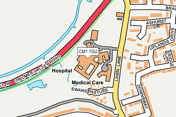
CM1 7GU is located in the Springfield North electoral ward, within the local authority district of Chelmsford and the English Parliamentary constituency of Chelmsford. The Sub Integrated Care Board (ICB) Location is NHS Mid and South Essex ICB - 06Q and the police force is Essex. This postcode has been in use since July 1995.


GetTheData
Source: OS OpenMap – Local (Ordnance Survey)
Source: OS VectorMap District (Ordnance Survey)
Licence: Open Government Licence (requires attribution)
| Easting | 571594 |
| Northing | 208996 |
| Latitude | 51.753372 |
| Longitude | 0.484598 |
GetTheData
Source: Open Postcode Geo
Licence: Open Government Licence
| Country | England |
| Postcode District | CM1 |
➜ See where CM1 is on a map ➜ Where is Chelmsford? | |
GetTheData
Source: Land Registry Price Paid Data
Licence: Open Government Licence
Elevation or altitude of CM1 7GU as distance above sea level:
| Metres | Feet | |
|---|---|---|
| Elevation | 30m | 98ft |
Elevation is measured from the approximate centre of the postcode, to the nearest point on an OS contour line from OS Terrain 50, which has contour spacing of ten vertical metres.
➜ How high above sea level am I? Find the elevation of your current position using your device's GPS.
GetTheData
Source: Open Postcode Elevation
Licence: Open Government Licence
| Ward | Springfield North |
| Constituency | Chelmsford |
GetTheData
Source: ONS Postcode Database
Licence: Open Government Licence
| Medical Centre (Lawn Lane) | Springfield | 153m |
| Medical Centre (Lawn Lane) | Springfield | 174m |
| Wear Drive (Waveney Drive) | Springfield | 200m |
| Wear Drive (Waveney Drive) | Springfield | 234m |
| Briarswood (Brackenden Drive) | Springfield | 267m |
| Chelmsford Station | 2.2km |
GetTheData
Source: NaPTAN
Licence: Open Government Licence
GetTheData
Source: ONS Postcode Database
Licence: Open Government Licence


➜ Get more ratings from the Food Standards Agency
GetTheData
Source: Food Standards Agency
Licence: FSA terms & conditions
| Last Collection | |||
|---|---|---|---|
| Location | Mon-Fri | Sat | Distance |
| Church Green | 17:15 | 13:00 | 649m |
| Torquay Road P.o. | 17:40 | 12:15 | 803m |
| Woodhall Road | 17:45 | 13:00 | 1,084m |
GetTheData
Source: Dracos
Licence: Creative Commons Attribution-ShareAlike
The below table lists the International Territorial Level (ITL) codes (formerly Nomenclature of Territorial Units for Statistics (NUTS) codes) and Local Administrative Units (LAU) codes for CM1 7GU:
| ITL 1 Code | Name |
|---|---|
| TLH | East |
| ITL 2 Code | Name |
| TLH3 | Essex |
| ITL 3 Code | Name |
| TLH36 | Heart of Essex |
| LAU 1 Code | Name |
| E07000070 | Chelmsford |
GetTheData
Source: ONS Postcode Directory
Licence: Open Government Licence
The below table lists the Census Output Area (OA), Lower Layer Super Output Area (LSOA), and Middle Layer Super Output Area (MSOA) for CM1 7GU:
| Code | Name | |
|---|---|---|
| OA | E00109807 | |
| LSOA | E01021620 | Chelmsford 004D |
| MSOA | E02004488 | Chelmsford 004 |
GetTheData
Source: ONS Postcode Directory
Licence: Open Government Licence
| CM1 6AF | Swans Pasture | 114m |
| CM1 6TU | Downsway | 176m |
| CM1 7QD | Waveney Drive | 192m |
| CM1 6TW | Uplands Drive | 203m |
| CM1 6TN | Ashurst Drive | 204m |
| CM1 7QB | Waveney Drive | 225m |
| CM1 6TT | Downsway | 260m |
| CM1 7QL | Tamar Rise | 277m |
| CM1 6UJ | Perriclose | 284m |
| CM1 6TR | Uplands Drive | 288m |
GetTheData
Source: Open Postcode Geo; Land Registry Price Paid Data
Licence: Open Government Licence