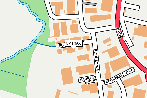
CM1 3AA is located in the Waterhouse Farm electoral ward, within the local authority district of Chelmsford and the English Parliamentary constituency of Chelmsford. The Sub Integrated Care Board (ICB) Location is NHS Mid and South Essex ICB - 06Q and the police force is Essex. This postcode has been in use since January 1980.


GetTheData
Source: OS OpenMap – Local (Ordnance Survey)
Source: OS VectorMap District (Ordnance Survey)
Licence: Open Government Licence (requires attribution)
| Easting | 569181 |
| Northing | 205392 |
| Latitude | 51.721731 |
| Longitude | 0.447923 |
GetTheData
Source: Open Postcode Geo
Licence: Open Government Licence
| Country | England |
| Postcode District | CM1 |
➜ See where CM1 is on a map ➜ Where is Chelmsford? | |
GetTheData
Source: Land Registry Price Paid Data
Licence: Open Government Licence
Elevation or altitude of CM1 3AA as distance above sea level:
| Metres | Feet | |
|---|---|---|
| Elevation | 30m | 98ft |
Elevation is measured from the approximate centre of the postcode, to the nearest point on an OS contour line from OS Terrain 50, which has contour spacing of ten vertical metres.
➜ How high above sea level am I? Find the elevation of your current position using your device's GPS.
GetTheData
Source: Open Postcode Elevation
Licence: Open Government Licence
| Ward | Waterhouse Farm |
| Constituency | Chelmsford |
GetTheData
Source: ONS Postcode Database
Licence: Open Government Licence
| Robjohns Road South (Westway) | Chelmsford | 257m |
| Robjohns Road South (Westway) | Chelmsford | 300m |
| Widford Road (London Road) | Widford | 386m |
| Westway First Depot (Westway) | Chelmsford | 394m |
| Widford Road (Three Mile Hill) | Widford | 421m |
| Chelmsford Station | 2.2km |
GetTheData
Source: NaPTAN
Licence: Open Government Licence
| Median download speed | 80.0Mbps |
| Average download speed | 67.0Mbps |
| Maximum download speed | 80.00Mbps |
| Median upload speed | 20.0Mbps |
| Average upload speed | 16.8Mbps |
| Maximum upload speed | 20.00Mbps |
GetTheData
Source: Ofcom
Licence: Ofcom Terms of Use (requires attribution)
Estimated total energy consumption in CM1 3AA by fuel type, 2015.
| Consumption (kWh) | 158,002 |
|---|---|
| Meter count | 9 |
| Mean (kWh/meter) | 17,556 |
| Median (kWh/meter) | 11,169 |
GetTheData
Source: Postcode level gas estimates: 2015 (experimental)
Source: Postcode level electricity estimates: 2015 (experimental)
Licence: Open Government Licence
GetTheData
Source: ONS Postcode Database
Licence: Open Government Licence


➜ Get more ratings from the Food Standards Agency
GetTheData
Source: Food Standards Agency
Licence: FSA terms & conditions
| Last Collection | |||
|---|---|---|---|
| Location | Mon-Fri | Sat | Distance |
| Writtle Road | 17:40 | 12:40 | 626m |
| Shakestones | 17:30 | 12:00 | 637m |
| Tesco Princes Road | 17:50 | 12:40 | 1,006m |
GetTheData
Source: Dracos
Licence: Creative Commons Attribution-ShareAlike
The below table lists the International Territorial Level (ITL) codes (formerly Nomenclature of Territorial Units for Statistics (NUTS) codes) and Local Administrative Units (LAU) codes for CM1 3AA:
| ITL 1 Code | Name |
|---|---|
| TLH | East |
| ITL 2 Code | Name |
| TLH3 | Essex |
| ITL 3 Code | Name |
| TLH36 | Heart of Essex |
| LAU 1 Code | Name |
| E07000070 | Chelmsford |
GetTheData
Source: ONS Postcode Directory
Licence: Open Government Licence
The below table lists the Census Output Area (OA), Lower Layer Super Output Area (LSOA), and Middle Layer Super Output Area (MSOA) for CM1 3AA:
| Code | Name | |
|---|---|---|
| OA | E00109870 | |
| LSOA | E01033138 | Chelmsford 009F |
| MSOA | E02004493 | Chelmsford 009 |
GetTheData
Source: ONS Postcode Directory
Licence: Open Government Licence
| CM1 3AG | Robjohns Road | 308m |
| CM2 8TB | Widford Park Place | 422m |
| CM1 3AF | Robjohns Road | 426m |
| CM2 8US | Whitebeam Close | 430m |
| CM2 8SY | Widford Road | 454m |
| CM2 8TE | London Road | 463m |
| CM2 8TA | Widford Close | 466m |
| CM2 8SX | Widford Chase | 517m |
| CM2 8SZ | Widford Chase | 523m |
| CM1 3BJ | Longacre | 525m |
GetTheData
Source: Open Postcode Geo; Land Registry Price Paid Data
Licence: Open Government Licence