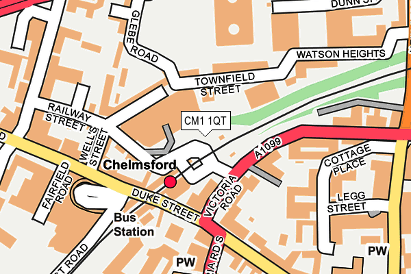
CM1 1QT is located in the Patching Hall electoral ward, within the local authority district of Chelmsford and the English Parliamentary constituency of Chelmsford. The Sub Integrated Care Board (ICB) Location is NHS Mid and South Essex ICB - 06Q and the police force is Essex. This postcode has been in use since April 2017.


GetTheData
Source: OS OpenMap – Local (Ordnance Survey)
Source: OS VectorMap District (Ordnance Survey)
Licence: Open Government Licence (requires attribution)
| Easting | 570716 |
| Northing | 207843 |
| Latitude | 51.743289 |
| Longitude | 0.471351 |
GetTheData
Source: Open Postcode Geo
Licence: Open Government Licence
| Country | England |
| Postcode District | CM1 |
➜ See where CM1 is on a map ➜ Where is Chelmsford? | |
GetTheData
Source: Land Registry Price Paid Data
Licence: Open Government Licence
| Ward | Patching Hall |
| Constituency | Chelmsford |
GetTheData
Source: ONS Postcode Database
Licence: Open Government Licence
| Anglia Ruskin University (New Street) | Chelmsford | 245m |
| Anglia Ruskin University (New Street) | Chelmsford | 275m |
| Keene Home (Broomfield Road) | Chelmsford | 335m |
| Keene Home (Broomfield Road) | Chelmsford | 342m |
| Swiss Avenue | Chelmsford | 377m |
| Chelmsford Station | 0.8km |
GetTheData
Source: NaPTAN
Licence: Open Government Licence
GetTheData
Source: ONS Postcode Database
Licence: Open Government Licence


➜ Get more ratings from the Food Standards Agency
GetTheData
Source: Food Standards Agency
Licence: FSA terms & conditions
| Last Collection | |||
|---|---|---|---|
| Location | Mon-Fri | Sat | Distance |
| Rivermead Gate P.o. | 18:00 | 12:45 | 295m |
| Fell Christy | 17:30 | 12:20 | 322m |
| Keenes Homes | 18:00 | 12:30 | 334m |
GetTheData
Source: Dracos
Licence: Creative Commons Attribution-ShareAlike
The below table lists the International Territorial Level (ITL) codes (formerly Nomenclature of Territorial Units for Statistics (NUTS) codes) and Local Administrative Units (LAU) codes for CM1 1QT:
| ITL 1 Code | Name |
|---|---|
| TLH | East |
| ITL 2 Code | Name |
| TLH3 | Essex |
| ITL 3 Code | Name |
| TLH36 | Heart of Essex |
| LAU 1 Code | Name |
| E07000070 | Chelmsford |
GetTheData
Source: ONS Postcode Directory
Licence: Open Government Licence
The below table lists the Census Output Area (OA), Lower Layer Super Output Area (LSOA), and Middle Layer Super Output Area (MSOA) for CM1 1QT:
| Code | Name | |
|---|---|---|
| OA | E00109675 | |
| LSOA | E01021592 | Chelmsford 006D |
| MSOA | E02004490 | Chelmsford 006 |
GetTheData
Source: ONS Postcode Directory
Licence: Open Government Licence
| CM1 1LG | Bishop Hall Lane | 177m |
| CM1 1RG | Henry Road | 206m |
| CM1 1RF | Rectory Lane | 282m |
| CM1 1RH | Elms Drive | 292m |
| CM1 1RE | Rectory Lane | 317m |
| CM1 1RU | First Avenue | 339m |
| CM1 1RN | Broomfield Road | 356m |
| CM1 1PY | Bishop Road | 364m |
| CM1 1RX | First Avenue | 377m |
| CM1 1RY | Broomfield Road | 378m |
GetTheData
Source: Open Postcode Geo; Land Registry Price Paid Data
Licence: Open Government Licence