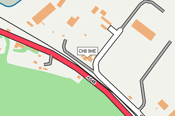
CH8 9HE is located in the Mostyn electoral ward, within the unitary authority of Flintshire and the Welsh Parliamentary constituency of Delyn. The Local Health Board is Betsi Cadwaladr University and the police force is North Wales. This postcode has been in use since January 1980.


GetTheData
Source: OS OpenMap – Local (Ordnance Survey)
Source: OS VectorMap District (Ordnance Survey)
Licence: Open Government Licence (requires attribution)
| Easting | 315567 |
| Northing | 380980 |
| Latitude | 53.319006 |
| Longitude | -3.268937 |
GetTheData
Source: Open Postcode Geo
Licence: Open Government Licence
| Country | Wales |
| Postcode District | CH8 |
➜ See where CH8 is on a map ➜ Where is Mostyn? | |
GetTheData
Source: Land Registry Price Paid Data
Licence: Open Government Licence
Elevation or altitude of CH8 9HE as distance above sea level:
| Metres | Feet | |
|---|---|---|
| Elevation | 10m | 33ft |
Elevation is measured from the approximate centre of the postcode, to the nearest point on an OS contour line from OS Terrain 50, which has contour spacing of ten vertical metres.
➜ How high above sea level am I? Find the elevation of your current position using your device's GPS.
GetTheData
Source: Open Postcode Elevation
Licence: Open Government Licence
| Ward | Mostyn |
| Constituency | Delyn |
GetTheData
Source: ONS Postcode Database
Licence: Open Government Licence
| Mostyn Docks (A548) | Mostyn | 242m |
| Mostyn Docks (A548) | Mostyn | 251m |
| Mostyn Lodge (A548) | Mostyn | 262m |
| Mostyn Lodge (A548) | Mostyn | 264m |
| Swan (Gloddaeth Terrace) | Rhewl-mostyn | 646m |
GetTheData
Source: NaPTAN
Licence: Open Government Licence
GetTheData
Source: ONS Postcode Database
Licence: Open Government Licence


➜ Get more ratings from the Food Standards Agency
GetTheData
Source: Food Standards Agency
Licence: FSA terms & conditions
| Last Collection | |||
|---|---|---|---|
| Location | Mon-Fri | Sat | Distance |
| Rhewl Post Office | 16:30 | 10:30 | 688m |
| Wirral View | 10:30 | 10:30 | 715m |
| Maes Pennant Road | 11:00 | 11:00 | 1,328m |
GetTheData
Source: Dracos
Licence: Creative Commons Attribution-ShareAlike
The below table lists the International Territorial Level (ITL) codes (formerly Nomenclature of Territorial Units for Statistics (NUTS) codes) and Local Administrative Units (LAU) codes for CH8 9HE:
| ITL 1 Code | Name |
|---|---|
| TLL | Wales |
| ITL 2 Code | Name |
| TLL2 | East Wales |
| ITL 3 Code | Name |
| TLL23 | Flintshire and Wrexham |
| LAU 1 Code | Name |
| W06000005 | Flintshire |
GetTheData
Source: ONS Postcode Directory
Licence: Open Government Licence
The below table lists the Census Output Area (OA), Lower Layer Super Output Area (LSOA), and Middle Layer Super Output Area (MSOA) for CH8 9HE:
| Code | Name | |
|---|---|---|
| OA | W00001716 | |
| LSOA | W01000320 | Flintshire 002B |
| MSOA | W02000059 | Flintshire 002 |
GetTheData
Source: ONS Postcode Directory
Licence: Open Government Licence
| CH8 9HD | The Quay | 148m |
| CH8 9EZ | Parkway | 360m |
| CH8 9QL | Gloddaeth Crescent | 627m |
| CH8 9QX | 630m | |
| CH8 9QF | 684m | |
| CH8 9QE | 685m | |
| CH8 9HX | Wirral View | 687m |
| CH8 9HW | 693m | |
| CH8 9QA | Maes Alarch | 704m |
| CH8 9QR | 712m |
GetTheData
Source: Open Postcode Geo; Land Registry Price Paid Data
Licence: Open Government Licence