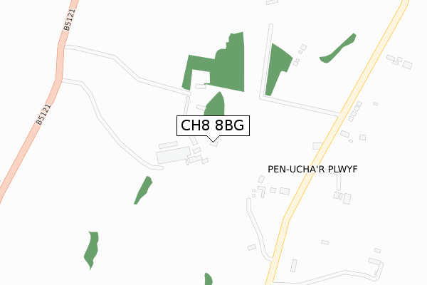
CH8 8BG is located in the Caerwys electoral ward, within the unitary authority of Flintshire and the Welsh Parliamentary constituency of Delyn. The Local Health Board is Betsi Cadwaladr University and the police force is North Wales. This postcode has been in use since October 2019.


GetTheData
Source: OS Open Zoomstack (Ordnance Survey)
Licence: Open Government Licence (requires attribution)
Attribution: Contains OS data © Crown copyright and database right 2025
Source: Open Postcode Geo
Licence: Open Government Licence (requires attribution)
Attribution: Contains OS data © Crown copyright and database right 2025; Contains Royal Mail data © Royal Mail copyright and database right 2025; Source: Office for National Statistics licensed under the Open Government Licence v.3.0
| Easting | 317466 |
| Northing | 372308 |
| Latitude | 53.241373 |
| Longitude | -3.238183 |
GetTheData
Source: Open Postcode Geo
Licence: Open Government Licence
| Country | Wales |
| Postcode District | CH8 |
➜ See where CH8 is on a map | |
GetTheData
Source: Land Registry Price Paid Data
Licence: Open Government Licence
| Ward | Caerwys |
| Constituency | Delyn |
GetTheData
Source: ONS Postcode Database
Licence: Open Government Licence
| Pen-uchar (Unclassified Road) | Pen-uchar Plwyf | 315m |
| Lixwm Garage (Ffordd Walwen) | Licswm | 920m |
| Lixwm Garage (Ffordd Walwen) | Licswm | 920m |
| Lixwm Turning Point (The Green) | Licswm | 963m |
| Bwlch (Main Road) | Bwlch | 973m |
GetTheData
Source: NaPTAN
Licence: Open Government Licence
GetTheData
Source: ONS Postcode Database
Licence: Open Government Licence

➜ Get more ratings from the Food Standards Agency
GetTheData
Source: Food Standards Agency
Licence: FSA terms & conditions
| Last Collection | |||
|---|---|---|---|
| Location | Mon-Fri | Sat | Distance |
| Lixwm Post Office | 15:31 | 10:30 | 1,053m |
| Bwlch, Rhes Y Cae, Holywell | 09:00 | 08:30 | 1,154m |
| Ffynnon Y Cyff | 11:00 | 08:15 | 1,325m |
GetTheData
Source: Dracos
Licence: Creative Commons Attribution-ShareAlike
The below table lists the International Territorial Level (ITL) codes (formerly Nomenclature of Territorial Units for Statistics (NUTS) codes) and Local Administrative Units (LAU) codes for CH8 8BG:
| ITL 1 Code | Name |
|---|---|
| TLL | Wales |
| ITL 2 Code | Name |
| TLL2 | East Wales |
| ITL 3 Code | Name |
| TLL23 | Flintshire and Wrexham |
| LAU 1 Code | Name |
| W06000005 | Flintshire |
GetTheData
Source: ONS Postcode Directory
Licence: Open Government Licence
The below table lists the Census Output Area (OA), Lower Layer Super Output Area (LSOA), and Middle Layer Super Output Area (MSOA) for CH8 8BG:
| Code | Name | |
|---|---|---|
| OA | W00001460 | |
| LSOA | W01000270 | Flintshire 006B |
| MSOA | W02000063 | Flintshire 006 |
GetTheData
Source: ONS Postcode Directory
Licence: Open Government Licence
| CH8 8LT | 262m | |
| CH8 8LS | 890m | |
| CH8 8LX | Maes Y Goron | 980m |
| CH8 8ND | Lixwm Green | 1026m |
| CH8 8NB | Cae Eithin | 1087m |
| CH8 8NA | Parc Capel | 1131m |
| CH8 8LU | Walwen | 1150m |
| CH8 8LW | Ffordd Walwen | 1157m |
| CH8 8NQ | 1170m | |
| CH8 8JT | Bwlch | 1184m |
GetTheData
Source: Open Postcode Geo; Land Registry Price Paid Data
Licence: Open Government Licence