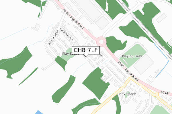
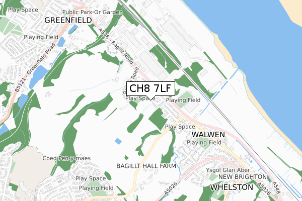
CH8 7LF is located in the Holywell East electoral ward, within the unitary authority of Flintshire and the Welsh Parliamentary constituency of Delyn. The Local Health Board is Betsi Cadwaladr University and the police force is North Wales. This postcode has been in use since May 2018.


GetTheData
Source: OS Open Zoomstack (Ordnance Survey)
Licence: Open Government Licence (requires attribution)
Attribution: Contains OS data © Crown copyright and database right 2025
Source: Open Postcode Geo
Licence: Open Government Licence (requires attribution)
Attribution: Contains OS data © Crown copyright and database right 2025; Contains Royal Mail data © Royal Mail copyright and database right 2025; Source: Office for National Statistics licensed under the Open Government Licence v.3.0
| Easting | 320121 |
| Northing | 376916 |
| Latitude | 53.283191 |
| Longitude | -3.199568 |
GetTheData
Source: Open Postcode Geo
Licence: Open Government Licence
| Country | Wales |
| Postcode District | CH8 |
➜ See where CH8 is on a map | |
GetTheData
Source: Land Registry Price Paid Data
Licence: Open Government Licence
| Ward | Holywell East |
| Constituency | Delyn |
GetTheData
Source: ONS Postcode Database
Licence: Open Government Licence
| Glan-y-don (Bagillt Road) | Wal-wen | 215m |
| Glan-y-don (Bagillt Road) | Wal-wen | 227m |
| Business Park (Bagillt Road) | Greenfield | 299m |
| Business Park (Bagillt Road) | Greenfield | 309m |
| Riverbank House (Bagillt Road) | Wal-wen | 388m |
| Flint Station | 5.8km |
GetTheData
Source: NaPTAN
Licence: Open Government Licence
| Percentage of properties with Next Generation Access | 100.0% |
| Percentage of properties with Superfast Broadband | 100.0% |
| Percentage of properties with Ultrafast Broadband | 0.0% |
| Percentage of properties with Full Fibre Broadband | 0.0% |
Superfast Broadband is between 30Mbps and 300Mbps
Ultrafast Broadband is > 300Mbps
| Percentage of properties unable to receive 2Mbps | 0.0% |
| Percentage of properties unable to receive 5Mbps | 0.0% |
| Percentage of properties unable to receive 10Mbps | 0.0% |
| Percentage of properties unable to receive 30Mbps | 0.0% |
GetTheData
Source: Ofcom
Licence: Ofcom Terms of Use (requires attribution)
GetTheData
Source: ONS Postcode Database
Licence: Open Government Licence

➜ Get more ratings from the Food Standards Agency
GetTheData
Source: Food Standards Agency
Licence: FSA terms & conditions
| Last Collection | |||
|---|---|---|---|
| Location | Mon-Fri | Sat | Distance |
| Greenfield Post Office | 17:00 | 11:30 | 942m |
| Pantasaph | 09:00 | 08:30 | 1,819m |
| Holywell Post Office | 17:30 | 11:30 | 1,819m |
GetTheData
Source: Dracos
Licence: Creative Commons Attribution-ShareAlike
The below table lists the International Territorial Level (ITL) codes (formerly Nomenclature of Territorial Units for Statistics (NUTS) codes) and Local Administrative Units (LAU) codes for CH8 7LF:
| ITL 1 Code | Name |
|---|---|
| TLL | Wales |
| ITL 2 Code | Name |
| TLL2 | East Wales |
| ITL 3 Code | Name |
| TLL23 | Flintshire and Wrexham |
| LAU 1 Code | Name |
| W06000005 | Flintshire |
GetTheData
Source: ONS Postcode Directory
Licence: Open Government Licence
The below table lists the Census Output Area (OA), Lower Layer Super Output Area (LSOA), and Middle Layer Super Output Area (MSOA) for CH8 7LF:
| Code | Name | |
|---|---|---|
| OA | W00001636 | |
| LSOA | W01000305 | Flintshire 003F |
| MSOA | W02000060 | Flintshire 003 |
GetTheData
Source: ONS Postcode Directory
Licence: Open Government Licence
| CH8 7HF | Derby Terrace | 145m |
| CH8 7HE | Clwyd Avenue | 153m |
| CH8 7HD | Bala Avenue | 160m |
| CH8 7HQ | Glan Y Don | 175m |
| CH8 7HG | Glan Y Don | 194m |
| CH8 7EU | Rayon Road | 208m |
| CH8 7EQ | Rayon Road | 240m |
| CH8 7PB | Bagillt Road | 333m |
| CH8 7EY | Bagillt Road | 346m |
| CH8 7FA | Llys Maes Teg | 349m |
GetTheData
Source: Open Postcode Geo; Land Registry Price Paid Data
Licence: Open Government Licence