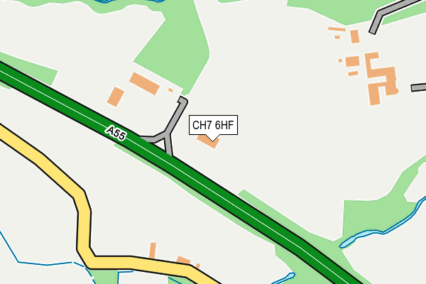
CH7 6HF is located in the Northop electoral ward, within the unitary authority of Flintshire and the Welsh Parliamentary constituency of Delyn. The Local Health Board is Betsi Cadwaladr University and the police force is North Wales. This postcode has been in use since August 1993.


GetTheData
Source: OS OpenMap – Local (Ordnance Survey)
Source: OS VectorMap District (Ordnance Survey)
Licence: Open Government Licence (requires attribution)
| Easting | 327268 |
| Northing | 367315 |
| Latitude | 53.197934 |
| Longitude | -3.090195 |
GetTheData
Source: Open Postcode Geo
Licence: Open Government Licence
| Country | Wales |
| Postcode District | CH7 |
➜ See where CH7 is on a map ➜ Where is Northop Hall? | |
GetTheData
Source: Land Registry Price Paid Data
Licence: Open Government Licence
Elevation or altitude of CH7 6HF as distance above sea level:
| Metres | Feet | |
|---|---|---|
| Elevation | 90m | 295ft |
Elevation is measured from the approximate centre of the postcode, to the nearest point on an OS contour line from OS Terrain 50, which has contour spacing of ten vertical metres.
➜ How high above sea level am I? Find the elevation of your current position using your device's GPS.
GetTheData
Source: Open Postcode Elevation
Licence: Open Government Licence
| Ward | Northop |
| Constituency | Delyn |
GetTheData
Source: ONS Postcode Database
Licence: Open Government Licence
| Black Lion (B5125) | Northop Hall | 418m |
| Black Lion (B5125) | Northop Hall | 430m |
| Bryn Gwyn Lane (B5125) | Northop Hall | 482m |
| Bryn Gwyn Lane (B5125) | Northop Hall | 487m |
| Boar`s Head Inn (B5125) | Northop Hall | 597m |
| Shotton Station | 3.8km |
| Hawarden Station | 4.1km |
| Hawarden Bridge Station | 4.4km |
GetTheData
Source: NaPTAN
Licence: Open Government Licence
GetTheData
Source: ONS Postcode Database
Licence: Open Government Licence


➜ Get more ratings from the Food Standards Agency
GetTheData
Source: Food Standards Agency
Licence: FSA terms & conditions
| Last Collection | |||
|---|---|---|---|
| Location | Mon-Fri | Sat | Distance |
| Alltami | 17:10 | 08:00 | 1,778m |
| Springfield Close. | 16:37 | 11:15 | 1,863m |
| Pengwladys Avenue. | 12:30 | 11:45 | 1,878m |
GetTheData
Source: Dracos
Licence: Creative Commons Attribution-ShareAlike
The below table lists the International Territorial Level (ITL) codes (formerly Nomenclature of Territorial Units for Statistics (NUTS) codes) and Local Administrative Units (LAU) codes for CH7 6HF:
| ITL 1 Code | Name |
|---|---|
| TLL | Wales |
| ITL 2 Code | Name |
| TLL2 | East Wales |
| ITL 3 Code | Name |
| TLL23 | Flintshire and Wrexham |
| LAU 1 Code | Name |
| W06000005 | Flintshire |
GetTheData
Source: ONS Postcode Directory
Licence: Open Government Licence
The below table lists the Census Output Area (OA), Lower Layer Super Output Area (LSOA), and Middle Layer Super Output Area (MSOA) for CH7 6HF:
| Code | Name | |
|---|---|---|
| OA | W00001744 | |
| LSOA | W01000325 | Flintshire 010D |
| MSOA | W02000067 | Flintshire 010 |
GetTheData
Source: ONS Postcode Directory
Licence: Open Government Licence
| CH7 6HE | Pinfold Lane | 257m |
| CH7 6LA | Institute Lane | 312m |
| CH7 6HJ | 328m | |
| CH7 6NS | Poppy Field Road | 336m |
| CH7 6LL | White Oaks Drive | 362m |
| CH7 6LP | Daytona Drive | 371m |
| CH7 6JN | Leasowe Terrace | 400m |
| CH7 6NP | Sebring Avenue | 401m |
| CH7 6JW | Village Road | 412m |
| CH7 6JH | Britannia Cottages | 414m |
GetTheData
Source: Open Postcode Geo; Land Registry Price Paid Data
Licence: Open Government Licence