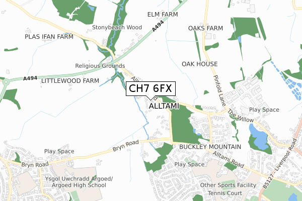
CH7 6FX is located in the Argoed and New Brighton electoral ward, within the unitary authority of Flintshire and the Welsh Parliamentary constituency of Delyn. The Local Health Board is Betsi Cadwaladr University and the police force is North Wales. This postcode has been in use since April 2020.


GetTheData
Source: OS Open Zoomstack (Ordnance Survey)
Licence: Open Government Licence (requires attribution)
Attribution: Contains OS data © Crown copyright and database right 2025
Source: Open Postcode Geo
Licence: Open Government Licence (requires attribution)
Attribution: Contains OS data © Crown copyright and database right 2025; Contains Royal Mail data © Royal Mail copyright and database right 2025; Source: Office for National Statistics licensed under the Open Government Licence v.3.0
| Easting | 326045 |
| Northing | 364831 |
| Latitude | 53.175441 |
| Longitude | -3.107923 |
GetTheData
Source: Open Postcode Geo
Licence: Open Government Licence
| Country | Wales |
| Postcode District | CH7 |
➜ See where CH7 is on a map ➜ Where is Mynydd Isa? | |
GetTheData
Source: Land Registry Price Paid Data
Licence: Open Government Licence
| Ward | Argoed And New Brighton |
| Constituency | Delyn |
GetTheData
Source: ONS Postcode Database
Licence: Open Government Licence
| Cherry Drive (Bryn Road) | Mynydd Isa | 125m |
| Cherry Drive (Bryn Road) | Mynydd Isa | 130m |
| Aran Close (Llywelyn Close) | Mynydd Isa | 260m |
| Moelwyn Close (Llywelyn Drive) | Mynydd Isa | 276m |
| Heol Fammau (Bryn-y-baal Road) | Mynydd Isa | 380m |
| Buckley Station | 3.7km |
| Penyffordd Station | 5.1km |
| Shotton Station | 6.2km |
GetTheData
Source: NaPTAN
Licence: Open Government Licence
GetTheData
Source: ONS Postcode Database
Licence: Open Government Licence


➜ Get more ratings from the Food Standards Agency
GetTheData
Source: Food Standards Agency
Licence: FSA terms & conditions
| Last Collection | |||
|---|---|---|---|
| Location | Mon-Fri | Sat | Distance |
| Bryn Y Baal | 17:02 | 08:45 | 280m |
| Mercia Drive | 17:00 | 11:30 | 786m |
| New Brighton Post Office | 17:05 | 09:00 | 858m |
GetTheData
Source: Dracos
Licence: Creative Commons Attribution-ShareAlike
The below table lists the International Territorial Level (ITL) codes (formerly Nomenclature of Territorial Units for Statistics (NUTS) codes) and Local Administrative Units (LAU) codes for CH7 6FX:
| ITL 1 Code | Name |
|---|---|
| TLL | Wales |
| ITL 2 Code | Name |
| TLL2 | East Wales |
| ITL 3 Code | Name |
| TLL23 | Flintshire and Wrexham |
| LAU 1 Code | Name |
| W06000005 | Flintshire |
GetTheData
Source: ONS Postcode Directory
Licence: Open Government Licence
The below table lists the Census Output Area (OA), Lower Layer Super Output Area (LSOA), and Middle Layer Super Output Area (MSOA) for CH7 6FX:
| Code | Name | |
|---|---|---|
| OA | W00001727 | |
| LSOA | W01000321 | Flintshire 014D |
| MSOA | W02000071 | Flintshire 014 |
GetTheData
Source: ONS Postcode Directory
Licence: Open Government Licence
| CH7 6RA | Cherry Drive | 70m |
| CH7 6SG | Llys Y Graig | 98m |
| CH7 6WT | Canol Y Bryn | 103m |
| CH7 6RY | Bryn Road | 139m |
| CH7 6WL | Bryn Road | 154m |
| CH7 6NL | Llys Gwynant | 165m |
| CH7 6SH | Berwyn Close | 181m |
| CH7 6SE | Rockcliffe | 201m |
| CH7 6SN | Aran Close | 217m |
| CH7 6NH | Parc Issa | 229m |
GetTheData
Source: Open Postcode Geo; Land Registry Price Paid Data
Licence: Open Government Licence