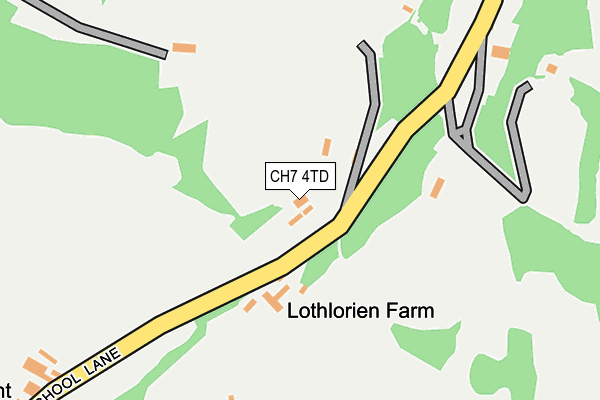
CH7 4TD is in Llanarmon Yn Ial, Mold. CH7 4TD is located in the Alyn Valley electoral ward, within the unitary authority of Denbighshire and the Welsh Parliamentary constituency of Clwyd West. The Local Health Board is Betsi Cadwaladr University and the police force is North Wales. This postcode has been in use since June 1997.


GetTheData
Source: OS OpenMap – Local (Ordnance Survey)
Source: OS VectorMap District (Ordnance Survey)
Licence: Open Government Licence (requires attribution)
| Easting | 319666 |
| Northing | 357577 |
| Latitude | 53.109308 |
| Longitude | -3.201518 |
GetTheData
Source: Open Postcode Geo
Licence: Open Government Licence
| Locality | Llanarmon Yn Ial |
| Town/City | Mold |
| Country | Wales |
| Postcode District | CH7 |
➜ See where CH7 is on a map | |
GetTheData
Source: Land Registry Price Paid Data
Licence: Open Government Licence
Elevation or altitude of CH7 4TD as distance above sea level:
| Metres | Feet | |
|---|---|---|
| Elevation | 270m | 886ft |
Elevation is measured from the approximate centre of the postcode, to the nearest point on an OS contour line from OS Terrain 50, which has contour spacing of ten vertical metres.
➜ How high above sea level am I? Find the elevation of your current position using your device's GPS.
GetTheData
Source: Open Postcode Elevation
Licence: Open Government Licence
| Ward | Alyn Valley |
| Constituency | Clwyd West |
GetTheData
Source: ONS Postcode Database
Licence: Open Government Licence
| Bryn-hyfryd (B5430) | Nant | 676m |
| Bryn-hyfryd (B5430) | Nant | 685m |
| Sun Inn (Bryn Euron) | Erryrys | 792m |
| Sun Inn (Bryn Euron) | Erryrys | 801m |
| Clover Grange (B5430) | Bryn-yr-ogof | 1,155m |
GetTheData
Source: NaPTAN
Licence: Open Government Licence
| Percentage of properties with Next Generation Access | 100.0% |
| Percentage of properties with Superfast Broadband | 0.0% |
| Percentage of properties with Ultrafast Broadband | 0.0% |
| Percentage of properties with Full Fibre Broadband | 0.0% |
Superfast Broadband is between 30Mbps and 300Mbps
Ultrafast Broadband is > 300Mbps
| Percentage of properties unable to receive 2Mbps | 0.0% |
| Percentage of properties unable to receive 5Mbps | 0.0% |
| Percentage of properties unable to receive 10Mbps | 0.0% |
| Percentage of properties unable to receive 30Mbps | 100.0% |
GetTheData
Source: Ofcom
Licence: Ofcom Terms of Use (requires attribution)
GetTheData
Source: ONS Postcode Database
Licence: Open Government Licence

➜ Get more ratings from the Food Standards Agency
GetTheData
Source: Food Standards Agency
Licence: FSA terms & conditions
| Last Collection | |||
|---|---|---|---|
| Location | Mon-Fri | Sat | Distance |
| Pantygwlanod | 09:00 | 09:00 | 621m |
| Dyffryn | 16:15 | 11:00 | 691m |
| Eryrys Post Office | 16:03 | 10:30 | 789m |
GetTheData
Source: Dracos
Licence: Creative Commons Attribution-ShareAlike
The below table lists the International Territorial Level (ITL) codes (formerly Nomenclature of Territorial Units for Statistics (NUTS) codes) and Local Administrative Units (LAU) codes for CH7 4TD:
| ITL 1 Code | Name |
|---|---|
| TLL | Wales |
| ITL 2 Code | Name |
| TLL1 | West Wales and The Valleys |
| ITL 3 Code | Name |
| TLL13 | Conwy and Denbighshire |
| LAU 1 Code | Name |
| W06000004 | Denbighshire |
GetTheData
Source: ONS Postcode Directory
Licence: Open Government Licence
The below table lists the Census Output Area (OA), Lower Layer Super Output Area (LSOA), and Middle Layer Super Output Area (MSOA) for CH7 4TD:
| Code | Name | |
|---|---|---|
| OA | W00001081 | |
| LSOA | W01000203 | Denbighshire 013A |
| MSOA | W02000054 | Denbighshire 013 |
GetTheData
Source: ONS Postcode Directory
Licence: Open Government Licence
| CH7 4DA | Old School Lane | 600m |
| CH7 5TF | 632m | |
| CH7 4BZ | Village Road | 659m |
| CH7 4BF | Bryn Awelon | 685m |
| CH7 4BT | Ochr Y Foel | 687m |
| CH7 4BY | Caer Odyn | 736m |
| CH7 4TB | School Lane | 799m |
| CH7 4BX | Village Road | 799m |
| CH7 4DB | Eryrys Road | 1205m |
| CH7 5TA | Llanarmon Road | 1212m |
GetTheData
Source: Open Postcode Geo; Land Registry Price Paid Data
Licence: Open Government Licence