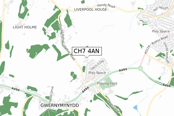
CH7 4AN is located in the Gwernaffield and Gwernymynydd electoral ward, within the unitary authority of Flintshire and the Welsh Parliamentary constituency of Delyn. The Local Health Board is Betsi Cadwaladr University and the police force is North Wales. This postcode has been in use since August 2019.


GetTheData
Source: OS Open Zoomstack (Ordnance Survey)
Licence: Open Government Licence (requires attribution)
Attribution: Contains OS data © Crown copyright and database right 2024
Source: Open Postcode Geo
Licence: Open Government Licence (requires attribution)
Attribution: Contains OS data © Crown copyright and database right 2024; Contains Royal Mail data © Royal Mail copyright and database right 2024; Source: Office for National Statistics licensed under the Open Government Licence v.3.0
| Easting | 321807 |
| Northing | 363073 |
| Latitude | 53.159035 |
| Longitude | -3.170885 |
GetTheData
Source: Open Postcode Geo
Licence: Open Government Licence
| Country | Wales |
| Postcode District | CH7 |
➜ See where CH7 is on a map ➜ Where is Gwernymynydd? | |
GetTheData
Source: Land Registry Price Paid Data
Licence: Open Government Licence
| Ward | Gwernaffield And Gwernymynydd |
| Constituency | Delyn |
GetTheData
Source: ONS Postcode Database
Licence: Open Government Licence
| Heol Y Wern (A494) | Gwernymynydd | 365m |
| Heol Y Wern (A494) | Gwernymynydd | 391m |
| Hafod-y-wern (A494) | Gwernymynydd | 492m |
| Hafod-y-wern (A494) | Gwernymynydd | 530m |
| Rainbow Garage (A494) | Gwernymynydd | 772m |
GetTheData
Source: NaPTAN
Licence: Open Government Licence
| Percentage of properties with Next Generation Access | 100.0% |
| Percentage of properties with Superfast Broadband | 100.0% |
| Percentage of properties with Ultrafast Broadband | 0.0% |
| Percentage of properties with Full Fibre Broadband | 0.0% |
Superfast Broadband is between 30Mbps and 300Mbps
Ultrafast Broadband is > 300Mbps
| Percentage of properties unable to receive 2Mbps | 0.0% |
| Percentage of properties unable to receive 5Mbps | 0.0% |
| Percentage of properties unable to receive 10Mbps | 0.0% |
| Percentage of properties unable to receive 30Mbps | 0.0% |
GetTheData
Source: Ofcom
Licence: Ofcom Terms of Use (requires attribution)
GetTheData
Source: ONS Postcode Database
Licence: Open Government Licence


➜ Get more ratings from the Food Standards Agency
GetTheData
Source: Food Standards Agency
Licence: FSA terms & conditions
| Last Collection | |||
|---|---|---|---|
| Location | Mon-Fri | Sat | Distance |
| Tros Y Wern | 15:30 | 08:30 | 153m |
| Swan Gwernymynydd | 11:30 | 11:15 | 367m |
| Gwernymynydd Post Office | 16:50 | 11:30 | 803m |
GetTheData
Source: Dracos
Licence: Creative Commons Attribution-ShareAlike
The below table lists the International Territorial Level (ITL) codes (formerly Nomenclature of Territorial Units for Statistics (NUTS) codes) and Local Administrative Units (LAU) codes for CH7 4AN:
| ITL 1 Code | Name |
|---|---|
| TLL | Wales |
| ITL 2 Code | Name |
| TLL2 | East Wales |
| ITL 3 Code | Name |
| TLL23 | Flintshire and Wrexham |
| LAU 1 Code | Name |
| W06000005 | Flintshire |
GetTheData
Source: ONS Postcode Directory
Licence: Open Government Licence
The below table lists the Census Output Area (OA), Lower Layer Super Output Area (LSOA), and Middle Layer Super Output Area (MSOA) for CH7 4AN:
| Code | Name | |
|---|---|---|
| OA | W00001605 | |
| LSOA | W01000300 | Flintshire 019B |
| MSOA | W02000076 | Flintshire 019 |
GetTheData
Source: ONS Postcode Directory
Licence: Open Government Licence
| CH7 4AB | Uwch Y Dre | 165m |
| CH7 4DS | Godrer Coed | 172m |
| CH7 4DT | Godrer Coed | 211m |
| CH7 4DR | Ger Y Llan | 234m |
| CH7 4AH | Heol Y Wern | 267m |
| CH7 4AD | Godrer Mynydd | 282m |
| CH7 4AP | Blaen Wern | 298m |
| CH7 5JS | Hafod Road | 367m |
| CH7 4AR | Erwr Fron | 368m |
| CH7 4AS | Maes Y Wern | 380m |
GetTheData
Source: Open Postcode Geo; Land Registry Price Paid Data
Licence: Open Government Licence