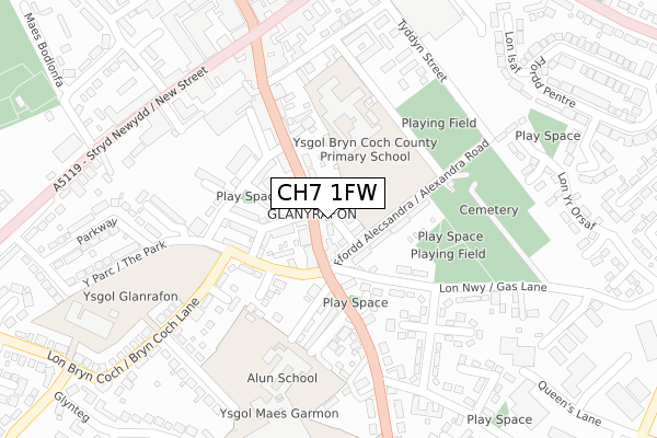
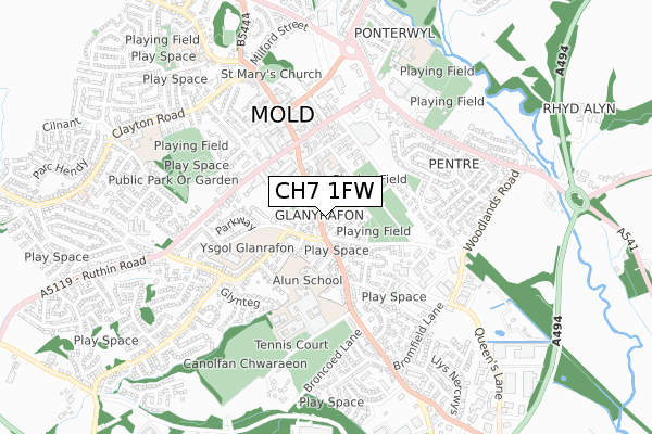
CH7 1FW is located in the Mold East electoral ward, within the unitary authority of Flintshire and the Welsh Parliamentary constituency of Delyn. The Local Health Board is Betsi Cadwaladr University and the police force is North Wales. This postcode has been in use since January 2018.


GetTheData
Source: OS Open Zoomstack (Ordnance Survey)
Licence: Open Government Licence (requires attribution)
Attribution: Contains OS data © Crown copyright and database right 2024
Source: Open Postcode Geo
Licence: Open Government Licence (requires attribution)
Attribution: Contains OS data © Crown copyright and database right 2024; Contains Royal Mail data © Royal Mail copyright and database right 2024; Source: Office for National Statistics licensed under the Open Government Licence v.3.0
| Easting | 323902 |
| Northing | 363611 |
| Latitude | 53.164174 |
| Longitude | -3.139688 |
GetTheData
Source: Open Postcode Geo
Licence: Open Government Licence
| Country | Wales |
| Postcode District | CH7 |
➜ See where CH7 is on a map ➜ Where is Mold? | |
GetTheData
Source: Land Registry Price Paid Data
Licence: Open Government Licence
| Ward | Mold East |
| Constituency | Delyn |
GetTheData
Source: ONS Postcode Database
Licence: Open Government Licence
| Conway Street (Wrexham Street) | Mold | 128m |
| Conway Street (Wrexham Street) | Mold | 134m |
| Red Lion Inn (Wrexham Street) | Mold | 212m |
| Red Lion Inn (Wrexham Street) | Mold | 232m |
| Bethesda (New Street) | Mold | 295m |
GetTheData
Source: NaPTAN
Licence: Open Government Licence
| Percentage of properties with Next Generation Access | 100.0% |
| Percentage of properties with Superfast Broadband | 100.0% |
| Percentage of properties with Ultrafast Broadband | 33.3% |
| Percentage of properties with Full Fibre Broadband | 0.0% |
Superfast Broadband is between 30Mbps and 300Mbps
Ultrafast Broadband is > 300Mbps
| Median download speed | 39.1Mbps |
| Average download speed | 38.3Mbps |
| Maximum download speed | 79.65Mbps |
| Median upload speed | 9.8Mbps |
| Average upload speed | 9.9Mbps |
| Maximum upload speed | 19.39Mbps |
| Percentage of properties unable to receive 2Mbps | 0.0% |
| Percentage of properties unable to receive 5Mbps | 0.0% |
| Percentage of properties unable to receive 10Mbps | 0.0% |
| Percentage of properties unable to receive 30Mbps | 0.0% |
GetTheData
Source: Ofcom
Licence: Ofcom Terms of Use (requires attribution)
GetTheData
Source: ONS Postcode Database
Licence: Open Government Licence


➜ Get more ratings from the Food Standards Agency
GetTheData
Source: Food Standards Agency
Licence: FSA terms & conditions
| Last Collection | |||
|---|---|---|---|
| Location | Mon-Fri | Sat | Distance |
| Grosvenor Street | 17:15 | 11:30 | 229m |
| Chester Street | 17:20 | 11:30 | 372m |
| Maes Y Derwen | 17:15 | 11:30 | 431m |
GetTheData
Source: Dracos
Licence: Creative Commons Attribution-ShareAlike
The below table lists the International Territorial Level (ITL) codes (formerly Nomenclature of Territorial Units for Statistics (NUTS) codes) and Local Administrative Units (LAU) codes for CH7 1FW:
| ITL 1 Code | Name |
|---|---|
| TLL | Wales |
| ITL 2 Code | Name |
| TLL2 | East Wales |
| ITL 3 Code | Name |
| TLL23 | Flintshire and Wrexham |
| LAU 1 Code | Name |
| W06000005 | Flintshire |
GetTheData
Source: ONS Postcode Directory
Licence: Open Government Licence
The below table lists the Census Output Area (OA), Lower Layer Super Output Area (LSOA), and Middle Layer Super Output Area (MSOA) for CH7 1FW:
| Code | Name | |
|---|---|---|
| OA | W00001694 | |
| LSOA | W01000315 | Flintshire 016C |
| MSOA | W02000073 | Flintshire 016 |
GetTheData
Source: ONS Postcode Directory
Licence: Open Government Licence
| CH7 1HQ | Wrexham Street | 36m |
| CH7 1RJ | Brook Street | 64m |
| CH7 1PG | Stanley Street | 68m |
| CH7 1HH | Marlow Terrace | 76m |
| CH7 1HJ | Alexandra Road | 95m |
| CH7 1PQ | Water Street | 104m |
| CH7 1PB | Chapel Street | 107m |
| CH7 1EZ | Llys Pont Y Garreg | 119m |
| CH7 1PH | Brook Street | 131m |
| CH7 1PF | Gladstone Street | 138m |
GetTheData
Source: Open Postcode Geo; Land Registry Price Paid Data
Licence: Open Government Licence