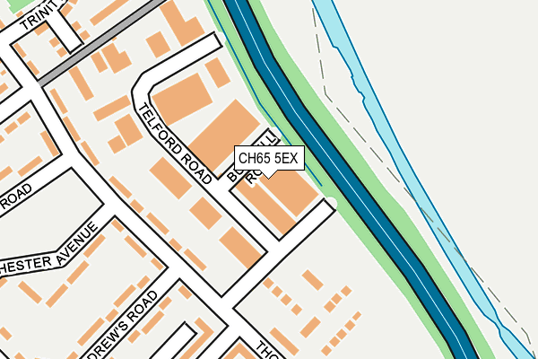
CH65 5EX is located in the Wolverham electoral ward, within the unitary authority of Cheshire West and Chester and the English Parliamentary constituency of Ellesmere Port and Neston. The Sub Integrated Care Board (ICB) Location is NHS Cheshire and Merseyside ICB - 27D and the police force is Cheshire. This postcode has been in use since June 1999.


GetTheData
Source: OS OpenMap – Local (Ordnance Survey)
Source: OS VectorMap District (Ordnance Survey)
Licence: Open Government Licence (requires attribution)
| Easting | 341214 |
| Northing | 375635 |
| Latitude | 53.274424 |
| Longitude | -2.883003 |
GetTheData
Source: Open Postcode Geo
Licence: Open Government Licence
| Country | England |
| Postcode District | CH65 |
➜ See where CH65 is on a map ➜ Where is Ellesmere Port? | |
GetTheData
Source: Land Registry Price Paid Data
Licence: Open Government Licence
Elevation or altitude of CH65 5EX as distance above sea level:
| Metres | Feet | |
|---|---|---|
| Elevation | 10m | 33ft |
Elevation is measured from the approximate centre of the postcode, to the nearest point on an OS contour line from OS Terrain 50, which has contour spacing of ten vertical metres.
➜ How high above sea level am I? Find the elevation of your current position using your device's GPS.
GetTheData
Source: Open Postcode Elevation
Licence: Open Government Licence
| Ward | Wolverham |
| Constituency | Ellesmere Port And Neston |
GetTheData
Source: ONS Postcode Database
Licence: Open Government Licence
| Rochester Drive (Thornton Road) | Wolverham | 135m |
| Rochester Drive (Thornton Road) | Wolverham | 157m |
| Rochester Drive (Thornton Road) | Wolverham | 205m |
| Rochester Drive (Thornton Road) | Wolverham | 214m |
| Wolverham Road | Wolverham | 310m |
| Ellesmere Port Station | 1.2km |
| Stanlow & Thornton Station | 2.8km |
| Overpool Station | 2.9km |
GetTheData
Source: NaPTAN
Licence: Open Government Licence
GetTheData
Source: ONS Postcode Database
Licence: Open Government Licence


➜ Get more ratings from the Food Standards Agency
GetTheData
Source: Food Standards Agency
Licence: FSA terms & conditions
| Last Collection | |||
|---|---|---|---|
| Location | Mon-Fri | Sat | Distance |
| Wolverham Road Post Office | 16:52 | 12:14 | 437m |
| Newham Drive | 18:15 | 12:00 | 703m |
| Alnwick Drive | 17:00 | 12:00 | 800m |
GetTheData
Source: Dracos
Licence: Creative Commons Attribution-ShareAlike
The below table lists the International Territorial Level (ITL) codes (formerly Nomenclature of Territorial Units for Statistics (NUTS) codes) and Local Administrative Units (LAU) codes for CH65 5EX:
| ITL 1 Code | Name |
|---|---|
| TLD | North West (England) |
| ITL 2 Code | Name |
| TLD6 | Cheshire |
| ITL 3 Code | Name |
| TLD63 | Cheshire West and Chester |
| LAU 1 Code | Name |
| E06000050 | Cheshire West and Chester |
GetTheData
Source: ONS Postcode Directory
Licence: Open Government Licence
The below table lists the Census Output Area (OA), Lower Layer Super Output Area (LSOA), and Middle Layer Super Output Area (MSOA) for CH65 5EX:
| Code | Name | |
|---|---|---|
| OA | E00093611 | |
| LSOA | E01018552 | Cheshire West and Chester 011D |
| MSOA | E02003849 | Cheshire West and Chester 011 |
GetTheData
Source: ONS Postcode Directory
Licence: Open Government Licence
| CH65 5DE | Thornton Road | 121m |
| CH65 5DF | Thornton Road | 179m |
| CH65 5EH | Braemar Court | 215m |
| CH65 9EH | Stokesay Court | 222m |
| CH65 5FG | Magdalene Walk | 259m |
| CH65 9EJ | Croft Court | 262m |
| CH65 5DL | Winchester Avenue | 267m |
| CH65 5FF | Homerton Close | 273m |
| CH65 9EG | Pembridge Court | 297m |
| CH65 5DG | St Andrews Road | 301m |
GetTheData
Source: Open Postcode Geo; Land Registry Price Paid Data
Licence: Open Government Licence