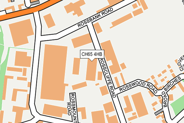
CH65 4HB is located in the Central & Grange electoral ward, within the unitary authority of Cheshire West and Chester and the English Parliamentary constituency of Ellesmere Port and Neston. The Sub Integrated Care Board (ICB) Location is NHS Cheshire and Merseyside ICB - 27D and the police force is Cheshire. This postcode has been in use since June 2000.


GetTheData
Source: OS OpenMap – Local (Ordnance Survey)
Source: OS VectorMap District (Ordnance Survey)
Licence: Open Government Licence (requires attribution)
| Easting | 339242 |
| Northing | 376979 |
| Latitude | 53.286281 |
| Longitude | -2.912829 |
GetTheData
Source: Open Postcode Geo
Licence: Open Government Licence
| Country | England |
| Postcode District | CH65 |
➜ See where CH65 is on a map ➜ Where is Ellesmere Port? | |
GetTheData
Source: Land Registry Price Paid Data
Licence: Open Government Licence
Elevation or altitude of CH65 4HB as distance above sea level:
| Metres | Feet | |
|---|---|---|
| Elevation | 30m | 98ft |
Elevation is measured from the approximate centre of the postcode, to the nearest point on an OS contour line from OS Terrain 50, which has contour spacing of ten vertical metres.
➜ How high above sea level am I? Find the elevation of your current position using your device's GPS.
GetTheData
Source: Open Postcode Elevation
Licence: Open Government Licence
| Ward | Central & Grange |
| Constituency | Ellesmere Port And Neston |
GetTheData
Source: ONS Postcode Database
Licence: Open Government Licence
| Lookers Gb (Rossmore Road East) | Overpool | 249m |
| Lookers Gb (Rossmore Road East) | Overpool | 254m |
| Westenra Avenue (Rossmore Road East) | Overpool | 388m |
| Camden Road (Princes Road) | Whitby | 392m |
| Westenra Avenue (Rossmore Road East) | Overpool | 399m |
| Overpool Station | 0.8km |
| Ellesmere Port Station | 1.2km |
| Little Sutton Station | 2km |
GetTheData
Source: NaPTAN
Licence: Open Government Licence
GetTheData
Source: ONS Postcode Database
Licence: Open Government Licence


➜ Get more ratings from the Food Standards Agency
GetTheData
Source: Food Standards Agency
Licence: FSA terms & conditions
| Last Collection | |||
|---|---|---|---|
| Location | Mon-Fri | Sat | Distance |
| Ellesmere Port Delivery Office | 18:00 | 12:45 | 34m |
| Poolhall Road | 17:28 | 12:56 | 294m |
| Princes Road | 18:15 | 12:00 | 581m |
GetTheData
Source: Dracos
Licence: Creative Commons Attribution-ShareAlike
The below table lists the International Territorial Level (ITL) codes (formerly Nomenclature of Territorial Units for Statistics (NUTS) codes) and Local Administrative Units (LAU) codes for CH65 4HB:
| ITL 1 Code | Name |
|---|---|
| TLD | North West (England) |
| ITL 2 Code | Name |
| TLD6 | Cheshire |
| ITL 3 Code | Name |
| TLD63 | Cheshire West and Chester |
| LAU 1 Code | Name |
| E06000050 | Cheshire West and Chester |
GetTheData
Source: ONS Postcode Directory
Licence: Open Government Licence
The below table lists the Census Output Area (OA), Lower Layer Super Output Area (LSOA), and Middle Layer Super Output Area (MSOA) for CH65 4HB:
| Code | Name | |
|---|---|---|
| OA | E00168841 | |
| LSOA | E01018563 | Cheshire West and Chester 007D |
| MSOA | E02003845 | Cheshire West and Chester 007 |
GetTheData
Source: ONS Postcode Directory
Licence: Open Government Licence
| CH65 3AS | Rosscliffe Road | 38m |
| CH65 3BU | Rosswood Road | 201m |
| CH65 3BS | Rossfield Road | 239m |
| CH65 3BX | Little Birches | 243m |
| CH65 3AB | Broad Birches | 281m |
| CH65 3DJ | Tees Court | 295m |
| CH65 3AG | Standingwood Road | 297m |
| CH65 3BY | Clover Birches | 319m |
| CH65 3DQ | Wharfe Lane | 333m |
| CH65 3DB | Ross Road | 333m |
GetTheData
Source: Open Postcode Geo; Land Registry Price Paid Data
Licence: Open Government Licence