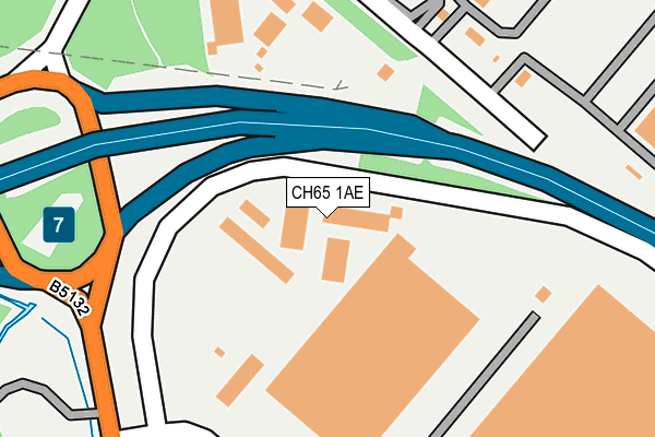
CH65 1AE is located in the Netherpool electoral ward, within the unitary authority of Cheshire West and Chester and the English Parliamentary constituency of Ellesmere Port and Neston. The Sub Integrated Care Board (ICB) Location is NHS Cheshire and Merseyside ICB - 27D and the police force is Cheshire. This postcode has been in use since December 2007.


GetTheData
Source: OS OpenMap – Local (Ordnance Survey)
Source: OS VectorMap District (Ordnance Survey)
Licence: Open Government Licence (requires attribution)
| Easting | 338904 |
| Northing | 378162 |
| Latitude | 53.296874 |
| Longitude | -2.918126 |
GetTheData
Source: Open Postcode Geo
Licence: Open Government Licence
| Country | England |
| Postcode District | CH65 |
➜ See where CH65 is on a map ➜ Where is Ellesmere Port? | |
GetTheData
Source: Land Registry Price Paid Data
Licence: Open Government Licence
Elevation or altitude of CH65 1AE as distance above sea level:
| Metres | Feet | |
|---|---|---|
| Elevation | 10m | 33ft |
Elevation is measured from the approximate centre of the postcode, to the nearest point on an OS contour line from OS Terrain 50, which has contour spacing of ten vertical metres.
➜ How high above sea level am I? Find the elevation of your current position using your device's GPS.
GetTheData
Source: Open Postcode Elevation
Licence: Open Government Licence
| Ward | Netherpool |
| Constituency | Ellesmere Port And Neston |
GetTheData
Source: ONS Postcode Database
Licence: Open Government Licence
| Naylor Place (Naylor Road) | Overpool | 676m |
| Netherpool Road (Naylor Road) | Ellesmere Port | 677m |
| Rivacre Brow (Rivacre Road) | Rivacre Valley | 734m |
| Hillside Drive (Rivacre Brow) | Rivacre Valley | 812m |
| Forest Road (Rivacre Road) | Overpool | 918m |
| Overpool Station | 1.5km |
| Little Sutton Station | 2.1km |
| Ellesmere Port Station | 2.2km |
GetTheData
Source: NaPTAN
Licence: Open Government Licence
GetTheData
Source: ONS Postcode Database
Licence: Open Government Licence


➜ Get more ratings from the Food Standards Agency
GetTheData
Source: Food Standards Agency
Licence: FSA terms & conditions
| Last Collection | |||
|---|---|---|---|
| Location | Mon-Fri | Sat | Distance |
| Gowey Court | 17:45 | 12:53 | 631m |
| Poolhall Road | 17:28 | 12:56 | 966m |
| Ellesmere Port Delivery Office | 18:00 | 12:45 | 1,213m |
GetTheData
Source: Dracos
Licence: Creative Commons Attribution-ShareAlike
The below table lists the International Territorial Level (ITL) codes (formerly Nomenclature of Territorial Units for Statistics (NUTS) codes) and Local Administrative Units (LAU) codes for CH65 1AE:
| ITL 1 Code | Name |
|---|---|
| TLD | North West (England) |
| ITL 2 Code | Name |
| TLD6 | Cheshire |
| ITL 3 Code | Name |
| TLD63 | Cheshire West and Chester |
| LAU 1 Code | Name |
| E06000050 | Cheshire West and Chester |
GetTheData
Source: ONS Postcode Directory
Licence: Open Government Licence
The below table lists the Census Output Area (OA), Lower Layer Super Output Area (LSOA), and Middle Layer Super Output Area (MSOA) for CH65 1AE:
| Code | Name | |
|---|---|---|
| OA | E00168840 | |
| LSOA | E01018563 | Cheshire West and Chester 007D |
| MSOA | E02003845 | Cheshire West and Chester 007 |
GetTheData
Source: ONS Postcode Directory
Licence: Open Government Licence
| CH66 1TD | Woodacre Grove | 378m |
| CH66 1SW | Woodacre Road | 438m |
| CH66 1TE | Plemston Court | 451m |
| CH66 1SN | Carlton Crescent | 461m |
| CH66 1ST | Poole Hall Industrial Estate | 473m |
| CH66 1TF | Huxley Court | 488m |
| CH66 1RW | Stapleford Court | 526m |
| CH66 1RP | Croughton Court | 575m |
| CH66 1RG | Gowy Court | 595m |
| CH66 1RH | Gateacre Court | 614m |
GetTheData
Source: Open Postcode Geo; Land Registry Price Paid Data
Licence: Open Government Licence