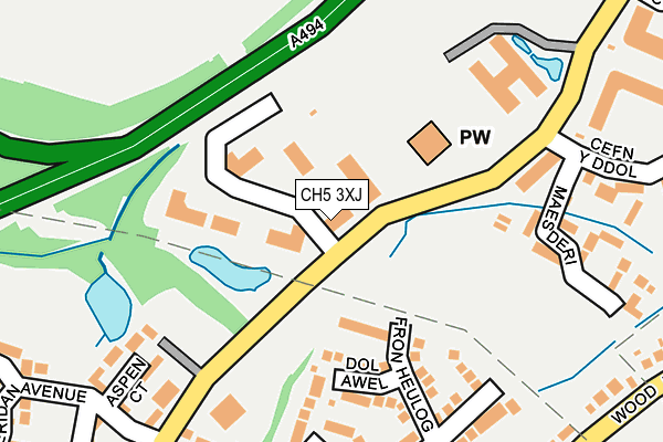
CH5 3XJ is located in the Hawarden: Ewloe electoral ward, within the unitary authority of Flintshire and the Welsh Parliamentary constituency of Alyn and Deeside. The Local Health Board is Betsi Cadwaladr University and the police force is North Wales. This postcode has been in use since January 1992.


GetTheData
Source: OS OpenMap – Local (Ordnance Survey)
Source: OS VectorMap District (Ordnance Survey)
Licence: Open Government Licence (requires attribution)
| Easting | 329523 |
| Northing | 366166 |
| Latitude | 53.187896 |
| Longitude | -3.056192 |
GetTheData
Source: Open Postcode Geo
Licence: Open Government Licence
| Country | Wales |
| Postcode District | CH5 |
➜ See where CH5 is on a map ➜ Where is Ewloe? | |
GetTheData
Source: Land Registry Price Paid Data
Licence: Open Government Licence
Elevation or altitude of CH5 3XJ as distance above sea level:
| Metres | Feet | |
|---|---|---|
| Elevation | 90m | 295ft |
Elevation is measured from the approximate centre of the postcode, to the nearest point on an OS contour line from OS Terrain 50, which has contour spacing of ten vertical metres.
➜ How high above sea level am I? Find the elevation of your current position using your device's GPS.
GetTheData
Source: Open Postcode Elevation
Licence: Open Government Licence
| Ward | Hawarden: Ewloe |
| Constituency | Alyn And Deeside |
GetTheData
Source: ONS Postcode Database
Licence: Open Government Licence
| Sycamore Lodge (Wood Lane) | Hawarden | 306m |
| Sycamore Lodge (Wood Lane) | Hawarden | 316m |
| School (Mold Road) | Ewloe Green | 437m |
| School (Mold Road) | Ewloe Green | 474m |
| Boar`s Head (Old Mold Road) | Ewloe Green | 474m |
| Hawarden Station | 1.6km |
| Buckley Station | 2.8km |
| Shotton Station | 3km |
GetTheData
Source: NaPTAN
Licence: Open Government Licence
GetTheData
Source: ONS Postcode Database
Licence: Open Government Licence


➜ Get more ratings from the Food Standards Agency
GetTheData
Source: Food Standards Agency
Licence: FSA terms & conditions
| Last Collection | |||
|---|---|---|---|
| Location | Mon-Fri | Sat | Distance |
| Wood Lane | 17:40 | 07:00 | 428m |
| Jefferson Road | 16:00 | 11:30 | 630m |
| Ewloe Post Office. | 16:00 | 11:30 | 639m |
GetTheData
Source: Dracos
Licence: Creative Commons Attribution-ShareAlike
The below table lists the International Territorial Level (ITL) codes (formerly Nomenclature of Territorial Units for Statistics (NUTS) codes) and Local Administrative Units (LAU) codes for CH5 3XJ:
| ITL 1 Code | Name |
|---|---|
| TLL | Wales |
| ITL 2 Code | Name |
| TLL2 | East Wales |
| ITL 3 Code | Name |
| TLL23 | Flintshire and Wrexham |
| LAU 1 Code | Name |
| W06000005 | Flintshire |
GetTheData
Source: ONS Postcode Directory
Licence: Open Government Licence
The below table lists the Census Output Area (OA), Lower Layer Super Output Area (LSOA), and Middle Layer Super Output Area (MSOA) for CH5 3XJ:
| Code | Name | |
|---|---|---|
| OA | W00001531 | |
| LSOA | W01000286 | Flintshire 013E |
| MSOA | W02000070 | Flintshire 013 |
GetTheData
Source: ONS Postcode Directory
Licence: Open Government Licence
| CH5 3GG | Fron Heulog | 143m |
| CH5 3GH | Dol Awel | 156m |
| CH5 3GF | Clos Y Meillion | 197m |
| CH5 3GE | Maes Glas | 200m |
| CH5 3XB | Maes Deri | 210m |
| CH5 3UX | Aspen Court | 212m |
| CH5 3UW | Maes Deri | 255m |
| CH5 3UB | Llys Brenig | 258m |
| CH5 3XG | Cefn Y Ddol | 262m |
| CH5 3UD | Ffordd Tegid | 272m |
GetTheData
Source: Open Postcode Geo; Land Registry Price Paid Data
Licence: Open Government Licence