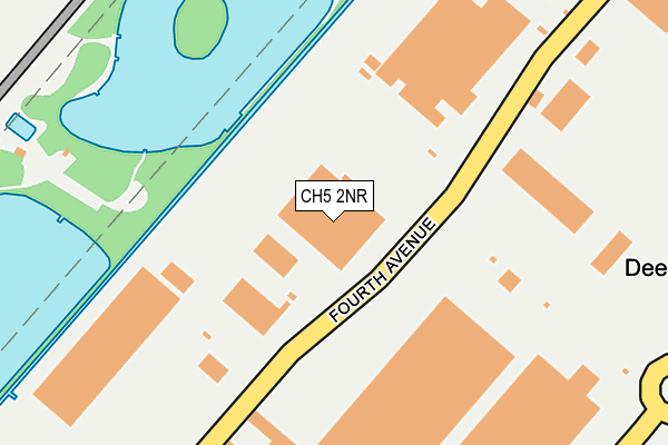
CH5 2NR lies on Fourth Avenue in Deeside Industrial Park, Deeside. CH5 2NR is located in the Queensferry and Sealand electoral ward, within the unitary authority of Flintshire and the Welsh Parliamentary constituency of Alyn and Deeside. The Local Health Board is Betsi Cadwaladr University and the police force is North Wales. This postcode has been in use since March 1982.


GetTheData
Source: OS OpenMap – Local (Ordnance Survey)
Source: OS VectorMap District (Ordnance Survey)
Licence: Open Government Licence (requires attribution)
| Easting | 332377 |
| Northing | 370809 |
| Latitude | 53.229996 |
| Longitude | -3.014473 |
GetTheData
Source: Open Postcode Geo
Licence: Open Government Licence
| Street | Fourth Avenue |
| Locality | Deeside Industrial Park |
| Town/City | Deeside |
| Country | Wales |
| Postcode District | CH5 |
➜ See where CH5 is on a map | |
GetTheData
Source: Land Registry Price Paid Data
Licence: Open Government Licence
Elevation or altitude of CH5 2NR as distance above sea level:
| Metres | Feet | |
|---|---|---|
| Elevation | 10m | 33ft |
Elevation is measured from the approximate centre of the postcode, to the nearest point on an OS contour line from OS Terrain 50, which has contour spacing of ten vertical metres.
➜ How high above sea level am I? Find the elevation of your current position using your device's GPS.
GetTheData
Source: Open Postcode Elevation
Licence: Open Government Licence
| Ward | Queensferry And Sealand |
| Constituency | Alyn And Deeside |
GetTheData
Source: ONS Postcode Database
Licence: Open Government Licence
| Deeside Industrial Park Iceland (Second Avenue) | Connah's Quay | 407m |
| Newtech Square (First Avenue) | Garden City | 599m |
| Parkway | Connah's Quay | 623m |
| Gdc Building (First Avenue) | Connah's Quay | 677m |
| Tenth Avenue | Garden City | 757m |
| Hawarden Bridge Station | 1.8km |
| Shotton Station | 2.5km |
| Hawarden Station | 5.1km |
GetTheData
Source: NaPTAN
Licence: Open Government Licence
GetTheData
Source: ONS Postcode Database
Licence: Open Government Licence


➜ Get more ratings from the Food Standards Agency
GetTheData
Source: Food Standards Agency
Licence: FSA terms & conditions
| Last Collection | |||
|---|---|---|---|
| Location | Mon-Fri | Sat | Distance |
| Deeside Ind Estate | 18:30 | 07:00 | 610m |
| Villa Road. | 16:00 | 11:00 | 2,071m |
| Deeside Delivery Office, | 17:00 | 11:15 | 2,352m |
GetTheData
Source: Dracos
Licence: Creative Commons Attribution-ShareAlike
The below table lists the International Territorial Level (ITL) codes (formerly Nomenclature of Territorial Units for Statistics (NUTS) codes) and Local Administrative Units (LAU) codes for CH5 2NR:
| ITL 1 Code | Name |
|---|---|
| TLL | Wales |
| ITL 2 Code | Name |
| TLL2 | East Wales |
| ITL 3 Code | Name |
| TLL23 | Flintshire and Wrexham |
| LAU 1 Code | Name |
| W06000005 | Flintshire |
GetTheData
Source: ONS Postcode Directory
Licence: Open Government Licence
The below table lists the Census Output Area (OA), Lower Layer Super Output Area (LSOA), and Middle Layer Super Output Area (MSOA) for CH5 2NR:
| Code | Name | |
|---|---|---|
| OA | W00001790 | |
| LSOA | W01000332 | Flintshire 009A |
| MSOA | W02000066 | Flintshire 009 |
GetTheData
Source: ONS Postcode Directory
Licence: Open Government Licence
| CH5 2NX | Second Avenue | 348m |
| CH5 2LA | Third Avenue | 612m |
| CH5 2UA | Tenth Avenue | 784m |
| CH5 2NU | First Avenue | 854m |
| CH5 2LR | Deeside Industrial Estate | 1164m |
| CH5 2LJ | Green Lane West | 1246m |
| CH5 2JE | Sandy Lane | 1478m |
| CH5 2HN | Sealand Avenue | 1506m |
| CH5 2JG | Sandy Lane | 1531m |
| CH5 2JF | Sandy Lane | 1534m |
GetTheData
Source: Open Postcode Geo; Land Registry Price Paid Data
Licence: Open Government Licence